Wednesday, July 31, 2013

BB-8 Report as on 31st Wednesday Night:

BB-8 moves Westwards as forecasted yesterday. Positioned over Eastern MP, it has considerable clouding fuelled by very strong Westerlies , in the SW quadrant.
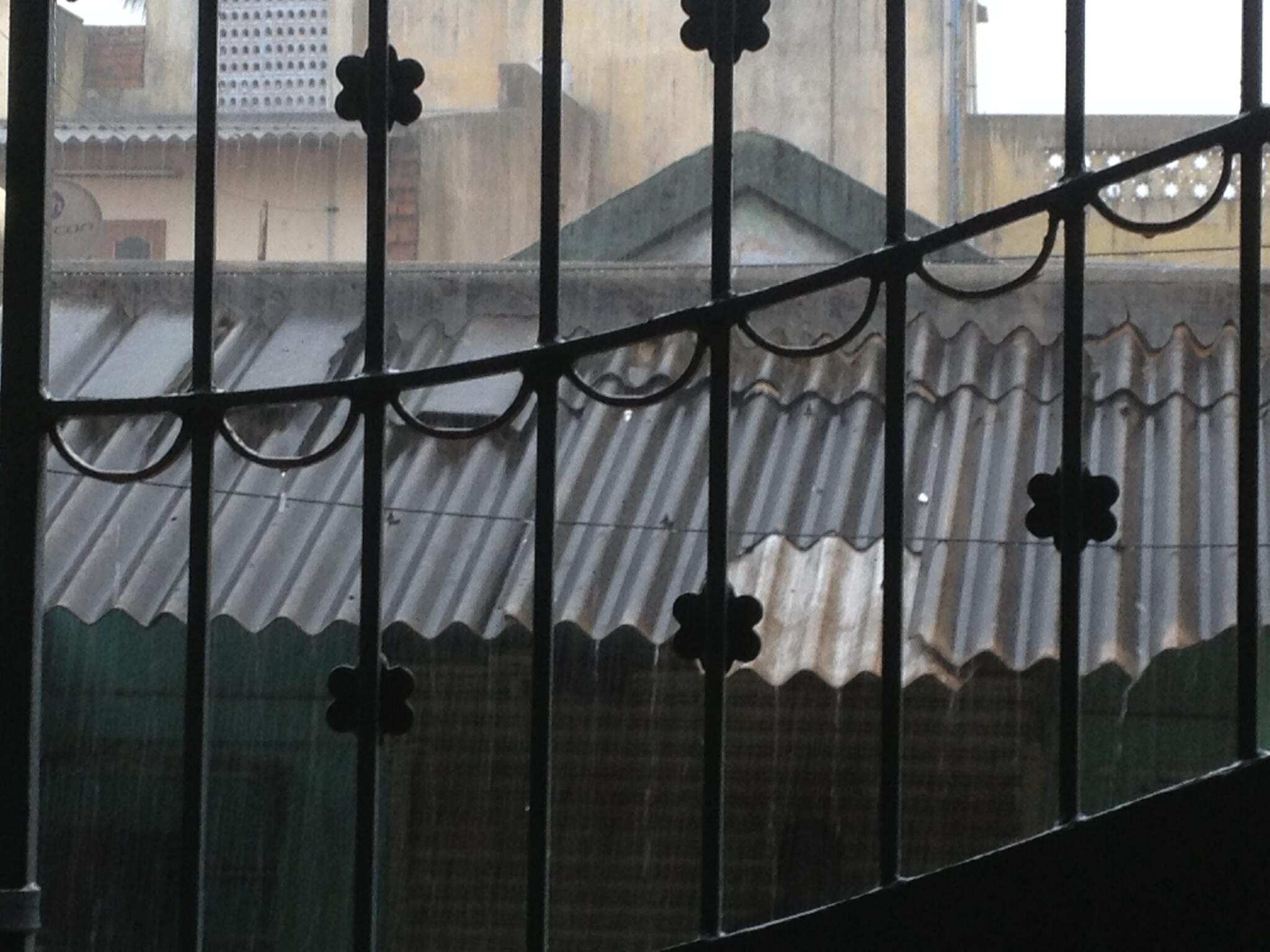
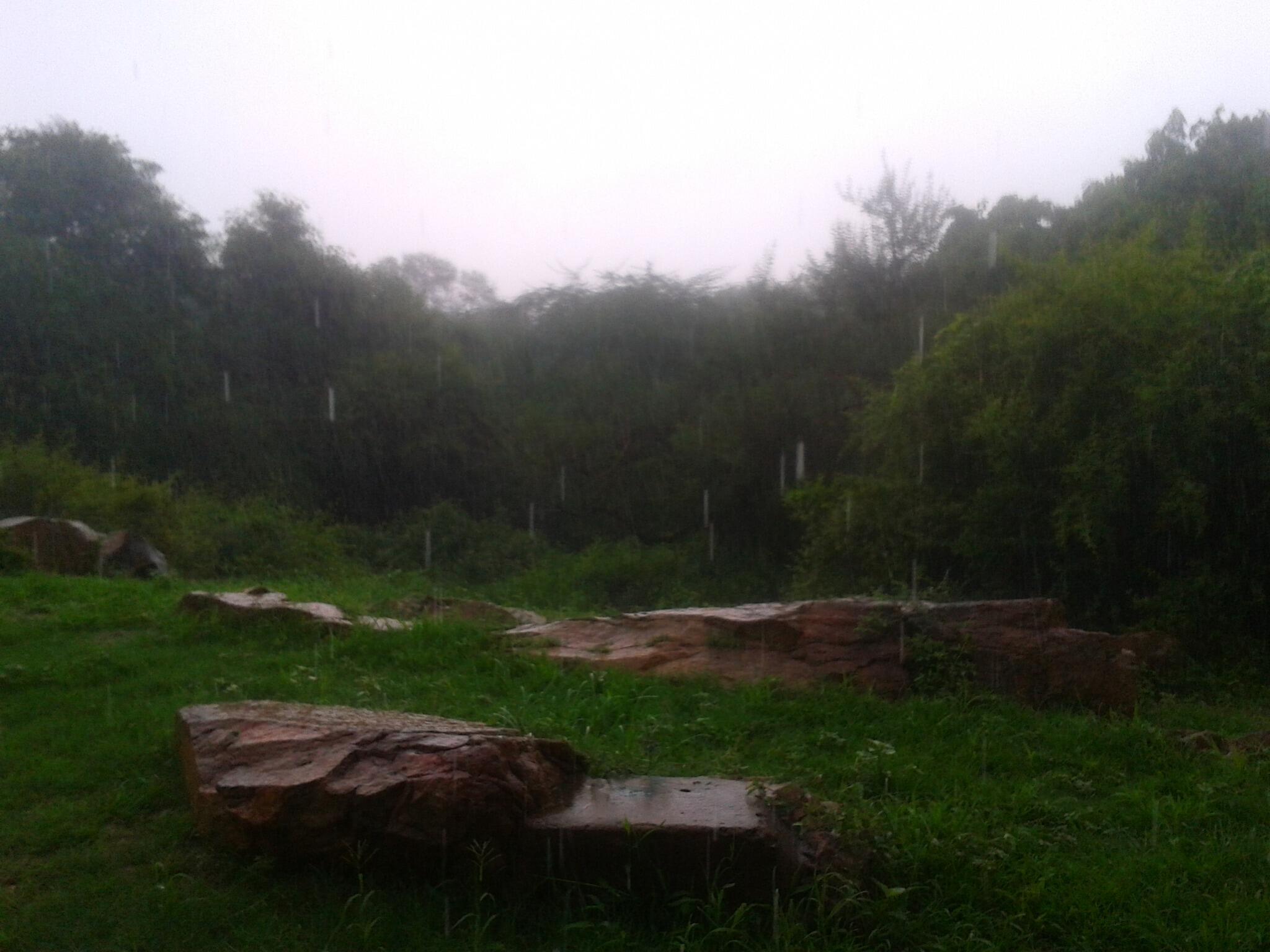
The heavy rainfall, which has occured, is occuring and will occur tomorrow, has not diverted from our estimate.
System expected to contine moving West, and weakening to 996 mb. 

Thursday: Districts of Aurangabad and Nasik watch out for heavy rains, and Surat, Bharuch and Navsari districts on Thursday evening. Rains >100 mms. Pockets get >150 mms.

Friday: Districts of Rajkot, Surendranagar and Jamnagar will receive heavy rains. Rest pf Gujarat too receive moderate rains. 125-150 mms in some pockets.
Eastern parts of Mahrashtra start getting reduced rains.

Cloudiness and patchy thunder showers may creep into Sindh on Friday/Saturday. More details as situation develops.

Maintaining Mumbai Forecast of rains from Wednesday night. Around 50 mms on Thursday and reducing from night.

#Delhi - forecast till Sunday evening

@karthiiyer @tinucherian >> #Delhi - can expect showers from early hrs of 1-Aug to evening. Low intensity rain expected on Friday

@karthiiyer @tinucherian >> #Delhi - Almost NO rain expected on Saturday and again chance of showers around noon on Sunday.

@karthiiyer @tinucherian >> #Delhi - On Saturday and Sunday, the max temperature will be around 33 C and will be Humid.

This Delhi forecast is initiated in response to tweets from @karthiiyer to @tinucherian

Bangalore - Cold evening and NEW live personal weather station (PWS)

RT @rajugana: Bangalore 8.15pm, Cloudy day, slight drizzles, no significant rain for the past few days..sky pic http://t.co/358kD7UaYY 

RT @karaikudy: Is this colder July?!! Now temp showing 20.7C and min expected tonight!! 18C!! #Malleswaram #Bangalore (8:52pm)

RT @arvenky: @karaikudy very true sitting outside and just shivering @weatherofindia #Bangalore (8:54pm)

#Bangalore - now have a LIVE "personal weather station" ... shows 22C at 9:20pm, check this out >> http://ow.ly/nv9sv 

Belgaum - "rain" 35 mm

Its very heavy raining by interwals.

Yesterday Belgaum city got 35mm and total rain stands at 713mm from june 1st.

Photo at 9am

#Monsoon around India at 5pm

RT @aknarendranath: Monsoon could be heading for a ‘break’ | Business Line @weatherofindia http://t.co/NSusw7HRwe  >> "a break in August is bad"

At noon, the LOW, low level circulation was seen over S,central Chatisgarh ... http://ow.ly/i/2KKik

And models expect the circulation to move W-N-W into central Madhyapradesh in next 30hrs and end up over N-W.Madhyapradesh on 2-Aug.

Today
~~~~~~~~~
RT @ganpatteli1: raining in #delhi (2:44pm)

Belgaum - 1:06pm, "Continuous heavy Rain in BELGAUM from last night ."

Bangalore - 4pm, "clouds coming from west. could bring heavy drizzle.".. http://ow.ly/i/2KKxz  >> from http://ow.ly/nuzCP

#Chennai - 5:30pm, "another" DRY and warm day with 75% cloud cover. NO sea breeze yet and weak upper level winds observed.

Malout - 5pm, "HOT day, again rains evading S-W Punjab".

5pm, Showers seen over N,N-E.Rajasthan, S,E.Haryana, central,S.Uttarpradesh, S.Punjab, E.Maharastra, N,central.Andhra http://ow.ly/i/2KKO6
5pm, showers also seen along N.Maharastra coast, Goa, coastal Karnataka and Jharkhand, S,S-W.Bengal .. http://ow.ly/i/2KKO6

A good weather photo from Kota, Rajasthan (today) ... http://ow.ly/i/2KKWr

RT @asarode: #beautiful weather in #hyderabad....  #rain #green http://t.co/nRVmBaXrqP (4:46pm)

Tuesday, July 30, 2013

BB-8, slightly deepened at 992 mb, now centred as a depression at 22N and 85E. System is expected to move Westwards.The associated Upper Air circulations extend upto 700 mb. 
The associated clouding is in the W/SW quadrant. The region of heavy effective rainfall currrently includes S.Chattisgarh and adjoining Vidarbh.

Wednesday, heavy rainfall moves westwards into Vidarbh and adjoining Marathwada. Very heavy rains are possible over Chattisgarh, Eastern Vidarbh and spreading into Marathwada. 
Rainfall upto > 125 mms in places.

Thursday, heavy rainfall over Marathwada and North Madhya Maharashtra and adjoing Southern MP.Districts to look out for heavy rainfall Nasik, Dhule, Jalgaon, Buldana and Akola.Rainfall upto >150 mms expected.
Heavy rains also likely in Aurangabad district.
Eastern Gujarat districts of  Dang, Tapi, Vadodara can expect heavy rains. Moderately heavy rains in Bharuch and Surat Districts. 50-60 mms expected in Surat and Vadodara.

Heavy rains may increase over North Konkan and Mumbai from Wednesday night.rain amounts increasing to about 60-65 mms on Wednesday night thru Thursday daytime.

From Vagaries

A mini update on the Odisha LOW .. "Heavy rain for E.Maharastra, S.Chatisgarh expected"

Latest analysis 5:30pm, show that the N-W.Bay LOW has drifted into N.Odisha ... http://ow.ly/i/2KgBo 

Models expect the system to move into central Chatisgarh in next 18 / 24hrs.

Due to this, In 24hrs HEAVY rain expected for E,central,S-E.Maharastra, S,central Chatisgarh, S.Odisha, N,N-E.Andhra http://ow.ly/i/2KgQm 
From now and before evening of 31-Jul, VERY HEAVY rain for E,N-E,N,central Maharastra, N.Andhra, S.Chatisgarh ... http://ow.ly/i/2KgXW 
Scattered rain expected to continue over most of S,central,E.Madhyapradesh during next 36hrs.

Update at 8pm

#Chennai - 8:06pm, Another ZERO rain day for city, even more Hot & Humid than yesterday.

5:30pm, Visible shows... E-central,N-E.Madhyapradesh, S,S-E.Uttarpradesh, N.Andhra, S,central Chatisgarh.. http://ow.ly/i/2Kfyh

RT @anansubramanium: @weatherofindia very hot and humid with dry winds at Vellore, Tamilnadu >> almost the same in #Chennai

Malout - "heavy rain in South Punjab and adjoining N.Rajasthan, Haryana" ... PIC http://ow.ly/i/2KfKL >> taken from http://ow.ly/nsKRA

Badlapur - Today, "windy with heavy rain" ... http://youtu.be/Lg01j06v6Zs  >> records 66mm at 5:30pm
#Kolkata - 3:16pm, Heavy passing shower now over N-central zones of city.

Weather around India, 1:10pm

12 pm kolkata - sunny with gusty winds reaching 50 km/h with passing showers.

12:30pm, Showers over N-E.Andhra, S,central Chatisgarh, S,central,N.Odisha, S-W.Madhyapradesh,W.Uttarpradesh .. http://ow.ly/i/2K1yd


12:35pm, Heavy Rain with strong Gusty Winds in Badlapur : http://youtu.be/_J-5UmFgs6c


10:34am, #Bangalore - "overcast" 


#Chennai - A clear and sunny day so far 1:33pm, temperature is around 34 C. Humidity around 44%. Breeze from West.


Today as well good vertical velocity expected after 4pm over N,N-E.Tamilnadu, #Chennai, S.Andhra... RAIN expected  http://ow.ly/i/2K2kz 


9:56am, its raining heavily here in Kasaragod,kerala...from 9 am . only one day break!!! that we got yesterday.

29-Jul, Analysis and Forecast for next 2 days.

11pm, Heavy rain seen over S-W.Kashmir, S-E.Rajasthan, border of Chatisgarh and Odisha,  S.Jharkhand, coastal Odisha http://ow.ly/i/2JI8D 
Analysis show a good low,mid level circulation over S.Bengal and N.Bay ... http://ow.ly/i/2JIfC 
Today another weak low level circulation seen over N-E.Madhyaoradesh and zone near Kanpur ... http://ow.ly/i/2JIln 
During next 36hrs, the circulation is expected to move into Odisha and track W-N-W into N.Chatisgarh ... http://ow.ly/i/2JItY 
During next 24hrs, high vertical velocity expected along #Goa, S,central Maharastra coast and along Karnataka coast http://ow.ly/i/2JICv 
Latest models suggest that the present N.Bay circulation will travel W-N-W and reach upto Gujarat again on 1-Aug.

Rainfall Forecast till evening of 31-Jul
~~~~~~~~~~~~~~~~~~~~~~~~~~~~~~~~~~~~~~~~
Heavy and widespread rain expected over #Goa, S.Maharatra coast and Karnataka coast in next 24hrs.
Tomorrom, high vorticity over S,S-E.Gujarat into N-W.Maharastra. Also seen over Odisha, S.Himachal.. Heavy Rain ahead http://ow.ly/i/2JJ0T 
On 31-Jul, High vorticity seen over W.Uttarpradesh, #Delhi, S.Haryana and N-E.Rajasthan. Also over N-N-E.Mahastra, E.Gujarat.. Heavy rain !!
In 24hrs, Heavy rain expected for N.Maharastra coast, S-E.Gujarat, N.Kerala, S.Chatisgarh, N,N-E.Odisha ... http://ow.ly/i/2JJgG 
Tomorrow(30-Jul), Heavy rain also for border zones of Haryana, Punjab and Himachal, Also for N,E-central Madhyapradesh.. http://ow.ly/i/2JJgG
30-Jul, Rain also for S.Jharkhand, S,N.Bengal and Uttarakhand as well.
On 31-Jul, HEAVY rain will push into E,N,central.Maharastra, s,central Chatisgarh and along most of Maharastra coast http://ow.ly/i/2JJxt 
On 31-Jul showers will continue over Uttarakhand, N.Uttarpradesh, E,N-E,central Madhyapradesh, S.Himachal, N.Bengal http://ow.ly/i/2JJxt
Showers expected for E,N-E,S-E.Rajasthan on 30,31-Jul.

Monday, July 29, 2013

Satellite IR at 3:30pm, "Heavy rain over E.Rajasthan"

3:30pm, HEAVY rain over S,E.Rajasthan, W,N-W.Madhyapradesh, E,central,W,N-W.Gujarat ... http://ow.ly/i/2Jrxy 

3:30pm, Showers also seen over N-N-W.Odisha and less rain seen along Maharastra coast, #Kerala and Karnataka coast http://ow.ly/i/2Jrxy

Sawoi Madhopur - E.Rajasthan, 2:30pm, "Raining" ... http://ow.ly/i/2JrBQ >> from our Facebook reader http://facebook.com/indianweatherman 

Davangere - "Cold,very windy and sun is well out today,no rain.", 3:21pm

Belgaum - 672 mm so far from 1-Jun-2013

Today also rain continue, But last 2 days rain little decreased compared to earlier days. Yesterday city got 12mm and total rainfall 672 from June 1st.
Pic took @ 10am today.

Forecast for #Chennai and #Bangalore, 29-Jul-2013

Today, high vertical velocity expected along N,N-E.Tamilnadu, S.Andhra ... almost 80% chance of rain for #Chennai and adjoining zones.

High vertical velocity expected along N,N-E.Tamilnadu, #Chennai and S.Andhra coast today after 4pm... http://ow.ly/i/2Jnsr 

After 4pm, mild short showers also expected for #Bangalore.

Windy #Pune at early hrs

RT @gsarkar: @weatherofindia Woah... high speed wind banging all the windows nd doors..  its scary... cold nd windy night @ Pune. (2:34am)

1 a.m 29th july 2013 kolkata

VERY HEAVY RAINS SINCE LAST 45 MINS ....
ALMOST SITUATION OF WATER LOGGING HAS AROSE NOW.. 

Sunday, July 28, 2013

#Chennai - Round 2, 10:30pm

#Chennai - 10:33pm, Round 2, a T.shower now moving into W-S-W suburbs of city. Drizzling over Polichalur zone.
RT @fabwrite: Heavy rain in #Mandavelli #Chennai @weatherofindia @chennaiweather 10:52pm

#Goa - today

RT @sanjeevnaique:6:23pm,  Its heavily raining in #Margao in #Goa this evening. Heavy #rain with high wind.@naikap #Goa @weatherofindia
1. Axis shifts Northwards from Monday.
Very Windy along Maharashtra coast and in Madhya Maharashtra.
2. Next 2/3 days, very heavy rainfall regions indicated (green), medium Heavy (Purple) and Moderate (Blue).
3.Southern Rajasthan/Adjoining Gujarat (Southern Udaipur District) gets heavy rains for a day.
4.West coast upto Surat, bit more active on Tuesday (40-50 mms at some stations).

Mumbai gets chance to catch up on 2000 mms on Tuesday. Tuesday sees a slight increase over Monday, with 30-40 mms on Tuesday. Will it reach 2000 mms before 30th morning then ?
Delhi NCR sees some heavy showers on Tuesday night.

Vagaries' Chart here..

Chennai - rain, Round #1

Chennai - 5:20pm, moderate rain now over Polichalur zone.

RT @alan_j_s: @weatherofindia raining in Egmore now. (4:44pm)

RT @senthilvijay: @weatherofindia Heavy rain now in north #Chennai #Tiruvottiyur http://t.co/cSd6Jk8sVi (4:53pm)

Bangalore - evening rain

RT @karaikudy: @weatherofindia  Oh No!! Rains!! evening walk gone! raining heavily!! #Malleswaram #Bangalore 4:28pm

RT @karaikudy: 4:40pm heavy rain 6:10pm see  beaming SUN makes it English Summer! #Malleswaram #Bangalore Glory! http://t.co/gUH7c8wMwU 

Chennai - 3:40pm, showers seen over W-S-W, S-W from city at around 40km. Rain will push into suburbs soon.

Analysis, 12am, 28-Jul - "More rain ahead for Madhyapradesh, S,S-W.Rajasthan"

Latest analysis show that, low, mid level circulation is seen along N-E.Madhyapradesh, N.Chatisgarh, E.Uttarpradesh.. http://ow.ly/i/2IT4L 
During next 24hrs, the circulation is expected to be over South of Kanpur and along N-N-E.Madhyapradesh and weaken.. http://ow.ly/i/2IT7z 

Due to this circulation, High vertical velocity expected along E,N-E,N and central Madhyapradesh during next 36hrs.. Heavy scattered rain !
Today, due to circulation over N-E.Madhyapradesh... Heavy rain witnessed over E,N-E,N.Madhyapradesh and into E,N-E,S,S-W.Rajasthan.

During next 24hrs, high vorticity seen over S,S-W,S-central Rajasthan.. more rain ahead ! #Good... http://ow.ly/i/2IThL 
On Monday, Heavy rain expected over central, S.Madhyapradesh and N,N-E.Maharastra ... http://ow.ly/i/2ITjD 

Rainfall forecast
~~~~~~~~~~~~~~~
Till Sunday evening, Heavy scattered rain over E,central,W.Madhyapradesh, S,S-W.Rajasthan and over central gujarat . http://ow.ly/i/2ITlR 
Good rain expected to continue for Karnataka coast, S.Maharastra coast till Sunday evening and less rain expected till Tuesday.
From Sunday evening to Monday evening, scattered rain expected for N,N-E,S,S-W.Madhyapradesh and into N.Maharastra as well.
Into Tuesday morning, some rain expected to push into #Delhi, N-E.Rajasthan and W.Uttarpradesh.

Saturday, July 27, 2013

Bangalore - light rain

Bangalore - 10:12pm, "Light rain near Bilekahalli area". 10:06pm, "drizzle in nagawara"

#Delhi - today rain, 3:45pm

RT @drjagadesh: @weatherofindia Heavy rain now in West Patel Nagar, New Delhi (3:44pm)

RT @qinnairen: #Rains #West #Delhi CC: @weatherofindia (3:44pm)

RT @ganpatteli1: Drizzling in Delhi @weatherofindia (3:54pm)

Chennai - Hot and humid day

Chennai - 4pm, after more than 10 days of mild and cloudy weather, today it's hot, humid and sunny.
Present temperature is 35 C

RT @shri611: Probably because the Sun is out today after a while, its scorching in #Chennai. Sultry, Humid, like-an-oven. All in one. 1:53pm

India's Wettest Places - Rajamalai, Kerala - Series No.2

Whenever people in India ask for wettest / Rainiest places they only know Cherrapunji or Mawsynaram or Agumbe. In these series, you will come to various places which i have identified to be wettest places of India. This series will be published every weekly. If you are fan of Heavy Rains and want to know more than Cherrapunji. Please Read it. Its only a compilation of data from various sources / articles / research materials.

The Eravikulam National Park is situated in the high ranges of Southern Western Ghats of Idukki district, Kerala, having an elevation up to 2695 mts with an average base elevation of 2000mts. The nearest town is Munnar. The park has the highest peak in South India, Anamudi, scaling to 2695mts and is located in this park. Rajamalai is the headquarters of the park, and is located 16 km from Munnar. There is a motorable road up to Rajamalai. Rajamalai is also known for its heavy rainfall. Here we will analyze the last 10 years rainfall in Rajamalai and the data reveal it is one of the few stations which get very heavy rainfall in this world. 


The park is represented by undulating terrain flanked on all sides by moderate to steep slopes. The major terrain types are slopes (low to steep), flat mountain tops and valleys (water logged and well drained). The main body of the Park is comprised of a high rolling plateau, with a base elevation of about 2000m. Most of the knolls and peaks on the plateau rise 100 to 300m above it. The main plateau area is split roughly in half from northwest to southeast by the Turner’s Valley. The southern fringe of the Park is mostly precipitous with broken cliffs descending from Anamudi, Umayamala and surrounding massifs. In contrast to the sustained and extremely steep escarpment along the eastern fringe of the Nilgiri plateau, the plateau fringe in the Eravikulam area is generally less steep with cliffs often grading into rock slabs with numerous brakes of grassland, shrubs or forests. Only along the west-facing crust between Kattumalai and Kumarikkalmalai, does the edge of the plateau resemble that of the Nilgiri plateau in this regard. In addition, cliffs are usually not abrupt, but rounded both horizontally and vertically. Where exposed, the rock usually has an irregular surface with numerous small dikes and discontinuities.

More on Rainfall data of Rajamalai visit

http://tamilnaduweatherman.blogspot.in/2013/07/indias-wettest-places-rajamalai-kerala.html


See also previous series 

India's Wettest Places - Walakkad, Kerala - Series No.1

heavy rains in kolkata in the morning of 27th july 2013

many low lying area's under water ... heavy rains in kolkata for last 3 -4 hrs
from overnite till 8 a.m today our area has recorded 71 mms of rains ..... 
very good rains in last 6 hrs for kolkata

Midnight analysis 12am, 27-Jul, "Circulation over S.Bengal"

Latest analysis show that the low, mid level circulation is over S,S-W.Bengal... http://ow.ly/i/2Iun4 
And this system is expected to drift W-N-W, reach border of Uttarpradesh, Chatisgarh, Madhyapradesh on Sunday evening http://ow.ly/i/2Iuxn 
This present system may push upto E,N-E.Madhyapradesh on Sunday evening.

Rainfall Forecast
~~~~~~~~~~~~~~~~~~~~~~~~~~~
During next 24hrs, HEAvy rain expected for Jharkhand and into N.Chatisgarh... http://ow.ly/i/2IuRb 
By tomorrow noon, scattered rain expected over most of Madhyapradesh especially over central zones.
Today (27-Jul), Good showers expected for S,E,W.Rajasthan... W.Rajasthan is going to get good rain after a long time.
Tomorrow, high upper level vorticity expected over S,S-E.Rajasthan and over central Gujarat.. Heavy rain expected.. http://ow.ly/i/2Ivbz 
On Sunday, the heavy rain from N,central Chatisgarh will push into E,S-E,S.Madhyapradesh ... http://ow.ly/i/2IviD 
On Sunday evening and into night, Heavy rain will push into central,W,N,E,S-E.Madhyapradesh... http://ow.ly/i/2IvnW 
During next 48hrs, heavy, scattered rain to continue over S.coast Maharastra, Goa and Karnataka coast.
Rain spread and intensity will be reduced over Kerala for next 2 days.
Meghalaya to get good rain on Sunday.
Less showers for Haryana, Himachal and Uttarakhand. Almost NO rain for Punjab and moderate rain for #Delhi on Sunday.
Less rain for Odisha forecast, except over N-W,W.Odisha during next 2 days.

Friday, July 26, 2013

Weekend Outlook for 27th and 28th July:

The short lived BB-7 , now over Northern Bay, will move W/NW into MP. Short lived, as it is expected to fizzle out by Sunday over MP. Weak because it is likely to contain its precipitation over a smaller region. 
It may not even activate the west coast trough.
This sytem, BB-7, (dont know whether I should number it at all), will keep the axis a bit South of its normal position.
But, as mentioned, if it fizzles out, and only an UAC survives as a remnant, then the axis moves North again from Monday.

West coast shore trough may tend to weaken from next week, and in absence of any system in Bay, East Coast trough would not exist.

A chance of A Low forming in Bay on 1st August.

27th Saturday, as the system moves inland, : Heavy rains expected over Northern Chattisgarh and adjoining East MP. Districts of Itarsi will be affected. The Itarsi-Amravati line  will recieve the maximum rains.
Due to upper air vortex, Udaipur district or nearby regions can get heavy rains on saturday evening.
Moderate rains over North Konkan and Coastal Karnataka (40-60 mms) in many places.

28th Sunday, heavy rains shifts West into MP, with heavy falls in MP. Districts ofIndore, Bhopal and Ujjain face heavy showers.

Nagpur gets showers increasing on Sunday. Some heavy and with thunder. 25-30 mms possible.

More cities on Vagaries

Homemade - Rain Gauge


Here’s how to make a really simple rain gauge using recycled materials, for some rainy day fun! There are plenty of opportunities for learning about measuring, number recognition, capacity and weather along the way too...


Check this link for more on 

Homemade Rain Gauge 

Sawai Madhopur - 5:19pm, "Light rain from 1:30pm".

5pm, Showers seen along central,N.Maharastra coast, Goa and over Kerala ... http://ow.ly/i/2Idi8 

5pm, Heavy rain over N,N-E,E.Madhyapradesh, N.Chatisgarh, N,E.Uttarpradesh, Jharkhand, E.Bihar .. http://ow.ly/i/2Idi8

Bangalore - 5pm

Bangalore - 4:59pm, "Spotted a raining cloud coming from west.might give showers or may vanish before entering city" http://ow.ly/i/2IcbX

#Chennai - now, 4:31pm

#Chennai - after 4 cloudy days and mild weather, today it was Sunny at times and HUMID. Temperature at 3:40pm was 34 C.

#Chennai - 4:31pm, medium level cloud formations and movement seen. Low level Sea breeze seen from S-E. Possibility of rain in next 4hrs

Kerala - today - "rain continues"

3pm, Showers continue over Kerala, Karnataka coast and over S.coast Maharastra ... http://ow.ly/i/2Iax1 

RT @nidheeshn: #rain #rainy afternoon #monsoon #kannur #kerala #india http://t.co/ivnB7HFm5t (1:54pm)

RT @saifarash: Heavy rain here @ #Mukkam #Kozhikode #Kerala #Weather #India http://t.co/AjUubAcR0W (3:35pm)

sarath Stuck In Heavy #rain #kerala #monsoon #trivandrum #street (10am)

Thursday, July 25, 2013

#Kolkata - 8:47pm

#Kolkata - 8:47pm, "very heavy rains in parts of south kolkata right now"

Davangere - "Intermittent showers"

Davangere - 2:54pm, "Sun was out in the morning after so many days, but after that frequent strong and long showers occurred"

Belgaum - "Another wet day"

  • Today also Belgaum experienced a wet day. 
    Yesterday city recorded 40mm and airport 20mm.

    9am, Today

    5pm, Today

#Delhi - 2pm, A spell of heavy shower .. Photo Essay


Photos by our Twitter follower @ganpatteli1  for  @weatherofindia

#Chennai - Cloudy for 4th consecutive day

#Chennai - 4:30pm, Cloud cover continues from Morning.. and this is 4th consecutive day. Today it was HUMID than yesterday.

#Chennai - 4:35pm, NO sign of rain yet. Low level Sea breeze has set in an hour back. Today as well showers forecast after 6pm.

On 24-Jul, S.coast Andhra got good rain ... Gudur (dist Nellore) 7 cm

Satellite IR at 3pm

3pm, HEAVY rain over W.Uttarpradesh into #Delhi, N,N-W,E.Madhyapradesh, S,E.Rajasthan, N,E,S-E.Gujarat .. http://ow.ly/i/2HxuD 

3pm, Showers continue over #Kerala, Karnataka coast. Less showers seen along Maharastra coast... http://ow.ly/i/2HxuD

Entire N,N-E,N-W Bay is active due to presence of fresh N.Bay circulation.

3 low level circulations today, one over E,N-E.Gujarat,  E.Madhyapradesh and N.Chatisgarh and over S.Bengal, N.Bay .. http://ow.ly/i/2Hy22 

Wednesday, July 24, 2013

Showers over S.Andhra coast, 6:15pm

6:20pm, Heavy showers continue to lash S.Andhra coast (around 100 to 150km N,N-W from #Chennai) during past 2hrs ... http://ow.ly/i/2GZWT

6:15pm, Showers also near N-central coastal Tamilnadu, S-S-W of Pondicherry.


Satellite IR at 3:30pm

3:30pm, HEAVY rain all over Gujarat, scattered over W,S,Central.Madhyapradesh and into S.Rajasthan ... http://ow.ly/i/2GWDo 

3:30pm, scattered Showers continue over Kerala. Rain also seen over W.Uttarpradesh, Punjab, Odisha, S,central Bengal http://ow.ly/i/2GWDo

4pm, Showers popping over S.coast Andhra.

#Chennai - Heavily cloudy with light drizzles from morning till 1pm. Now 4:30pm it's partly broken and "chance of rain is 70% after 5:30pm"

RT @mumbai24x7: Mumbai: Rain stops in most parts, civic body holds special meeting: Mumbai:  http://t.co/UY7UpnRaqx 

#Kolkata - 3pm, "many parts in kolkaat getting intermittent heavy rains"

#Bangalore - 4:44pm, Raining in Domlur .. From https://www.facebook.com/groups/blrwwatch/

Tuesday, July 23, 2013

Wednesday 24th, Thursday 25th and Friday 26th Outlook:
As the axis slips Southwards in Central India. and supported by a UAC "fulcrum" in the West over Gujarat, most of the rains in the next 3 days (Wed-Fri) will be concentrated from Gujarat Eastwards thru MP and parts of Chattisgarh.

Many Parts of Saurashtra to get heavy showers from Wednesday thru Friday.
Starting with the coastal regions (Porbundar can get heavy rains in excess of 50-70 mms), main Saurashtra Peninsula will get good and beneficial showers Wednesday thru Friday.
Surat can get showers amounting to 30-40 mms on Wednesday.

Konkan and coastal Karnataka will recieve heavy rains on Wednesday, with a few stations exceeding 150 mms.

NW and North India may get the isolated localised convective showers, popping up at random.

Southern peninsula too may get decreased rainfall, with Chennai just  a localised shower in some parts may be possible.
From Vagaries

#Goa - Today

RT @pinkchilligoa: heavy rain past night and day. N.Goa right now is damp with a chill in air but at least a small break in the rains 9:14pm

#Mumbai - HEAVY rain ahead !

Latest models suggest, HEAVY rain to continue for #Mumbai, entire Maharastra coast, Goa, S,S-E.Gujarat for 36hrs.. http://ow.ly/i/2GtWm 

Tomorrow, HEAVY rain alert for #Mumbai, entire Maharastra coast, #Goa and S.Gujarat... http://ow.ly/i/2Gu4T 

Tomorrow, Heavy and scattered rain expected for most of Madhyapradesh, N,central Chatisgarh, Jharkhand, N.Odisha.. http://ow.ly/i/2Gu4T

Coastal Karnataka, N,central Kerala to get more rain during next 36hrs.

Tomorrow, showers also expected for E.Gujarat, central,E.Maharastra and another wet day ahead for S,central.Bengal as well.

Till tomorrow evening, LESS rain for N,N-W India... #Delhi - almost NO rain expected.

@iam_idiott >> For #Chennai - Scattered Sharp showers can be expected for tomorrow as well after 4pm.

On 24-Jul, some showers may pop over central,E.Karnataka and into W.Andhra .

#Mumbai today - "Heavy rain" - some Instagrams

RT @tdadvait: @weatherofindia In #Mumbai almost everybody is swimming his way in knee deep water & this is all over the city. 

suzanne_ruth_kunder Venice in #Mumbai. only during the #rainy #season. #mumbairains #flooded #rains #rainyseason #waterlogging

afra_87 Thats what rain does to us! #mumbai #monsoon #bombay#WaterLogging #flooding #floods
day_dream_err Driving in heavy rains ... Me likes it! #Mumbai #Rains#FunDrives
doshimaulik Hindmata junction #mumbai #rains