CHENNAI: People driving down GST Road southwards were in for a surprise on Wednesday morning. The time was 8.10 am and the sun was bright and
shining till Tambaram. Suddenly, the road beyond Tambaram emerged as a stretch enveloped by thick fog. The lush greenery on the sides of the road and the fog provided the experience of driving along a hill station path.
It was more than an hour and a half after sunrise, but there was too little sunlight, cutting the visibility to about 50 metres. Those who had fog lamps turned the on, the others just slowed down.
"I take the road almost every day, but have not witnessed such a condition even in the earlier hours of the day. Today, even at 8.30 am I could hardly see the surroundings. The feeling is, however, heavenly, as I drove from the city into the suburbs," said Niranjan Kumar, a businessman.
Many two-wheeler riders first mistook it for pollution-induced smog. However, they soon realised that it was only fog when they felt the chilly wind on their faces as they drove through. Many motorists were seen parking their vehicles in front of the lake near SRM university to capture a picture of the mist over the lake on their mobile phones.
The met office explained the phenomenon as a combination of factors. "When the sky is clear in the night and the wind speed is slow, there can be radiation loss, leading to foggy conditions. It is a natural phenomenon. The sky over the city was partly cloudy and that was the reason there was no fog in the city. When the upper atmosphere is stable, the fog takes a longer time to clear," regional meteorological centre director S R Ramanan said.
Chennaiites had a very pleasant winter with the lowest temperature going down to around 18.3 degrees Celsius. According to the met office, weather will remain stable for a few days, with pleasant morning hours and hot afternoon hours.
"The temperature will start going up gradually till the summer arrives after March. However, the night and morning hours will remain cool for few more weeks," a meteorological department official said.

Friday, January 30, 2009
Thursday, January 29, 2009
Getting warm & humid
Recent satellite images showed lot of cloud activity over southern bay and near 5th parallel. Even South-south-tamilnadu had some share of scattered mild showers.
Chennai:
we are experiencing near 30 deg temperatures and bit more humid than previous weeks.
Certainly for the past 4 days the minimum temperature was not at all low.
Today, morning it was fully cloudy and warm.
Now(29-Jan-09, 11:35AM) the humidity is on the higher side 65% and temperature is rising steady at 28.8°C.
Are we nearing the end of winter season or something else..??
We might have a localized shower or two in next 72 hrs.
GFS models suggest nothing and will remain so.
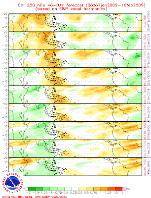
MJO forecast suggests still we are in a mild wet phase... and will continue till 10-Feb-09.
Here is the long range precipitation forecast till June-2009.... It suggests a more than normal rainfall for Western Peninsular India.

Chennai:
we are experiencing near 30 deg temperatures and bit more humid than previous weeks.
Certainly for the past 4 days the minimum temperature was not at all low.
Today, morning it was fully cloudy and warm.
Now(29-Jan-09, 11:35AM) the humidity is on the higher side 65% and temperature is rising steady at 28.8°C.
Are we nearing the end of winter season or something else..??
We might have a localized shower or two in next 72 hrs.
GFS models suggest nothing and will remain so.
MJO forecast suggests still we are in a mild wet phase... and will continue till 10-Feb-09.
Here is the long range precipitation forecast till June-2009.... It suggests a more than normal rainfall for Western Peninsular India.

Saturday, January 24, 2009


A classic shot of 2 cyclones
A classic shot of 2 cyclones
one to north-east of Madagaskar "TC - ERIC"
and other one approaching Madagaskar from South-west "TC - FANELE"

one to north-east of Madagaskar "TC - ERIC"
and other one approaching Madagaskar from South-west "TC - FANELE"

Mild winter day & night
We(Chennai) are experiencing a mild winter day & night from 10-Jan-09 to till date.
From 15-Jan-09 to 21-Jan-09 there was some cloud activity over the South-south-bay near the 5th parallel...gradually it became a huge cloud mass and moved south instead of moving north-west.
Now it's a potential cyclone just south of Equator.
Again the Bay is clear and there are some cloud formations over South-western Arabian sea.
Going thru all parameters, next 5 days will be with bit warm days and mild nights.
The low temperature will be around 21 deg.
A sudden change in MJO forecast says,
that we are currently in a wet phase and will continue till 7-Feb-09.
Previously it was predicting a wet phase from 2-Feb-09 to 14-Feb-09.

Monday, January 19, 2009
Some activity in South Bay

Chennai, remained clear and dry thru the day.
Some cloud formations can be seen till early Noon and nothing else after that.
Meanwhile, latest satellite pic shows lot's of activity near EAST of Srilanka and it covers a GOOD sizeable region in Southern Bay.
Early morning picture showed very small cloud mass, but now (7:07pm) it's a huge mass.
GFS reflects nothing for even South-Tamilnadu.
Friday, January 16, 2009
Almost an Electric shower
As expected we(Chennai) almost had an electric shower...
We had a sharp shower late into night with any electric activity.
From yesterday morning, it was DIM with a mild high cloud cover, Temperatures nearing 30 deg, Bit high in humidity around 60% and in late afternoon lot's of low cloud formations were seen.
We even had some sprinkles of rain around 6 PM.
After that also clouds formations were moderate and after midnight we had a shower.
Satellite pic analysis and latest visible satellite pic shows some formations overnight and nothing much now(16-Jan-09, 12:30PM).
For the past 3 days we have some moisture from sea, that is creating these local bursts.
Please note: These local moisture based activities CANNOT be predicted using any GFS models till date. These can be predicted ONLY using VERY LOCAL weather data.
Today(16-Jan-09), it's like a perfect November monsoon day.... bit warm and sultry.
Less cloud formations can be seen.
Forecast: These local disturbance will continue for another 48 hrs, then gradually the night will become cold again and with DEWs in morning.
Thursday, January 15, 2009

Warm and Windy - Pongal Holidays.!
Chennai, lately is warm, sunny and WINDY.
Humidity was and is around 60%.
After some 10 days the minimum temperature was a bit low today(15-Jan-09) at 23.0°C.
Wind is from North-north-east and at times it's gusting from 20 KM/h to 30 km/h.
Going thru all local weather patterns, we might soon have a electric shower.
Latest Satellite pic shows nothing over Bay region.
And GFS shows no activity for next 5 days.
Tuesday, January 13, 2009

Bit warm day(s) and morning(s)
Chennai:
For the past 7 days the minimum temperature was not low at this time of year.
Humidity was around 50%.
Although the DAY temperature was around 29 deg, we can feel some HEAT out of it.
Latest GFS & Satellite... shows NOTHING(No rain) for next 5 days.
Even the "Total percipitable Water" potential has also gone down over the Bay region.
This means there'll not be any formations over Bay for next 7 days.

According to MJO forecat, we are moving into a VERY dry phase of MJO.

Today morning we got reports of MILD showers over South of Chennai(not suburbs).


Thursday, January 08, 2009
After a January month wet night...
All Time record for this month
High: 34.4 C (25.1.2006)
Low: 13.9 C (29.1.1905)
Daily Rain: 212,9 mm (15.1.1915)
Total Rain: 244.1 mm (1915)
Chennai:
We received rainfall from yesterday Afternoon, initially it was a mild drizzle then it became showery and steady.
Mild showers thru the night.
Past 24 hr rain: 17 mm
Now (8:39AM) it's partly cloudy with rain cloud formations moving into city from east-north-east. It's bit warm now, signs of high humidity.
Last year also we had some showers around 10-Jan-08.
Latest satellite image shows...NOTHING.. for us.
Yesterday's cloud formation over us is melting away..
And we can see some activity near WEST of srilanka. And this will move west and cross Tamilnadu's Southern tip.


Here's the RAIN forecast from BBC for SATURDAY and SUNDAY.

Latest GFS shows..
A high pressure will be over us from 10-Jan to another 5 days.
This will give a good winter weather.
MJO
Latest MJO forecast shows...
SEVERE DRY phase for us till 22-Jan-09.
After that we move into a SEVERE WET phase.
We might experience a WET early february this year, if that happens then it'll be a UNUSUAL year to start.
High: 34.4 C (25.1.2006)
Low: 13.9 C (29.1.1905)
Daily Rain: 212,9 mm (15.1.1915)
Total Rain: 244.1 mm (1915)
Chennai:
We received rainfall from yesterday Afternoon, initially it was a mild drizzle then it became showery and steady.
Mild showers thru the night.
Past 24 hr rain: 17 mm
Now (8:39AM) it's partly cloudy with rain cloud formations moving into city from east-north-east. It's bit warm now, signs of high humidity.
Last year also we had some showers around 10-Jan-08.
Latest satellite image shows...NOTHING.. for us.
Yesterday's cloud formation over us is melting away..
And we can see some activity near WEST of srilanka. And this will move west and cross Tamilnadu's Southern tip.


Here's the RAIN forecast from BBC for SATURDAY and SUNDAY.

Latest GFS shows..
A high pressure will be over us from 10-Jan to another 5 days.
This will give a good winter weather.
MJO
Latest MJO forecast shows...

SEVERE DRY phase for us till 22-Jan-09.
After that we move into a SEVERE WET phase.
We might experience a WET early february this year, if that happens then it'll be a UNUSUAL year to start.
Wednesday, January 07, 2009
Surprise Day in January!
What a surprise we woke up with slight drizzle.
No DEW around.
Temperature was mild with some slight breeze blowing from NORTH.
In the morning it was partly cloudy and with some signs of MORE drizzle.
Today thru the day we recorded high humidity..at 91%
Now (4:43PM) it's drizzling mild and steady.
More drizzles and even a mild shower is forecast for late evening. And from tomorrow morning this weather pattern will slowly move away.
Going by the latest Visible & IR satellite image...

We can see some mild cloud cover can be seen over most of North-Tamilnadu and South-Andhra.
This is causing some local formations and that too weak in nature.
We can expect this weather pattern for next 24 hrs and melt away.
Latest numeric models suggest... more rain for Southern Tamilnadu.
Sunday, January 04, 2009
"Cold Wave in India Attributed to Global Warming"
'Cold Wave in India Attributed to Global Warming'
Taken from Newsbusters.org
Imagine yourself as a big time editor, and somebody brings you an article with the headline, "Cold Wave in India Attributed to Global Warming."
Wouldn't you strongly suggest a rewrite?
Well, no such sanity occurred at the Indian website Sify on Tuesday.
Instead, that preposterous title actually did get published atop an article of equally absurd and hypocritical content (emphasis added):
Story Continues Below Ad ↓
Mumbai: The recent cold wave sweeping across Mumbai and other parts of India could be attributed to global warming, experts said on Tuesday here at an environmental conference.
Addressing the ‘Combat Global Warming’ conference at the Indian Merchants Chamber (IMC) here, former Union minister for power and environment Suresh Prabhu said global warming was primarily a problem created and induced by human beings.
He said the increase in emission of green house gases like carbon dioxide, nitrogen oxide and methane had resulted in the situation, which could prove catastrophic if unchecked.
Prabhu said the cold wave that swept Maharashtra and other parts of India recently could be attributed to the phenomenon of global warming.
Astounding, wouldn't you agree?
After all, the foundation of anthropogenic global warming is that carbon dioxide placed in the atmosphere by man is exacerbating the greenhouse effect thereby making the planet heat up to dangerous levels that will melt glaciers and polar icecaps making ocean levels rise and eventually swamp coastal areas around the world.
Yet, conveniently, now that we have entered solar cycle 24, and the planet as predicted by many scientists is starting to cool, the global warming crowd is blaming it on carbon dioxide.
Which is it, folks: is carbon dioxide WARMING the planet, or COOLING it?
In the end, it's a wonderful position of infallibility these folks have created, for now regardless of what the weather does, it can all be attributed to man.
Sadly, the joke's on us, for poorly educated and biased media representatives not only don't recognize the hypocrisy in this position, but also certainly won't question it.
How unfortunate for all of us.
Cold wave in North India
Here are lots of headlines regarding "Cold" conditions in North India...
Dense fog disrupts rail traffic - December 21, 2008
Cold wave grips Bihar - December 18, 2008
Dense fog disrupts air, rail traffic in Delhi - December 30, 2008
Trains starting from Jammu cancelled - August 5, 2008
Heavy fog affects flights, train schedules in Delhi (Second Lead) - December 29, 2008
Flights, trains to and from Delhi delayed by fog (Lead) - December 29, 2008
Three die after falling off overcrowded train in West Bengal - November 19, 2008
Dense fog engulfs Delhi, hits flight, train schedules - December 29, 2008
Cold wave claims 50 lives
**********************************
New Delhi - Over 50 people have died as towns and cities in India's northern Uttar Pradesh state came under the grip of a cold wave, a news report said on Saturday.
"Over 50 deaths due to cold were recorded in hospitals across the state in the past week. Most of the victims were pavement dwellers," a government spokesperson told the Indo-Asian News Service, Ians.
The deaths were reported from districts such as Sultanpur, Banda, Jaunpur and Rae Bareli, which witnessed near-freezing temperatures.
Temperatures have plummeted as state capital Lucknow and other main cities such as Kanpur and Agra saw temperatures between 3.6 degrees celsius and 4.4 degrees celsius.
Little protection against cold
Beggars and the homeless spent the bitterly cold nights with little protection beyond plastic sheets and sacks, the reports said. They were seen lighting fires to save themselves from the bitter cold.
The thick blanket of fog disrupted air and rail traffic in the state. Even on the roads, vehicles moved slowly to avoid any accidents.
The state home department has issued orders for bonfires to be lit along roads for the homeless. It has also advised the local administrations of various districts to order the closure of educational institutions due to the extreme cold.
Indian weather officials said the cold would persist over the next few days.
"The cold spell will continue for at least another week even though the temperature could rise a little over the next 24 hours," state meteorological department director JP Gupta said.
**********************************
Chennai:
City remains mild after 2 nights of cold before 1-Jan-09.
Now the min. temperature is around 19.5°C.
For next 3 days the Max temperature will be around 29 deg and Min temperature will be around 19 deg.
Mainly clear skies and humidity around 50%, and this might go up after 48hrs.
No threat of rain and not even drizzles.
Thursday, January 01, 2009
NASA Finishes Listening For Phoenix Mars Lander
December 1, 2008 -- After nearly a month of daily checks to determine whether Martian NASA's Phoenix Mars Lander would be able to communicate again, the agency has stopped using its Mars orbiters to hail the lander and listen for its beep.
As expected, reduced daily sunshine eventually left the solar-powered Phoenix craft without enough energy to keep its batteries charged.
The final communication from Phoenix remains a brief signal received via NASA's Mars Odyssey orbiter on Nov. 2. The Phoenix lander operated for two overtime months after achieving its science goals during its original three-month mission. It landed on a Martian arctic plain on May 25.
"The variability of the Martian weather was a contributing factor to our loss of communications, and we were hoping that another variation in weather might give us an opportunity to contact the lander again," said Phoenix Mission Manager Chris Lewicki of NASA's Jet Propulsion Laboratory, Pasadena, Calif.
The end of efforts to listen for Phoenix with Odyssey and NASA's Mars Reconnaissance Orbiter had been planned for the start of solar conjunction, when communications between Earth and Mars-orbiting spacecraft are minimized for a few week. That period, when the sun is close to the line between Earth and Mars, has begun and will last until mid-December.
The last attempt to listen for a signal from Phoenix was when Odyssey passed overhead at 3:49 p.m. PST Saturday, Nov. 29 (4:26 p.m. local Mars solar time on the 182nd Martian day, or sol, since Phoenix landed). Nov. 29 was selected weeks ago as the final date for relay monitoring of Phoenix because it provided several weeks to the chance to confirm the fate of the lander, and it coincided with the beginning of solar conjunction operations for the orbiters. When they come out of the conjunction period, weather on far-northern Mars will be far colder, and the declining sunshine will have ruled out any chance of hearing from Phoenix.
************************************
Here's the last recorded weather in Phoenix's landing area:

************************************
Some images from Phoenix:


Subscribe to:
Posts (Atom)