Wednesday, June 11, 2014

Posted Wednesday Night:

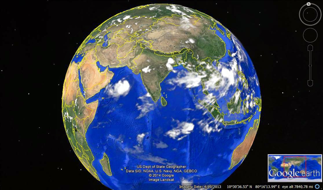
Na Nauk has tracked NW, and is located at 17.5N and 65.9E...core estimated winds at 55-60 knts and estimated pressure is 983 mb..
System will track west from Thursday, and move towards Oman...System will weaken from its strongest phase, and may strike lower than Cat 1. Na Nauk may cross Oman coast near Masira island in the region between Sur and Khaluf on Saturday.
Muscat may get intermittent rains from Friday.

For Mumbai, the best would be for the system to first cross west of 65E. That would "detach" the SW winds from being engulfed, and would be free to flow SW into the West coast of India.
Hopefully, the 65E boundary would be crossed by Thursday night, and revival of Monsoon would start from Friday/Saturday.
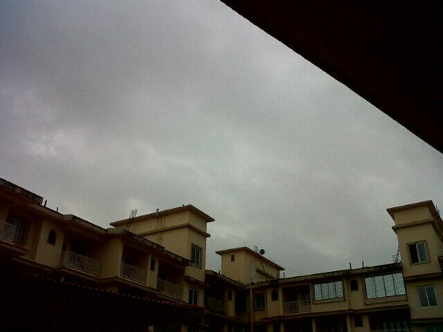
In the meantime, some convective thunder cells are likely to pop up around Mumbai and Pune on Thursday..giving the region a hit/miss chance. Convective chances are good in Madhya Mah. and Marthwada.

From: www.vagaries.in

Bleak revival again over west coast

As expected the weak monsoon flow  STOP supplying feeder to NANAUK.

Though weak the SWM current,  may re organise over Kerala coast.

The Mascarene high is in a very diffused stage with 1020hPa near Mauritius.

Nanauk update at 8pm

Cyclone Nanauk has again tracked in N-W direction in past 6 hrs and maintained it's intensity.
Pressure 982 mb
Winds upto 110 kmph

5:30pm, Shows the massive structure of Cyclone Nanauk and lots of T showers over central,East India ... http://ow.ly/i/5S131 
5:30pm, Lots of showers seen along N,central Kerala and along Karnataka coast, T showers also seen over Himachal ... http://ow.ly/i/5S131

Belgaum -  "on and off rain in afternoon and now its raining heavy at 8pm"
#Chennai - 7:30pm, a mini moderate intensity shower is nearing W-S-W,S-W suburbs, expected to push in another 30 min.

Weather Instagram at June 11, 2014 at 06:05PM

#chennai - 6pm, warm evening. Short moderate rain possible in some zones after 7pm. #weather


from Instagram

Monsoon for Mumbai expected on 17-Jun !!


3:30pm, More showers lining up to push into Kerala coast and intermittent showers continue along Karnataka coast ... http://ow.ly/i/5RP41 

On 12-Jun, Monsoon current at mid-levels will push and establish into S,S-central Karnataka, S Andhra http://ow.ly/i/5RQ6s 
Monsoon current at lower levels are established upto Goa and into most zones of Karnataka, Tamilnadu, S,central Andhra as well.

Next monsoon push along S-W coast is expected from 15-Jun just after Cyclone Nanauk ... http://ow.ly/i/5RQhm 
@ShrirangAS >> Monsoon is expected to reach #Mumbai on 17-Jun !!
The parameters will get clear only after Arabian sea Cyclone Nanauk !

In Bay wing of Monsoon, a mid, upper level circulation expected over N-E Bay on 15-Jun ... http://ow.ly/i/5RQE0 

Monsoon reports from S-W coast of India, 11-Jun

RT @Sailorabee: It's still raining. @weatherofindia @WeAreKochi 
#kochi #Monsoons (12:54am)

RT @vikantsahay: @weatherofindia cloud cover over Goa this morning. Rained heavily last night.  monsoon? http://t.co/PD4esIxUmW (6:57am)


RT @rajeshpp2: @weatherofindia Yesterday night insistent rain lashed Alleppey ,Kerala  !!! (8:42am)

RT @rajugana: @weatherofindia Bangalore 11.10am, Clear skies, bright sunshine, windy...where all the monsoon clouds gone ??? 

RT @rajugana: Bangalore 1.45pm,  High Cirrus clouds, silverish Sunshine..with patch of dark clouds ..Surreal atmosp http://ow.ly/i/5RLv8 


RT @sanjeevnaique: No sign of rain here in #Margao in #Goa with bright sun shine at 2pm. Hot n Humid climate. If it rain will update.

Cyclone NANAUK takes shape, intensifies, moves N-W

An insight into 02A - Nanauk - "Will it hit Indian coast??"

Analysis at 1:30pm suggests that, Cyclone Nanauk has further intensified and has tracked N-W during past 12hrs.
Present position is 16.97N , 66.57E
Pressure around 980mb
Winds upto 110kmph.

1:30pm, Visible shot reveals an EYE in Cyclone Nanauk. And heavy convective activity is concentrated along its S-W quadrant.

JTWC report at 2pm
~~~~~~~~~~~~~~~~~~~~~~~~~~~~
TROPICAL CYCLONE (TC) 02A (TWO), LOCATED APPROXIMATELY 496 NM EAST-
SOUTHEAST OF MASIRAH ISLAND, HAS TRACKED WEST-NORTHWESTWARD AT 05
KNOTS OVER THE PAST SIX HOURS. ANIMATED ENHANCED INFRARED SATELLITE 
IMAGERY INDICATES THAT DEEP CONVECTION HAS WEAKENED OVER THE PAST 
SIX HOURS DUE TO INCREASING EASTERLY VERTICAL WIND SHEAR (VALUES 
ABOUT 20 TO 25 KNOTS). A 110549Z METOP-A IMAGE DEPICTS CURVED DEEP 
CONVECTIVE BANDING WRAPPING INTO A DEFINED CENTER, HOWEVER, THE BULK 
OF THE DEEP CONVECTION IS DISPLACED OVER THE WESTERN SEMI-CIRCLE. 
BASED ON THE DEGRADED MICROWAVE SIGNATURE, THERE IS FAIR CONFIDENCE 
IN THE INITIAL POSITION. FURTHERMORE, DVORAK INTENSITY ESTIMATES 
HAVE REMAINED AT 55 KNOTS, THEREFORE, THE INITIAL INTENSITY IS 
MAINTAINED AT 55 KNOTS. OVERALL, THERE ARE NO MAJOR CHANGES TO THE 
FORECAST PHILOSOPHY WITH TC 02A EXPECTED TO MAINTAIN A WEST-
NORTHWESTWARD TRACK UNDER THE STEERING INFLUENCE OF THE SUBTROPICAL 
STEERING RIDGE. DYNAMIC GUIDANCE HAS DEGRADED WITH POOR AGREEMENT 
DUE TO MAJOR DIFFERENCES IN THE INTENSITY AND TRACK FORECASTS. GFDN 
INDICATES RAPID WEAKENING AND AN ERRATIC NORTHWARD TRACK WHICH MAKES 
LITTLE SENSE WHILE UKMO TRACKS THE SYSTEM SLOWLY INTO THE 
SUBTROPICAL RIDGE. GFS AND NAVGEM HAVE REMAINED THE MOST CONSISTENT 
MODELS AND PRESENT THE MOST LOGICAL SOLUTION WITH A WEST-
NORTHWESTWARD TRACK. THE JTWC FORECAST FAVORS THESE MODELS AND IS 
CONSISTENT WITH THE PREVIOUS FORECASTS. THE INTENSITY FORECAST 
REMAINS THE MOST CHALLENGING ISSUE WITH GFS TRACKING A STRONGER 
SYSTEM WESTWARD OVER OMAN WHILE NAVGEM WEAKENS THE SYSTEM PRIOR TO 
LANDFALL AND TURNS IT WEST-SOUTHWESTWARD. DUE TO THE PRESENCE OF DRY 
AIR AND PERSISTENT EASTERLY VERTICAL WIND SHEAR, THE SYSTEM WILL 
LIKELY WEAKEN RAPIDLY AS IT APPROACHES THE COAST. THIS FORECAST WILL 
MAINTAIN THE PEAK INTENSITY OF 80 KNOTS FOR THE TIME BEING. DUE TO 
THE INCREASING DISAGREEMENT BETWEEN THE MODELS AND THE UNCERTAINTY 
IN THE INTENSITY FORECAST, THERE IS LOW CONFIDENCE IN THE JTWC 
FORECAST TRACK, ESPECIALLY AFTER TAU 72.

Forecast::
~~~~~~~~~~~~~~~~
NAVGEM model expects the Cyclone to track N-W and reach Oman coast on 15/16-Jun as Cyclone itself.

GFS expects the Cyclone to track N-W during next 72hrs and weaken or even dissipate before reaching Oman coast on 15-Jun.
If this happens, then it's good for the Arabian sea wing of the Monsoon to consolidate and progress North upto Mumbai.