Sunday, August 31, 2014

Posted Sunday Night:
Come September ! 
(Only significant rain events elaborated).
Monday 1st September, the current UAC moves West/ North-Westwards and brings Heavy Rain to West MP, Eastern Gujarat region, South Gujarat Coast and parts of North Central Maharashtra (Aurangabad, Jalgaon, Akola, Nasik). 
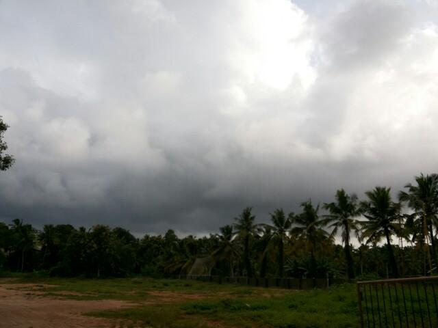
Rains reduce in Konkan.

Monday Night into Tuesday 2nd, Showers increase in Coastal Saurashtra.

Monday and Tuesday due to moisture inflow, patches of rain are possible in North Rajasthan, Haryana, Punjab, and Delhi NCR.

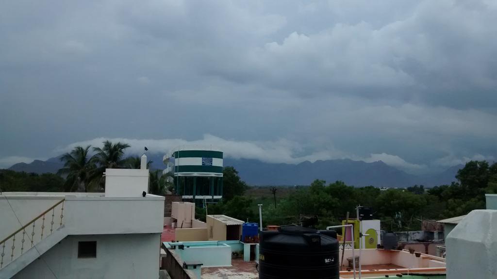
Tuesday Night/Wednesday 3rd, rains move into rest of Gujarat including Kutch. Increase in rains in NW India States. 

On 2nd September, from the pulse from the erstwhile UAC, AS-1 forms as a Low near the West Gujrat/Pakistan border. Kutch and adjoining Sindh may get heavy showers in patches.

Pakistan:
2nd September, Rains also move into South and SE Sindh, Upper Sindh, adjoining Pak Punjab, almost covering roughly the Eastern half of Pakistan. ( Sukkur, Hydreabad, Nawabshah included).
Punjab cities ( Lahore, Gujrat, Multan ) can get thunder showers.

Thunder Showers in Karachi Tuesday Night through Wednesday. There is a possibility of heavy rains on Saturday next, but we wait before confirming.
Heavy Falls in MP on all days.

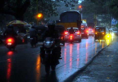
Delhi NCR: The odd shower on Monday in some patches. Rains increase on Wednesday and regions may get around 20-25 mms.

Mumbai: Reduced rain intensity on Monday, with some evening showers could be heavy. Rains around 35 mms.
Lessening intensity on Tuesday and Wednesday.
Pune: another Thunder shower on Monday, and some decrease in rains from Tuesday.


No significant rains developing around Hyderabad.
Seems that the axis shifting South has forced the Bay winds to push eastwards into North India plains. This may delay the earlier announced formation of BB-8.
 

Badlapur Overall August 2014 Weather.

Overall August month had good normal to above normal Rain.


Weather stats in above pic.


Rainfall analysis in above chart.(Click on image for better view)

Weather Instagram at August 31, 2014 at 04:30PM

#chennai - 4:27pm, low, medium cloud formations seen but nothing threatening. Photo facing SW. #weather


from Instagram

RT @pvvn4u: Unstoppable rain in #Mumbai from last night. Thank god its Sunday. Just be at your home and tweet. #Twitter 12:42pm.

RT @WeAreTrivandrum: Itz a sunny sunday today! No showers till now! #Thiruvananthapuram #trivandrum @weatherofindia 1:54pm

Come September ..... Second summer rainfall

சூரியன் செப்டம்பர் மாதத்தில் இந்தியாவின் தெற்கு பகுதியான தமிழகம் உள்ளிட்ட தென் பகுதிக்கு வந்துவிடும். இந்திய பெருங்கடலின் தென் பகுதியில் வெப்பம் பரவ ஆரம்பிக்கும் நேரம் இது.  எனினும் மோரிஷியஷுக்கு அருகில் 'உயர் காற்று மண்டலம்" வலுபெற்று உள்ளது. 
இதனை படங்கள் உறுதி செய்கின்றன. இதன் காரணமாக இந்தியாவின் மேற்கு கரை ஓரம் மீண்டும் மழை வலுப்பெறும்.  

 This precipitable water  indicated atleast 50mm rainfall over TamilNadu and above 60mm above Mangalore coast to Gujarat coast.

According to midnight GFS model...
Chennai, NE Tamilnadu - today is expected to get showers around noon and into evening.
Almost 60% chance of rain today.

Saturday, August 30, 2014

Weather Instagram at August 30, 2014 at 10:55AM

#chennai - 10:50am, partly cloudy, getting hot with breeze around. Moderate rain expected after 3:30pm. #weather


from Instagram

Thursday, August 28, 2014

Weather Instagram at August 28, 2014 at 06:58PM

#chennai - 6:45pm, a mild evening. Light rain expected after midnight. #weather


from Instagram

#Chennai - Today, Friday - there's a 20 to 30% chance of T shower after 5pm.
Overall less rain forecast for Tamilnadu during next 2 days.

@ssg89 >> NO rain expected for much of N,N-central,N-W India (including #Delhi ) during next 2 or days.
Signs of Monsoon withdrawal seen !

Latest analysis show a strong low-level circulation over Bay near to N-E Andhra coast, S Odisha coast ... http://ow.ly/i/6Ham6 
A weak low-level circulation also seen over Uttarpradesh as well.

Present Bay circulation is titled S-S-W with height.
700hpa / mid-level circulation is near to N-E Andhra coast .. http://ow.ly/i/6Haq8 
At 500hpa / upper-level the circulation is near to S-central coast of Andhra ... http://ow.ly/i/6Harb 

At low,mid-levels the circulation over S,S-W Rajasthan persists even today ... http://ow.ly/i/6HatI 

11am, Due to this Bay circulation... HEAVY convective activity seen along central Andhra coast and central Bay .. http://ow.ly/i/6Havy 
11am, HEAVY rain persisting along Karnataka coast, rain also over S Madhyapradesh, Odisha, S Bengal ... http://ow.ly/i/6Havy

In 42hrs, the low,mid-level circulation from Bay is expected to push into N-E,N-central Andhra coast and drift N-W .. http://ow.ly/i/6HazW 
The upper-level circulation will push into S-central coast Andhra and drift N-W into inland in next 42hrs ... http://ow.ly/i/6HaE2 
Bay circulation after crossing into N-E Andhra, the low,mid-level circulation expected to pop into Arabian sea along Mumbai coast on 31-Aug

Rainfall alert for next 42hrs
~~~~~~~~~~~~~~~~~~~~~~~~

HEAVY rain along Karnataka coast to persist during next 2 days.
Scattered rain will persist along N,central Kerala.. http://ow.ly/i/6HaMl 
Before morning of Friday...
HEAVY rain for N,N-E,E Karnataka, N,N-W,N-E,central Andhra into S-E,E Maharastra .. http://ow.ly/i/6HbgB 
Before today late-evening, scattered T showers for S Chatisgarh, Jharkhand, Odisha and S,N Bengal .

Friday - mid morning, afternoon, evening ..
Scattered HEAVY rain for N-E,N,N-W,central Andhra and push into S,central,E Maharastra.
Friday and into morning of Saturday, scattered HEAVY rain for N,N-E,N-central,E Karnataka ... http://ow.ly/i/6HbpC 
As the circulation pushes N-W..
Heavy showers for S,S-W,central,S-E,N,N-W Maharastra on Friday and into Saturday... http://ow.ly/i/6Hbsf 

Wednesday, August 27, 2014


RT @WeAreTrivandrum: Cloudy #trivandrum. Chance for an evening shower! #Thiruvananthapuram #Kerala  http://t.co/kO1zyTzYhu (5:22pm)

RT @WeAreTrivandrum: Yes! It is raining here now at #trivandrum, after 2 days!! #Kerala @weatherofindia (5:59pm)

Weather Instagram at August 27, 2014 at 03:42PM

#chennai - 3pm, a mild and fully cloudy day so far. Showers possible after 7pm. #weather


from Instagram


As expected a circulation has formed at all levels over Bay.
Sea level circulation is seen over N-central Bay ... http://ow.ly/i/6Gslu 
The mid,upper-level circulations are slightly tilted to S-S-W.
Upper is seen over W-central Bay ... http://ow.ly/i/6Gsp2 

1:30pm, Due to circulation over Bay.. it is very active over central,West Bay ... http://ow.ly/i/6GsqJ 
1:30pm, Heavy rain along Karnataka coast and N,central Kerala ... http://ow.ly/i/6GsqJ

Tuesday, August 26, 2014

#chennai - 10:20pm, a T shower system is now pushing into W suburbs.
More rain ahead for the night... http://ow.ly/i/6G27Z


1pm, Massive rain seen all along from S-E Gujarat coast to S Karnataka coast ... http://ow.ly/i/6FGaR 
"central Bay is very active"

Good offshore trough seen along Maharastra coast upto S Karnataka coast ... http://ow.ly/i/6FGhi 
A good upper-level circulation seen along W, coast Maharastra ... http://ow.ly/i/6FGki 
And expected to persist for next 18hrs.

In 24hrs, a strong low,mid-level circulation expected over N-central,central Bay ... http://ow.ly/i/6FGnk 
On 29/30-Aug, the low,mid-level circulation from Bay is expected to reach N,central Andhra coast ... http://ow.ly/i/6FGqr 
And, the upper-level circulation is expected to cross S Andhra coast, #Chennai on 29/30-Aug... http://ow.ly/i/6FGsG 

Today, the low,mid-level circulation over S,S-W Rajasthan persists ... http://ow.ly/i/6FGvh 
This S Rajasthan circulation is expected to persist for next 42hrs !

Rainfall alert
~~~~~~~~~~~~~~~~~~~
Widespread rain along Maharastra coast, Karnataka coast is expected to persist till Thursday morning.
Scattered HEAVY rain also expected for N,central Kerala during next 42hrs... http://ow.ly/i/6FGDx 

Before early morning of 27-Aug...
Scattered T showers for S,central,W Maharastra, many parts of Karnataka, W,S,N-W Andhra.
T showers also for S Karnataka, N,N-W,N-E,N-central coast Tamilnadu and S Andhra on today and Wednesday.

Scattered T showers for S Odisha, S,central Bengal on today and 27-Aug !
Today, Tomorrow - T showers for S-E,E,N-E Gujarat, S,S-E Rajasthan, W,S-W Madhyapradesh

#Chennai - T showers expected today evening into midnight.
And Showers expected around mid-morning of Wednesday.

Tomorrow, scattered T showers expected for Odisha, N,N-E Andhra, E Maharastra, S Chatisgarh.. http://ow.ly/i/6FGQB 

Monday, August 25, 2014


5:30pm, Scattered HEAVY rain over S,S-E,E Gujarat, W,central,S Maharastra, N,N-W,N-E Andhra, Odisha, Jharkhand.. http://ow.ly/i/6F2B8 

#Chennai - 7:20pm, T showers seen over N-W at around 130km from city. T Showers "may" push into city after 10pm !
#Chennai - Rainfall till 8:30am today...
Nungambakkam = 89.3 mm,
Airport = 85.2 mm,
IWM Polichalur = 45 mm.

#Chennai - 24-Aug, Midnight Thunder Storm... RADAR images video ... http://youtu.be/v9OXLgS8030


Chennai - 24-Aug, Thunder Storm "Lightning Video" ... http://youtu.be/a0m1CIap3MY

Sunday, August 24, 2014

Posted Sunday 24th Night..

Initial Indication of Season Change is seen at 200 mb levels. Jet streams have become Westerly above the 25N line. Monsoon can see a change in the next 10 days...

A trough off the West Coast of India remains active.
A UAC could form in the trough somewhere around South Konkan.

On Tuesday, we can expect an interaction of North winds and West winds around N.I.Karnataka regions.


City weather and details in Vagaries
#Chennai - 10:53pm, its raining now over Polichalur zone with high winds.

RT @abhish05: @weatherofindia raining in T Nagar too. Thanikachalam road. 10:56pm  #chennai
#chennai - 11:49pm, heavy T shower with winds continue over Polichalur zone.
IWM Polichalur rainfall so far 35.7mm

#chennai - 9:45pm, severe T shower is now pushing into NW suburbs.
This can be widespread covering all zones of city http://ow.ly/i/6ECah

DHATSAN AYANAM & Rainfall

23.08.2014 16 LT

24.08.2014 16 LT
The downward [south] marching sun will be around 14 to 13 Degree North latitude for this date and time.

In land heating around this area is evident.


The South Indian Ocean (SIO) slowly getting warmer.

This diffuses the semi permanent high there

Impact will be felt on SWM rainfall after two or three days.

1:40pm, T showers seen over S Andhra, around 150 to 200km N-N-W,N-W from #Chennai ... http://ow.ly/i/6EvCC 
#Chennai - 2pm, After a cloudy morning.. it is getting hot and humid.
T showers expected to push in from W,N-W after 4pm.


RT @rajugana: @weatherofindia Bangalore 1.30pm, Sky dotted with puffy clouds, sun playing hide n seek.. sky pic http://t.co/m3oEdYvDJF 

Analysis show that low,mid-level circulation is now over Arabian sea near to Karnataka coast ... http://ow.ly/i/6EujT 
This circulation is expected to weaken and become a trough along Goa, N-coast Karnataka, S-coast Maharastra in 36hrs http://ow.ly/i/6EulZ 
On 25-Aug evening, an upper-level(500hpa) weak circulation is expected along Maharastra coast ... http://ow.ly/i/6Eun4 

Goa and Karnataka coast, N-Kerala coast to get good rainfall till Tuesday !

A weak mid,low-level circulation expected to pop along S Chatisgarh and near-by Odisha on Tuesday.

Around late-evening of 23-Aug, a weak low-level(850hpa) circulation formed along S Andhra coast ... http://ow.ly/i/6EujT
11:30am, Satellite shows rain along Karnataka coast and cloudiness, rain along Andhra coast (due to circulation) .. http://ow.ly/i/6Eusc 
The Andhra coast circulation is not expected to persist after next 12hrs !

Before morning of 25-Aug...
Scattered rain for S,W,central,N-W Karnataka, W,S-W,central,S Maharastra... http://ow.ly/i/6Euun 
Today evening, late-evening, Heavy T showers expected to push into W,central,S,N-W,N Andhra.
Today, scattered T showers for N,N-E,N-central-coast Tamilnadu and #Chennai as well.
Scattered T showers for Odisha, S Bengal, S Chatisgarh and N-E Andhra expected before 8pm today.

After midnight today, scattered rain expected for S,central Maharastra coast and Goa.
Moderate scattered rain expected over N,N-W,N-central Maharastra on forenoon of Monday.
Tomorrow afternoon again...
Heavy scattered rain for W,S-W,S,central Maharastra, N,N-W,N-E Karnataka, into W,N-W,central, N-E Andhra.
Tomorrow, scattered Heavy T showers expected over most zones of Andhra and push into S Chatisgarh, S Odisha.. http://ow.ly/i/6EuyN 
Monday evening, T showers also for N,N-E Tamilnadu, #Chennai.

Saturday, August 23, 2014

Naraikadu  - 10:50am, "a violent push of SW rains since yesterday evening. Rainfall till 8.30 am is 109 mm and still going strong."

Today, the circulation is seen along N, central Kerala coast over Arabian sea .. http://ow.ly/i/6Eazg 
Present circulation is expected push North along Karnataka coast, Goa in next 36hrs ... http://ow.ly/i/6EaDM 

10:30am, HEAVY rain seen along Kerala coast, E Gujarat ... http://ow.ly/i/6EaBW 

Weather Instagram at August 23, 2014 at 11:51AM

#chennai - 11:50am, sharp showers now near Tambaram. #weather . photo from Pallavaram.


from Instagram

The past one week of convective activity has transformed into a violent push of SW rains since yesterday evening. Naraikadu rainfall till 8.30 am is 109 mm and still going strong.

Friday, August 22, 2014

4:30pm, HEAVY rain over Kerala, S tip,S Tamilnadu, S,S-W,S-E Madhyapradesh, Chatisgarh, Odisha, Jharkhand, Bihar.. http://ow.ly/i/6DzjT 


RT @rajugana: @weatherofindia Bangalore 4.10pm, This Dark cloud has a Silver lining...hope it may rain!!.. sky pic http://ow.ly/i/6Dwoc 


RT @WeAreTrivandrum: #Trivandrum #Weather -  raining heavily. @weatherofindia (5:38pm)
RT @WeAreTrivandrum: Motorists were forced to turn on their lights at noon in #Trivandrum via @TvrmConnect.

 http://t.co/EzDVRKriWX 


RT @Arvind_LFC: @weatherofindia  Sathuragiri hills view from Elumalai,Madurai district after an hour rain http://t.co/p3h18PMlXT (5:47pm)

Nagercoil - 4:30pm, Raining from around 1pm.. now heavy [VIDEO] ... http://youtu.be/A63jWsJwWkk
Light rain yesterday evening as well.


Weather Instagram at August 22, 2014 at 03:27PM

#chennai - 2:10pm. Thunder cells over W,SW,WNW. Not expected to move in. #weather


from Instagram


Today as well the low-level N-S trough persists upto S Tamilnadu ... http://ow.ly/i/6Dsq3 
Low,mid-level circulation over S Tamilnadu persists ... http://ow.ly/i/6Dssj 
And even the upper-level (500hpa) circulation persists along S-E corner Arabian sea ... http://ow.ly/i/6Dsux 

From now, the mid,low-level circulation is expected to move N-N-W and push upto Karnataka coast on 24-Aug ... http://ow.ly/i/6DsxO 

Widespread HEAVY rain ahead for S,central Kerala, S tip Tamilnadu from today evening till midnight of Saturday and even into Sunday !!


RT @rajugana: @weatherofindia Bangalore 1.15pm, Sunny, hot and humid with passing clouds...,will it rain?? sky http://ow.ly/i/6DrC9 

#Delhi - 21-Aug, "At 38.4°C, hottest August day in Delhi in 12 years" ... http://ow.ly/ABg3K 
#Delhi - 1pm, HOT again 36.3 C (feels like 43 C).

12:30pm, Showers over N-W,S-W Maharastra, S Tamilnadu, S Kerala. Fresh T showers over Odisha, Jharkhand ... http://ow.ly/i/6Ds3T 

Weather Instagram at August 22, 2014 at 11:00AM

#chennai - 10:45am, good cloud formation and movement from SSE. Rain possible before 2pm. #weather


from Instagram

Outlook for Friday 22nd and Saturday 23rd August:

Thunder showers with heavy falls likely on both days along the North-South stretch from North Madhya Maharastra ( Nasik region) down Southwards into Nagar, Pune , Kolhapur, Solapur and Interior Karnataka regions (Bangalore included). Thunder showers also will be heavy in "interior" Konkan and coastal Karnataka.
Heavy falls in patches will be around 75-100 mms.
Saturday evening will see thunder showers in Marathwada also and Showers possible in Saurashtra and Surat region.

In Pakistan, Karachi area gets light rain on late Friday night/Saturday morning.
Sunday 24th: Rains decrease in the above region. Increase in rainfall in Goa.
Rains increasing in Odisha from Monday.

Mumbai: Thundery conditions and cloudy with some parts getting rain. Saturday night, Mumbai City can get heavy showers, spilling into Sunday morning. With thunder/lightning, guage can measure 35-45 mms by Sunday morning.
Very heavy rain likely in Eastern outer townships on Saturday evening.
Pune: Thunder showers on Friday, and heavier on Saturday. Possibily >35 mms on Saturday.
Kolkata: Showers likely upto 15 mms on Friday, decreasing in the weekend with sunny spells.
Delhi NCR: Only what i can write is days might touch 40c and nights 30c ! 
Parts of Delhi NCR showed the maximum toucjing 39.4c (Yamumna Complex). Palam was 39.3 c on Thursday. Nights could be warm at 29-30c.
Nagpur may get heavy thundershowers in the region on Friday and Saturday.

from Vagaries

Thursday, August 21, 2014

Rain...Rain...... going away

 In the previous post the "condensation Trail" is depicted over  Chennai.  This implies moisture at 30,000 ft .  The warm air advection will bring rain tomorrow morning.
                              or
At least clouding will be there in Chennai tomorrow [22.08.2014] morning. 

This WMO [Severe Weather Information Center-SWIC] picture indicates TS over Tamil Nadu along 10 Deg Parallel too. 
Rapid formation will be there
As the SUN is marching towards south, the south Indian ocean is slowly getting warmth.  This means strength of SWM will be reducing .

The SWM seasonal rainfall pattern for TN

Weather Instagram at August 21, 2014 at 06:49PM

#chennai - 6:30pm, a warm and clear evening. No rain expected on Friday. #weather


from Instagram

@VigneshMohan >> For #Chennai - there's a good chance of T shower over W,S-W suburbs on Saturday evening !

Today as well the low-level trough is seen along S-E coast dipping South upto S tip tamilnadu... http://ow.ly/i/6CJbQ
In this trough, a low,mid-level circulation is embedded and located over S Tamilnadu, Gulf Mannar ... http://ow.ly/i/6CMsL

Yesterday's upper-level circulation over S-E corner Arabian sea near to S Kerala coast persists ... http://ow.ly/i/6CNdD

In next 3 days, the mid-level circulation is expected to drift N-N-W from S Tamilnadu and emerge over Arabian sea along Karnataka coast.
By Sunday, the low-level circulation is expected to reach #Mumbai coast after traveling from S Tamilnadu ... http://ow.ly/i/6CNjD
In 2/3 days, the upper-level circulation will persist over Lakshadweep after moving N-N-W from present position ... http://ow.ly/i/6CNta

N Bay is expected to be CALM till 26-Aug !

Rainfall forecast for next 2 days ::
~~~~~~~~~~~~~~~~~~~~~~~~~~~~~~~~~~

In next 12hrs, Scattered T showers expected ALL along W-ghats from N Maharastra to S tip Tamilnadu ! .. http://youtu.be/igEoI77-wa8
Today late-evening,into early morning...
Scattered HEAVY rain ahead over Karnataka, S,central,E Maharastra, W,N,N-W Andhra into S Chatisgarh
Before midnight today...
Scattered HEAVY T showers expected over central,W,N,N-W Tamilnadu... http://youtu.be/igEoI77-wa8
Tomorrow afternoon again...
HEAVY scattered T showers expected ALL along W-ghats from central Maharastra to S-tip Tamilnadu.
Friday, HEAVY scattered T showers to continue over W,S,central,N-W Tamilnadu ... http://youtu.be/igEoI77-wa8
Friday afternoon... scattered rain expected over Odisha, Jharkhand and into S Bengal.
Scattered T showers for Karnataka to continue on tomorrow.
More T showers ahead for W,S-W,N-W karnataka on Saturday as well.

From early hrs of Saturday, HEAVY widespread rain expected over S,central,W-ghats Kerala and over S tip Tamilnadu.
On Saturday, HEAVY widespread rain for Kerala, Karnataka coast, W-ghats, S tip Tamilnadu ... http://ow.ly/i/6CPus 
12:30pm, Heavy morning rain along #Mumbai has almost vanished now... http://ow.ly/i/6CIN3 
12:30pm, lots of fresh T showers has popped over N-central Maharastra, Odisha and into Jharkhand .. http://ow.ly/i/6CIN3

RT @dna: #Mumbai - Waterlogging in Dadar due to heavy rain http://t.co/18891Mua5G http://t.co/QVjguVZtsu 

Wednesday, August 20, 2014

#Chennai -Today, 21-Aug. W,S-W,N-W suburbs can get a moderate rain... during next 2 days the showers(if any)  may not push from West to Sea.

#Chennai - 2pm, had a HOT and Humid day so far !!


Today, the expected Low-level trough is seen along S-E coast from S Bengal to S tip Tamilnadu ... http://ow.ly/i/6BZjT 
At low-levels a weak circulation or wind discontinuity is seen over S Karnataka, N,N-W,N-E Tamilnadu, S Andhra... http://ow.ly/i/6BZoO 
This low-level trough and embedded circulation is expected to persist for next 2 days over S-central Peninsula ... http://ow.ly/i/6BZrs 

Today at mid,upper-levels, a circulation is seen over S-E corner Arabian sea along Kerala coast ... http://ow.ly/i/6BZvw 
In next 42hrs, mid-level circulation is expected to consolidate over S Tamilnadu embedded into the trough ... http://ow.ly/i/6BZy2 
GFS expects that the upcoming low,mid-level circulation over S,S-central Peninsula will drift N-N-W along W-ghats upto #Mumbai on 24-Aug !!

Sadly !! Almost NO North Bay LOW expected till 25-Aug !!

At present the N-W India, Pakistan LOW (monsoon axis) is around 1002mb ... this is weak and expected to have a strengthening after 25-Aug!
The present low-level trough over Peninsular India can have good rainfall over Interior zones of peninsula and less along S-W,W coast !

12:30pm, Showers persist over N Bihar, N Bengal ... http://ow.ly/i/6BZQk 

Tuesday, August 19, 2014

Weather Instagram at August 19, 2014 at 12:15PM

Acharapakkam - 12:14pm, warm and humid. Clear skies. #weather


from Instagram