
Tuesday, December 31, 2013

Tamilnadu - Jan-2014, first week rain forecast !!
Meanwhile, the low level circulation over S-E Bay persists along 5N ... now it is expected to drift West towards Srilanka coast in 36hrs.
Model(s) suggest that the circulation will reach E-N-E Srilanka coast on 3-Jan... http://ow.ly/i/4aqWb
On 3-Jan noon, Scattered moderate rain expected to push into S,S-E,central,central,S-E-coast of Tamilnadu... http://ow.ly/i/4aqYN
On 4,5-Jan, showers may push deep into Tamilnadu and spread to N-coast, #Chennai as well.

COLD wave and W.D mix !
RT @aknarendranath: @weatherofindia Coldest December morning in Delhi for seventeen years! http://t.co/8cJAxC3O8X
RT @aknarendranath: Cold wave grips north India, Muzaffarnagar coldest in UP at 0.3 degree - The Times of India http://t.co/yaGFDSdxX5
North India shivers as cold wave intensifies ... http://ow.ly/sawF5
North India braves the cold as temperatures continue to dip ... http://ow.ly/sawGH
COLD North India... today morning Hissar (Haryana) and Churu (Rajasthan) records a low temp of -0.1 C
Rainfall till 8:30am today ... "Due to W.D"
HIMACHAL PRADESH: Una 1 cm.
Jammu and Kashmir: Pahalgam, Srinagar, Kathua and Batote 3, Bhaderwah and Banihal 2 cm
Kukarnag, Jammu, Quazigund and Udhampur 1 cm
PUNJAB: Phangota, Madhopur, R.S.Dam site and Shahpur Kandi 1 cm.
EAST RAJASTHAN: Kota 1 cm.
WEST UTTAR PRADESH: Agra, Aligarh, Bareilly, Shahjahanpur, Jhansi, Orai and Hathras 1 cm. UTTARAKHAND: Nanital 1 cm

At present the W.D circulation and trough is weakening... expected to vanish, move E-N-E in next 24hrs ... http://ow.ly/i/4aqGT
But some moisture presence is expected over central,W-central India till 2-Jan.
3:30pm, Cloudy with showers over central Uttarpradesh, and over most places in Kashmir, N Himachal ... http://ow.ly/i/4aqMM

Monday, December 30, 2013
Today as well, the low level circulation over S,S-E Bay along 5th parallel persists ... http://ow.ly/i/49WiB
Models expect the S-E Bay circulation to become a LOW and track West towards N-E Srilanka by 2-Jan-2014... http://ow.ly/i/49Wpa
Going by latest models, almost 95% chance of showers for S,coastal Tamilnadu after 2-Jan.
 Until evening of 1-Jan, DRY, partly cloudy days with COLD mornings ahead for most of Tamilnadu, #Chennai.
FROST warning for Nilgiris.
Models expect the S-E Bay circulation to become a LOW and track West towards N-E Srilanka by 2-Jan-2014... http://ow.ly/i/49Wpa
Going by latest models, almost 95% chance of showers for S,coastal Tamilnadu after 2-Jan.

FROST warning for Nilgiris.
Chennai - Today morning, IWM Polichalur station = 19.4 C (5:44am), Nungambakkam = 20.3 C.
Today morning in South India, Chamarajanagar records a low temp of 11 C
7:30pm, Due to W.D, cloudy with showers seen over N,N-W Madhyapradesh, Haryana, W Uttarpradesh ... http://ow.ly/i/49VoF

Today morning in South India, Chamarajanagar records a low temp of 11 C
7:30pm, Due to W.D, cloudy with showers seen over N,N-W Madhyapradesh, Haryana, W Uttarpradesh ... http://ow.ly/i/49VoF

Delhi = 2.4 C, Hissar = -0.8 C, Agra = 1.4 C
Delhi shivers at 2.4 degree Celsius as cold wave intensifies in north India ... http://ow.ly/s8CZJ
RT @aknarendranath: Coldest December in Delhi in over a decade. Minimum temperature settles at 2.4 degrees Centigrade http://t.co/qvbq4DaKgy
Cold wave continues in North India, Agra records 1.4 deg C ... http://ow.ly/s8D2W
#COLD - Hissar (Haryana) records a low temp of -0.8 C today morning.
Today morning, Chandigarh = 3 C, Srinagar = -5 C, Amristar, Ludhiana = 1 C, Lucknow = 2 C (-6 C below normal)

Mid level W.D trough, circulation persists over central,W Pakistan ... http://ow.ly/i/49LOg
Expected to persist till 1-Jan
Due to this trough,circulation over Pakistan. cloudy, moderate rain, snow expected over Kashmir, Himachal till 1-Jan http://ow.ly/i/49LS7
Today, Due to W.D trough, Cloudy weather with moderate rain for central,E,N-E Rajasthan, N,N-W Madhyapradesh, Haryana, Punjab, #Delhi, W-UP
Cloudy weather, showers expected over N,N-central India till evening of 31-Dec or even till 1-Jan.

12:30pm, Cloudy over E,central Rajasthan, W,N,N-W madhyapradesh ... http://ow.ly/i/49LX1

Saturday, December 28, 2013
MAHARASHTRA SEEING ABOVE NORMAL MIN TEMPS !
Below are the minimum temperature recorded today (28-12-2013):
Amravati 11.4°C (which is lowest in the state today!)
A'Nagar 12.4°C
Nanded 12.5°C
Pune 13.4°C (Above normal by 3c)
Nagpur 13.6°C
Nashik 14.0°C (Above normal by 4.3c)
Jalgaon 14.2°C (Above normal by 3c)
Beed 14.6°C
Sangli 14.7°C
Aurangabad 15.0°C (Above normal by 4.4c)
Bramhapuri 15.2°C (Above normal by 3.3c)
Chandrapur 15.2°C
Buldhana 16.0°C
Solapur 16.1°C
Akola 16.7°C (Above normal by 3.6c)
Ratnagiri 17.5°C
Mumbai (S'Cruz) 18.0°C
Washim 18.0°C
Alibaug 18.3°C
Dahanu 18.9°C
Panji, Goa 19.3°C
S-E Bay is active with a weak low level circulation along 5th parallel over S-E Bay ... http://ow.ly/i/498RV
Both NAVGEM, GFS model continues to predict a Depression over S,S-W Bay on 1-Jan-2014 ... http://ow.ly/i/498Tn ... http://ow.ly/i/498UH

 Till evening of 31-Dec-2013... DRY, partly cloudy day with Cold morning expected for Tamilnadu, #Chennai.
Both NAVGEM, GFS model continues to predict a Depression over S,S-W Bay on 1-Jan-2014 ... http://ow.ly/i/498Tn ... http://ow.ly/i/498UH


In South peninsular India, Belgaum records a min temp of 11 C today morning.
#Chennai - IWM Polichalur station records 21.7 °C (at 7:04am) and Nungambakkam = 22.5 C.
Cold mornings for Tamilnadu... Salem, Dharmapuri = 17 C, Coimbatore = 18 C.
Some other cold cities in South India ... Bangalore, Hyderabad = 15 C, Hassan = 11 C
#Chennai - IWM Polichalur station records 21.7 °C (at 7:04am) and Nungambakkam = 22.5 C.
Cold mornings for Tamilnadu... Salem, Dharmapuri = 17 C, Coimbatore = 18 C.
Some other cold cities in South India ... Bangalore, Hyderabad = 15 C, Hassan = 11 C
Hissar (Haryana) records 0 C almost 6 C below normal
Today morning's minimum temp over N.India was recorded at Adampur (Punjab) = 1.1 C.
Yesterday's lowest day temperature was recorded at Moradabad (Uttar Pradesh) = 13.8 C
North India COLD wave ... Hissar (Haryana) records 0 C almost 6 C below normal.
Mid level W.D trough persists along N-W India upto 25th parallel. moisture presence seen over central,E-central India http://ow.ly/i/498sx
4:30pm, W.D is affecting N Kashmir and cloudy over N-E Madhyapradesh, central,E Uttarpradesh ... http://ow.ly/i/498yn
Till 8:30am today, Rainfall due to mid level W.D trough ... : Jhansi and Hamirpur (Both Uttarpradesh) 1 CM each.
 Present W.D system is expected to persist over N,N-W India with rain / snow till evening of 31-Dec-2013 ... http://ow.ly/i/498Cp
Due to mid level W.D trough... moisture presence, cloudy with light rain is expected to persist over Central,N-central India till 31-Dec.
Cloudy days for N,N-E Madhyapradesh and most of Uttarpradesh is expected to persist till 31-Dec.
Yesterday's lowest day temperature was recorded at Moradabad (Uttar Pradesh) = 13.8 C
North India COLD wave ... Hissar (Haryana) records 0 C almost 6 C below normal.
Mid level W.D trough persists along N-W India upto 25th parallel. moisture presence seen over central,E-central India http://ow.ly/i/498sx
4:30pm, W.D is affecting N Kashmir and cloudy over N-E Madhyapradesh, central,E Uttarpradesh ... http://ow.ly/i/498yn
Till 8:30am today, Rainfall due to mid level W.D trough ... : Jhansi and Hamirpur (Both Uttarpradesh) 1 CM each.

Due to mid level W.D trough... moisture presence, cloudy with light rain is expected to persist over Central,N-central India till 31-Dec.
Cloudy days for N,N-E Madhyapradesh and most of Uttarpradesh is expected to persist till 31-Dec.
Friday, December 27, 2013
Latest analysis show a weak low level circulation and easterlies seen along 5th over S-E Bay ... http://ow.ly/i/48OvO
Latest GFS, NAVGEM models expect a Depression over S,S-W Bay on 1-Jan-2014 ... http://ow.ly/i/48OBs
Surprise !! Showers expected for Tamilnadu during 1st week of Jan-2014 !!

Meanwhile, Partly Cloudy days with DRY nights and COLD mornings expected for most of Tamilnadu, #Chennai till 31-Dec.
#Chennai - today morning it was 20.5 °C at 6:35am.
Temperature now 10:54pm is 24.2 C.
COLD North #India.. #Delhi = 7 C, Lucknow = 5 C, Chandigarh = 4 C, Hissar, Ludhiana = 2 C ( -5 C below normal)
Mid level trough persists along Pakistan, N-W India upto 21st parallel ... http://ow.ly/i/48NF3
9:30pm, This mid level trough is pushing moisture central,N-central India, so its cloudy in this zone with light rain http://ow.ly/i/48NMa


The moisture present over central India is expected to persist till 1-Jan-2014.
A moderate W.D will affect Kashmir, Himachal in next 12hrs.
The W.D is expected to persist even till 1-Jan, with most rain / snow expected to be over Kashmir, Himachal, Punjab http://ow.ly/i/48O6G
For most of N,N-W,N-central, E India ... COLD wave is expected to persist till 31-Dec.
It may dip even more over N,N-W India as well.
Freezing cold continues across Punjab and Haryana ... http://ow.ly/s63Xv
Minus 15 degrees Celsius (-15 C) in Leh ... #Delhi day temp today = 17.1 C (-4 C below normal) ... http://ow.ly/s649n
Mid level trough persists along Pakistan, N-W India upto 21st parallel ... http://ow.ly/i/48NF3
9:30pm, This mid level trough is pushing moisture central,N-central India, so its cloudy in this zone with light rain http://ow.ly/i/48NMa


A moderate W.D will affect Kashmir, Himachal in next 12hrs.
The W.D is expected to persist even till 1-Jan, with most rain / snow expected to be over Kashmir, Himachal, Punjab http://ow.ly/i/48O6G
For most of N,N-W,N-central, E India ... COLD wave is expected to persist till 31-Dec.
It may dip even more over N,N-W India as well.
Freezing cold continues across Punjab and Haryana ... http://ow.ly/s63Xv
Minus 15 degrees Celsius (-15 C) in Leh ... #Delhi day temp today = 17.1 C (-4 C below normal) ... http://ow.ly/s649n
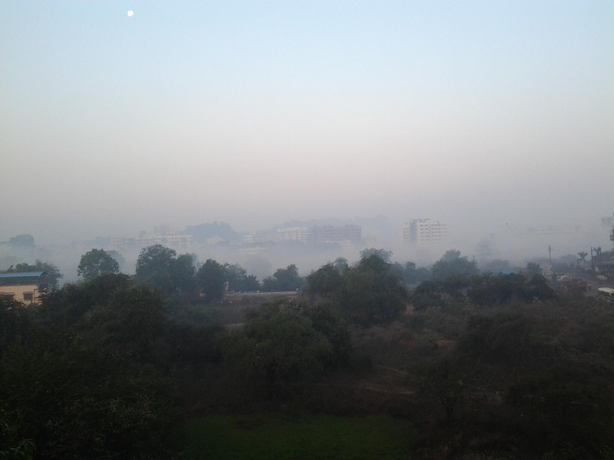
Dense fog engulfs many places in West bengal .
27TH DEC 2013 : -
DENSE FOG PICTURE IN KRISHNAGAR (WESTBENGAL) ...
BRILLIANT PICTURE TAKEN BY :- ATANU KHANDIKAR .....

post by : sksmanian
DENSE FOG PICTURE IN KRISHNAGAR (WESTBENGAL) ...
BRILLIANT PICTURE TAKEN BY :- ATANU KHANDIKAR .....

post by : sksmanian
Thursday, December 26, 2013

Max Temps remain LOW in kolkata .
Conditions Right Now in Kolkata : -
Cool and Cool .......
Cool and Cool .......
temp did not cross 23 C once again ... today ,
with brisk winds from North .
with brisk winds from North .
Mid level trough along Pakistan is seen upto 23rd parallel is pushing moisture into W,central India .. cloudy now... http://ow.ly/i/48689


A moderate W.D is expected to reach N,N-W India around evening of 29-Dec ... http://ow.ly/i/486hb


A moderate W.D is expected to reach N,N-W India around evening of 29-Dec ... http://ow.ly/i/486hb
RT @ajitmishra71: Bhagalpur is feeling extremely cold wave at this time with max temp 16C, min temp 6C. 2 PM, 25-Dec http://t.co/PvaKKzJHNQ

Rajasthan #COLD, Churu records a minimum of 1.5 C.
#Kolkata - today min temp
Alipur : 13.3 C
Dumdum : 10.9 C
Over N,N-W India, yesterday the day temp was also low ... Narnaul (Haryana) records a max temp of 16.5°C
#Chennai - Airport today morning records 20.4 C
Rajasthan #COLD, Churu records a minimum of 1.5 C.
#Kolkata - today min temp
Alipur : 13.3 C
Dumdum : 10.9 C
Over N,N-W India, yesterday the day temp was also low ... Narnaul (Haryana) records a max temp of 16.5°C
#Chennai - Airport today morning records 20.4 C
Chill comes back to the city of joy .
suddenly the cold is biting everyone
today min temp of kolkata :- ( 26th dec 2013 )
1. Alipur : 13.3 C
2. Dumdum : 10.9 C !!!!!!!!!!!
today min temp of kolkata :- ( 26th dec 2013 )
1. Alipur : 13.3 C
2. Dumdum : 10.9 C !!!!!!!!!!!
Tuesday, December 24, 2013
Some cold news from North India, 24-Dec-2013
Intense Cold in North India, Fog Returns to Disrupt Life ... http://ow.ly/s2NZS
North India shivering, Cold wave kills 2 in Himachal Pradesh ... http://ow.ly/s2O8m
#Health - Flu Vs. Cold: How To Identify? ... http://ow.ly/s2Ogv
Cold wave tightens grip in Uttarakhand, Mussoorie receives snowfall ... http://ow.ly/s2Oup
Cold wave intensifies as more hilly areas receive snow, 4 dead in HP ... http://ow.ly/s2OCZ
Manali in Himachal Pradesh recorded 12 cm of fresh snowfall on Monday while Shimla received 6 cm snowfall.. http://ow.ly/i/47yd2
Leh (Jammu & Kashmir) records -9 C
Today morning, Low temp was recorded at Narnaul (Haryana) = 3.3 C.
Mahabaleshwar - "It was very windy here last night. Winter is normal around 12 C"
In next 2 days Min. temps expected to drop even more over most of Rajasthan, Gujarat, across Uttarpradesh and E India http://ow.ly/i/47mLd
Day and Night temp over most of N,N-W,N-central India is expected to be Normal at this time of year during next 3 days.

Some moisture is expected to persist over N,central Peninsula and even over central,East India during next 2 / 3 days.
Present W.D system has almost cleared out from N,N-W India.
Mid level N-S trough to 25N along N-W India is expected to persist for 3 days, pushing moisture into central,E India http://ow.ly/i/47jYY

Present W.D system has almost cleared out from N,N-W India.
Mid level N-S trough to 25N along N-W India is expected to persist for 3 days, pushing moisture into central,E India http://ow.ly/i/47jYY

Monday, December 23, 2013
#COLD Rajasthan, Today morning low temp was recorded at Bikaner = 4.5 C and lowest Max temp in#India was recorded at Jaisalmer = 12.9 C.
Yesterday, most of N India recorded below normal DAY temperatures ... Hissar = 16 C (-6C), Amristar = 15 C (-5C), Dehradun = 12 C (-9C)
Minimum temp over most of S India rose above normal. In #Chennai, IWM - Polichalur station = 20.9 C and Nungambakkam = 23 C.
#Chennai city and suburbs - Today morning received some scattered drizzles.
RT @being_delhite: #Chennai yesterday,
These were dark isolated clouds over Koyembedu . rest of the sky was clear http://t.co/hvJ1NjczgQ
Weather Alarmists Forecasted “Ice-Free” Arctic by 2013; Ice Cover Expands 50%
Everyone who has been following news about “global warming” — now more often referred to as “climate change” owing to public-relations concerns — also know that global temperatures have not risen ''alarmingly" for last 17 years. 2013 marks the 17th year of no warming on the planet. Almost everything that could go wrong did go wrong for the cause of global warming. 2013 was the best of years for climate skeptics; the worst of years for climate change enthusiasts for whom any change – or absence of change — in the weather served as irrefutable proof of climate change SHOW IMAGE OF TEMPS HERE
The spectacular lack of warming demolished all 73 of the “climate models” used by the United Nations to push its controversial theories.
Self-styled “global-warming” supposed “climate scientists” have egg all over their faces — big time. In 2007, 2008 and 2009, they publicly and very hysterically warned that the North Pole would be “ice-free” by around 2013 because of alleged “man-made global warming.” Citing “climate” experts, the governments hyped the mass hysteria, running a now-embarrassing article under the headline: “Arctic summers ice-free ‘by 2013’.” German scientists have predicted that based on declining sunspot activity and natural climate oscillation the world will cool over the next century. Temperatures will eventually drop to levels corresponding with the “little ice age” of 1870.
Speaking to an audience in Germany five years ago, Gore alleged that “the entire North Polarized cap will disappear in 5 years.” “Five years,” Gore emphasized again, is “the period of time during which it is now expected to disappear.”
Well, 2013 is almost over, and contrary to the alarmist “predictions” and what critics refer to as “doomsday cult,” the latest satellite data show that Arctic ice cover has actually expanded 50 percent over 2012 levels. In fact, during October, sea-ice levels grew at the fastest pace since records began in 1979. Experts now predict the expansion to continue in the years to come, leaving global-warming alarmists scrambling fiendishly for explanations to save face — and to save the rapidly melting climate hysteria.
Request, if Interested, Please read full article on vagaries
Saturday, December 21, 2013

Malout - 8:26am, "no #fog, overcast from three days.
no sun yet and temperature normal "
Yesterday's LOWest max temperature in India was recorded at Ganganagar (Rajasthan) = 12.7 C
North India today morning - Most places recorded a above normal Low temperature.
Except Jammu = 5 C (-4 C below normal), Jodhpur= 8 C (-3 C)
#Chennai - Today morning Low temp, IWM station Polichalur = 18.6 C.
Today, W.D system is slowly pushing into N,N-W India ... http://ow.ly/i/45Th9
12:30pm, Most of Kashmir is cloudy with some rain/snow around, getting cloudy over Punjab, Himachal now... http://ow.ly/i/45Tip

The present W.D system is expected to push across N,N-Central India during next 36hrs... http://ow.ly/i/45Tks
On today and till tomorrow midnight, scattered rain expected over Himachal (snow also), Uttarakhand, Punjab and Haryana.
Heavy snow/rain expected over Kashmir on today and tomorrow, and even till Monday noon.

Friday, December 20, 2013
By tomorrow noon a W.D system is expected to affect N-W,N India... expected to last till 23-Dec... http://ow.ly/i/45ecP
Moderate to heavy Snow expected over Kashmir, N Himachal on 21,22-Dec.
W.D - Some showers also expected over Punjab and into Haryana on 21,22-Dec.
Less FOG expected over Punjab tomorrow, Sunday.

Moderate to heavy Snow expected over Kashmir, N Himachal on 21,22-Dec.
W.D - Some showers also expected over Punjab and into Haryana on 21,22-Dec.
Less FOG expected over Punjab tomorrow, Sunday.

Mild T shower over N-E Suburbs of Kolkata
4pm, FOG persists over Punjab, N,N-W,N-E Rajasthan ... http://ow.ly/i/45dwE
4pm, Mild showers seen over W,W-N-W Uttarpradesh, central Jharkhand, East Bengal... http://ow.ly/i/45dwE
#Kolkata - 4:36pm, "freakish mild T-storm reported from NE suburbs of kolkata an hour ago"

4pm, Mild showers seen over W,W-N-W Uttarpradesh, central Jharkhand, East Bengal... http://ow.ly/i/45dwE
#Kolkata - 4:36pm, "freakish mild T-storm reported from NE suburbs of kolkata an hour ago"

COLD update !
RT @meet_abhijit: @weatherofindia Badlapur min temp 14.0c with an ground fog today. http://t.co/DN8nTd4EWl (8:58am)
Low temp of over N India was recorded at Erinpura Road (Rajasthan) and Najibabad (Uttar Pradesh) = 5 C.
In East India, Coochbehar and Sundergarh records a low temp of 8 C.
#Chennai - Airport records a low temp of 18.6 C today morning.
#Bangalore records 15 C today morning.
Pune, Jeur and Nasik records 8 C.
Thursday, December 19, 2013
#Chennai - Today low temp, IWM-Polichalur = 20.4 C (6:34pm), Nungambakkam = 20.9 C
Bangalore - records 14.7 C today morning.
 3:30pm, S,S-W Bay along Srilanka continues to be active.. cloudy and warm weather over S Tamilnadu, S kerala persist ow.ly/i/44rIp
Bangalore - records 14.7 C today morning.
 3:30pm, S,S-W Bay along Srilanka continues to be active.. cloudy and warm weather over S Tamilnadu, S kerala persist ow.ly/i/44rIp
A moderate W.D system is expected to reach N,N-W India on Saturday, 21-Dec.... http://ow.ly/i/44rkj
A low level circulation is also expected to pop over N-W,central Rajasthan on 21-Dec... http://ow.ly/i/44rqS
and expected to drift N-E

The upcoming W.D is expected to push moisture upto E Uttarpradesh and into Bihar as well on 22,23-Dec.
This will increase the day temp.
On Saturday, snow expected over Kashmir, N Himachal and rain over Punjab, Haryana ... http://ow.ly/i/44rzj
Due to W.D, from 21-Dec to 24-Dec, the day temperature over N,N-W,N-central,central,East India is expected to be normal or above it.
Today, Chandigarh - Airport recorded a low temp of 5 C in North India.
In South India, Bijapur records a low temp of 8 C today morning.
In East India, Phulbani also records 5 C today morning.
1:30pm, Thick FOG can be seen over most of Punjab, W,central Haryana, N,N-W,central Rajasthan... http://ow.ly/i/44r93
1:30pm, FOG also seen over some parts of Uttarpradesh as well.
Wednesday, December 18, 2013
Posted Wednesday 18th Evening:
Dense fog in Punjab, Delhi and Western UP have resulted in a sharp fall in day temperatures, with Amritsar not rising over 12.0c on Wednesday, and 13.8c on Tuesday. Most Punjab cities were below 20c in the day.
Delhi NCR recorded a drop and cold day on Wednesday, with the range around 20c.Mungeshpur was coldest in the day today at 18.3c, while S'Jung aw a high of 22.3c
In UP, Meerut and Hindon high on Wednesday was 19.8c, as versus 20.7c on Tuesday.
Thursday/Friday/Saturday: Sub Continent ( India, Pakistan and Nepal) Precipitation : Nil ! Dry as a Bone ! NEM showers continue in Sri Lanka.
On Saturday, a trough will start to form (East-West) along the Northern plains. On Saturday, this will bring some cloudiness in the Northern parts of the plains of India.
Sunday 22nd, the above mentioned trough would merge with a WD. Overcast weather with light rains expected on Sunday 22nd, in Punjab and parts of Haryana.
Delhi NCR would be cloudy, with light rain in some areas. As a result, the current fog would abate from Saturday. By Saturday, Days would get cooler to around 20/21c and nights would edge up a few notches. Delhi weather clears up quickly by Monday.
But, Sunday and Monday heavier and more widespread rains are more likely in Northern Pakistan, and Kashmir and HP regions of India. Snow over the middle hills (Gulmar/Pahalgam/Keylong) possible on Sunday and Monday. Srinagar may get some dusting of snow alongwith rains.
Mumbai: Maximum temperatures in Mumbai have been around 32/33c last few days, with E and NE winds blowing.
The above mentioned trough will be good for Mumbai, as Northern winds will dominate from Thursday itself, and the day temperatures will see a fall of 2/3c till the week end. The current maximum temperatures in Mumbai are 32/33c. Would expect a fall to 29/30c. A very "smoggy" and low visibility Friday night and Saturday morning. Night lows at Scruz would remain around 15/16c till Saturday, with slight rise on Sunday.
Outer townships too could have a similar effect.
I would not anticipate much change South of Mumbai in the Konkan. The E and NE winds would continue South of Mumbai as the effect of the N winds from the trough would not be far reaching. S.Konkan and Goa would be warmer in the days.
South winds would warm up Vidharbh for the week end.
Gujarat would have strong Northerly winds, cooling down the days appreciably. Nights would also see a fall in temperatures in Gujarat from Thursday thru Sunday.
The east west trough instability will bring some stray clouds over Kolkata on Friday. The night temperatures would rise as a reslt to around 16/17c. On clearing, a drop and a foggy morning on Sunday.
Chennai, what's with the NEM ? Only NE winds blowing. Chennai, with cool, misty mornings with the mercury reading around 19/20c, there are no signs of any revival (of the NEM ) this week till Sunday. The Vagaries NEM page is also running dry !
Chennai AP has received 486 mms ths season, which is 259 less than normal, and city has guaged up 436 mms, again as much as 382 less than normal.
Clear and cool , foggy mornings for Bangalore. Nights around 13/14c.
From vagaries
Fog, Cold, Pollution and W.D
Lucknow zone continues to be COLD below normal, today Lucknow = 5 C and Kanpur = 4.6 C.
#Delhi continues to be FOGGY and low temperature around 9 / 10 C.
#Kolkata today morning records slightly above normal temps... alipur - 15.6 C (+2), dumdum - 13.6 C (+1)
Now 2pm "Dull sunshine"
#COLD - Night and day temp over N,N-W,N-central India is expected to go down from 20 to 24-Dec.

#Delhi continues to be FOGGY and low temperature around 9 / 10 C.
#Kolkata today morning records slightly above normal temps... alipur - 15.6 C (+2), dumdum - 13.6 C (+1)
Now 2pm "Dull sunshine"
#COLD - Night and day temp over N,N-W,N-central India is expected to go down from 20 to 24-Dec.
COLD North India is expected to have a W.D circulation on 20-Dec over N,central Rajasthan along with a mid level trough over Pakistan.
Moderate W.D is expected to affect N,N-W India from evening of 20-Dec ... http://ow.ly/i/43EI8

RT @gaganchauhan90: @weatherofindia Today's thick fog over #punjab #haryana #delhi http://t.co/e7SHQaNRCP
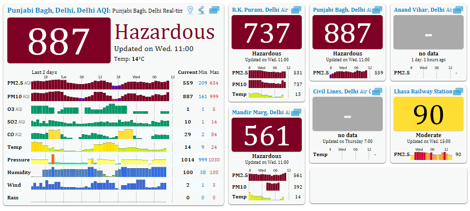
RT @rbrowne: #Delhi pollution levels out of whack. experts consider above 50 to be unhealthy. http://t.co/XvrzeKgG5u
Bangalore - 7am, Misty morning, no winds (cool breeze from east).... chill
#Chennai - 10:38am, Getting warm now, Morning low temperature was 20.3 C at 4:05am
Belt from Punjab to Haryana, #Delhi to entire Uttarpradesh to Bihar and N,central Jharkhand is FOGGY again .. http://ow.ly/i/43B8E
#Chennai - 10:38am, Getting warm now, Morning low temperature was 20.3 C at 4:05am
Belt from Punjab to Haryana, #Delhi to entire Uttarpradesh to Bihar and N,central Jharkhand is FOGGY again .. http://ow.ly/i/43B8E
Tuesday, December 17, 2013

RT @gaganchauhan90: @weatherofindia a look from space #delhi #fog http://t.co/vU0TsIhRnr
Today morning, Muzaffarnagar (Uttar Pradesh) records a low temperature of 3.6 C
Today morning, Muzaffarnagar (Uttar Pradesh) records a low temperature of 3.6 C
#Delhi Fog !
RT @aknarendranath: Fog in Delhi. @weatherofindia http://t.co/xLhhOwFu9N (8:21am)

8:30am, Visible shot shows the thick FOG central Pakistan to #Delhi, Uttarpradesh, Bihar, Jharkhand ... http://ow.ly/i/42RH5

#Chennai - IWM Polichalur station, today morning, 20.9 °C at 6:35am
#COLD #Kolkata - DumDum records 10.7 C today morning.
8:30am, Visible shot shows the thick FOG central Pakistan to #Delhi, Uttarpradesh, Bihar, Jharkhand ... http://ow.ly/i/42RH5

#Chennai - IWM Polichalur station, today morning, 20.9 °C at 6:35am
#COLD #Kolkata - DumDum records 10.7 C today morning.
Monday, December 16, 2013
Today, a weak low level circulation is seen over S-W Bay just S-E of Srilanka ... and this is keeping S-W Bay active http://ow.ly/i/42lSX
7pm, The S-W Bay circulation is throwing heavy rain over Srilanka and pushing light rain into S,S-E Tamilnadu .. http://ow.ly/i/42lZD

During next 2 days, the present S-W Bay circulation is expected to weaken, drift S-W and vanish.
In next 48hrs, scattered drizzles, light/moderate rain will continue to pop over S,S-E Tamilnadu.
During next 3 days, rest of Tamilnadu is expected to be DRY days with COLD nights, early morning.
Frost warning for Nilgiris !
A moderate easterlies is expected to push into S-E Bay after 22-Dec ... this might pop a circulation over S,S-S-E Bay on 25-Dec. !!
Deficient rainfall for Tamilnadu, Karnataka, S Andhra from 1-Oct to 11-Dec ... Bad times ahead for Tamilnadu .. http://ow.ly/i/42n7t

COLD Monday morning.
#Chennai - COLD morning, IWM station at Poilichalur = 18.7 °C at 6:35am.
Airport = 18.5 C
Nungambakkam = 19.3 C
COLD N,central Tamilnadu today morning, Adiramapatnam = 18.4 C, Tiruchy = 18.1 C, Dharmapuri = 14.5 C, Tirupattur = 14.4 C, Vellore = 16.6 C
RT @meet_abhijit: Badlapur cold with dew formation on sliding windows and current temp 12.8c at 7.10am today. http://t.co/tVZthoifAd
Today morning, FOG experienced over Punjab, Delhi, Uttarpradesh, Bihar and Jharkhand.
COLD Lucknow again.. today records 5.2 C ( 3 deg C below normal)
Other COLD cities of N,N-central India... Jodhpur = 9 C, Ludhiana = 5 C, Hissar = 6 C.

Sunday, December 15, 2013

Lucknow continues to be COLD below normal ... today morning it recorded 5.2 C, 4 deg C below normal.
Srinagar records -4 C, Udaipur = 7 C and #Delhi is around 9 C.
A cold night and day ahead for N-W,N,central,E India during this week.
N,N-W,N-central,central and E India to experience cold days as well from Wednesday.
From tonight till wednesday, cold nights and DRY days ahead for most of S,central Peninsula.
Saturday, December 14, 2013
#Chennai - got a early morning drizzle, IWM Polichalur station records 1.5mm of rain.
#Chennai - 1:33pm, Heavy cloud cover now over Pallavaram zone. High chance of a localized shower.
Tamilnadu Rainfall Till 8:30am today, Coonoor = 33.3mm, Kodaikanal = 25.4mm, Rajapalayam, Rasipuram, Aranmanaipudur, Padalur = 2 cm.
Almost NO rain expected for most Tamilnadu from tomorrow... COLD nights expected.
During next 18hrs, showers expected over S, South W-ghats of Tamilnadu.
There's a 60% possibility of a good easterlies after 21-Dec for Tamilnadu.
Adampur (Punjab) shivers at 2.2 C today morning.
Other COLD cities of N India ... #Delhi (Airport) = 9 C, Hissar, Ludhiana = 6 C, Lucknow = 5 C.
A moderate W.D is expected to affect Kashmir and some more zones of N,N-W India on Monday... http://ow.ly/i/41qVl

Other COLD cities of N India ... #Delhi (Airport) = 9 C, Hissar, Ludhiana = 6 C, Lucknow = 5 C.
A moderate W.D is expected to affect Kashmir and some more zones of N,N-W India on Monday... http://ow.ly/i/41qVl

Subscribe to:
Posts (Atom)