Friday, August 09, 2013

Weather around India, 9pm round up.

7:30pm, Heavy rain  W,N-W,N.Madhyapradesh, E,S-E.Rajasthan, S,S-E.Uttarpradesh, S.Odisha, N-E.Andhra, S.Chatisgarh http://ow.ly/i/2PRIq

Malout - Today - "Hazy till noon and after that overcast with some passing clouds"

RT @ganpatteli1: @weatherofindia #Delhi  is getting ready for rain on 4th consecutive day. (12:08pm)

RT @shri611: After heavy rains over past two days, now its pleasant weather at #Ranchi. @weatherofindia http://t.co/NbYlJjkkLa (9:55am)
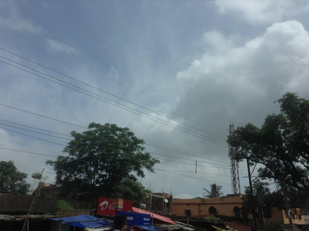
RT @parshwati: @weatherofindia thanks... "its already overcast and drizzly... " Udaipur (9:55am)

RT @aravindslm: @weatherofindia light drizziling now in #salem, tamilnadu (8:13am)

#Mumbai - Today - "mild passing showers, hazy at times"

Davangere - 8:08am, "Drizzling here now.Finally some rain."

#Bangalore update - 7:30pm

Bangalore - 6:25pm, "no sign of rain god" ... http://ow.ly/i/2PSAm >> Taken from ... https://www.facebook.com/groups/blrwwatch/

Bangalore - Small, distant T.cells visible in photo. There's a good chance, these may build up, travel and push in. http://ow.ly/i/2PSAm

7:30pm, Satellite IR shows these small T.cells over W,S-W from Bangalore ... http://ow.ly/i/2PRIq

N-E.Tamilnadu "super" T.shower, 7pm

7:40pm, a massive T.shower is sweeping N-E.Tamilnadu, South of #Chennai at around 120km from city... http://ow.ly/i/2PQQd 

7:30pm, More T.showers seen over N-W,S-central Tamilnadu ... http://ow.ly/i/2PRIq 

Yesterday, massive showers swept S.Andhra coast and N-central coast Tamilnadu..  Virudhachalam (Cuddalore dt) 16 cm. http://ow.ly/i/2PS2x 

#Chennai - moderate to Heavy rain expected to push into city after midnight.

Forecast for #chennai, Tamilnadu, Udaipur, #Bangalore

Today, evening or late evening rain for Nilgiris zone, N-E.Tamilnadu, S,central Andhra coast.

Central, N.Tamilnadu coast , S,central Andhra coast is expected to be active with T.showers again on early hrs of Saturday.

#Bangalore - Today again, NO rain or a mini shower expected after 6pm.

@parshwati >> #Udaipur - S-E,E.Rajasthan Zone is expected to get HEAVY rain, so some moderate rain may push into Udaipur in next 48hrs.

Morning, Weather analysis and forecast for next 36hrs

2 circulations persist along axis, one along Kanpur, N-E.Madhyapradesh and another over Jharkhand, Bihar and Bengal . http://ow.ly/i/2PAF2 
The upper level 500hpa circulation is seen over W.Bengal and this is expected to move W-N-W or W in next 36hr to N-central,N-E Madhyapradesh
In next 12hrs, a good low, mid level circulation will take shape over N,N-E.Madhyapradesh and Kanpur,Allahabad zone http://ow.ly/i/2PAUB 

Due to this S.Uttarpradesh circulation, High vorticity expected over N-W,W,S,N-E.Madhyapradesh, N-W,N,E.Maharastra.. Moderate Rain expected
Today, Heavy rain expected for E,S-E.Rajasthan, W,N-W,S.Madhyapradesh, S,W.Uttarprdesh into #Delhi
Today, Heavy rain also for Odisha, S,W,N.Bengal including #Kolkata, N,E.Bihar, S,S-E.Gujarat .. http://ow.ly/i/2PB6V 
Scattered rain also expected for S.Himachal, Uttarakhand, E.Punjab during next 24hrs.
E,N-E.Maharastra will also get heavy rain tonight or into early hrs of Saturday.
Less rain forecast for most of S-W coast today as well.

Good morning Chennai, Kolkata

#Chennai - 6:45am, a massive T.shower is seen over Sea, N-E from city at around 18km... moving S-S-E.. http://ow.ly/i/2PAbR

RT @shri611: Heavy rains. #Kolkata @weatherofindia 3.35am. http://t.co/B5WklOvEvj 

~~ updates from 8-Aug-2013 ~~
RT @rajugana: Bangalore 10.00pm, Mainly clear skies, bright sunshine & Dry. No rain for the past few days. A pic http://t.co/GGDaGHkXYU 

8-Aug, 3:30pm,"near NH 15 close village kattian wali, Punjab" .. VIDEO ... http://youtu.be/x998w-hrRRo

Thursday, August 08, 2013

a) Current UAC in the axis over UP tends to move westwards on Friday 9th. Rainfall increase possible over Northern India (including Delhi NCR) on Saturday 10th, and shifting West into Rajasthan on Sunday 11th. 
Remaining moisture can produce sharp convective rains around NCR till 11th.

Moisture attraction from Arabian Sea will pull rains into Gujarat and stretching into Rajasthan on Monday 12th. Coastal Sindh may get some regional rains on 12th.
Interior Mah goes almost dry from Sunday 11th.
Rains may spread (decreased intensity) into Central Pakistan, Northern Pakistan on 13th. 
West coast remains "dull" compared to normal rains, next 5 days. 

b) Monday, 12th, a UAC/Low forms in the Northern Bay off Orissa coast. Moves inland and brings good rainfall to Orissa and adjoining regions to the West. An East coast trough can form on 13th, and bring good precipitation on 13th and 14th from UP down South to entire Eastern India upto AP and Northern TN. 
Western regions of Bengal included, but Kolkata "skirted". 
Thunder activity continues as System forms, and Stray thundercells continue drifting in Kolkata region as  trough forms.

Rains and Thundershowers can stretch into TN on Wednesday 14th. Good precipitation can occur in TN coast and interior on 14th and 15th August.
More on vagaries

Weather update around India at 7pm, satellite visible at 5:30pm

5:30pm, HEAVY rain over S,S-E,W.Uttarpradesh, N.Madhyapradesh, E,S-E.Rajasthan, N.Chatisgarh, Jharkhand, W,S-W.Bengal http://ow.ly/i/2PaPH 

#Chennai - 6:30pm, moderate rain seen S-W of Chengelpet near Vandavasi, at around 65 to 100km from city.

5:30pm, Showers seen over central,N-central Tamilnadu and over E.Punjab ... http://ow.ly/i/2PaPH

Malout - 6:15pm, "Today had some passing drizzles from West, after that it was HOT with clear skies"

Kolkata - 7:14pm, Today, so far 3 brief spell of rain, another one nearing city now.

12:30pm, Almost NO rain over W,S-W Coast of India

12:30pm, Almost NO rain seen all along S-W coast from N.Maharastra coast to S.tip of Tamilnadu.. http://ow.ly/i/2P4UR 

12:30pm, Widespread rain over coast,S,N.Odisha, Rain also over S,N.Chatisgarh, most of Bengal, S,E.Bihar, S.Jharkhand http://ow.ly/i/2P4UR

12:30pm, Showers seen over S,central,W,N-W.Uttarpradesh, E.Rajasthan, N.Madhyapradesh into Haryana, #Delhi.. http://ow.ly/i/2P4UR

RT @toidelhinews: Rain lashes Delhi for third consecutive day, causes traffic jams http://t.co/jTCYalqQQm 

Update for Chennai, Tamilnadu, Andhra, S.Karnataka

RT @shri611: The city wakes up to a rainy morning. #Chennai @weatherofindiapic.twitter.com/PEyfwTGjnQ (6:38am)

#Chennai - Polichalur zone got a heavy drizzle at around 6:30am.

#Chennai - 1pm, HOT and Humid, temperature around 34 C with humidity around 50%. "A chance of evening rain after 4pm"

#Bangalore - There's a good chance of evening mini shower after 4pm.

Till tomorrow morning, scattered moderate rain expected for S.Karnataka, central,N,N-E.Tamilnadu and N,N-E,S,central-coast.Andhra.