Monday, July 27, 2015

FLOOD alert :: N,central,E,N-W Gujarat, S,S-W,S-E Rajasthan, W Madhyapradesh


During next 2/3 days...
The S Rajasthan LOW is expected to deepen and persist almost in same zone... http://static.ow.ly/photos/normal/c1I0o.jpg
Almost the same situation expected for N Bay LOW..
This LOW is also not expected to move N-W during next 2/3 days... http://static.ow.ly/photos/normal/c1I0o.jpg

GFS expects BOTH the systems to persist in SAME location even till Friday.
This can be a disaster for N,N-W Gujarat, S,S-W,S-E Rajasthan !
GFS expects S Rajasthan LOW to drift W-N-W into Pakistan ONLY on 2-Aug. 
And the N Bay LOW to move West on that day.. http://static.ow.ly/photos/normal/c1InD.jpg

Till Wednesday / Thursday.. the west coast offshore trough will be active from S Gujarat to central Karnataka coast.
Heavy rain ahead !

Rainfall forecast for next 36hrs
~~~~~~~~~~~~~~~~~~~~~~~~~~~~~~

From NOW till noon of 29-Jul..
HEAVY / Very HEAVY rain forecast for N,N-E,central,E,N-W,S,S-W Gujarat ... http://static.ow.ly/photos/normal/c1IBx.jpg
From NOW till noon of 29-Jul..
Very HEAVY rain forecast for S,S-W,S-E,S-central Rajasthan, W,S-W Madhyapradesh ... http://static.ow.ly/photos/normal/c1IBx.jpg

During next 2 days, Heavy rain also for N-W,coastal Maharastra, Mumbai 
and 
Moderate / heavy rain for coastal Karnataka and Goa.

On eastern end of axis..
Scattered heavy rain for Jharkhand, S,central Bengal, N,coast Odisha on today and 28-Jul.

From midnight today and till noon of 29-Jul... Less or NO rain forecast for Kerala !.. http://static.ow.ly/photos/normal/c1IRK.jpg

Aternoon to midnight of Today and 28-Jul..
Scattered T showers for S,S-E Karnataka, Bangalore, N,N-E,N-central Tamilnadu, Chennai, S Andhra.

Over North end of monsoon axis...
Scattered heavy rain expected Himachal, Uttarakhand into S,S-W Kashmir for 48hrs.. http://static.ow.ly/photos/normal/c1J6o.jpg

A perfect start to the week. Twin engine for the Monsoon !


Today, there's twin propellers of Monsoon is in force...
One is over S Rajasthan.
And
Another over N-extreme Bay.. http://static.ow.ly/photos/normal/c1GHm.jpg
West-coast offshore trough seen from S Gujarat to central coast Kerala.
And
East-coast trough from N Bay to S-E coast Tamilnadu.

For both LOWs, circulations from low to upper-levels are strong and located almost in same locations respectively.. http://static.ow.ly/photos/normal/c1HcJ.jpg

11am, HEAVY rain N,N-W,central Gujarat, N-W,N-coast Maharastra, Mumbai.. cloudy with showers over Jharkhand, Bengal http://static.ow.ly/photos/normal/c1Hxz.jpg
11am, Heavy rain seen all along Karnataka and in some zones of central Kerala as well ... http://static.ow.ly/photos/normal/c1Hxz.jpg

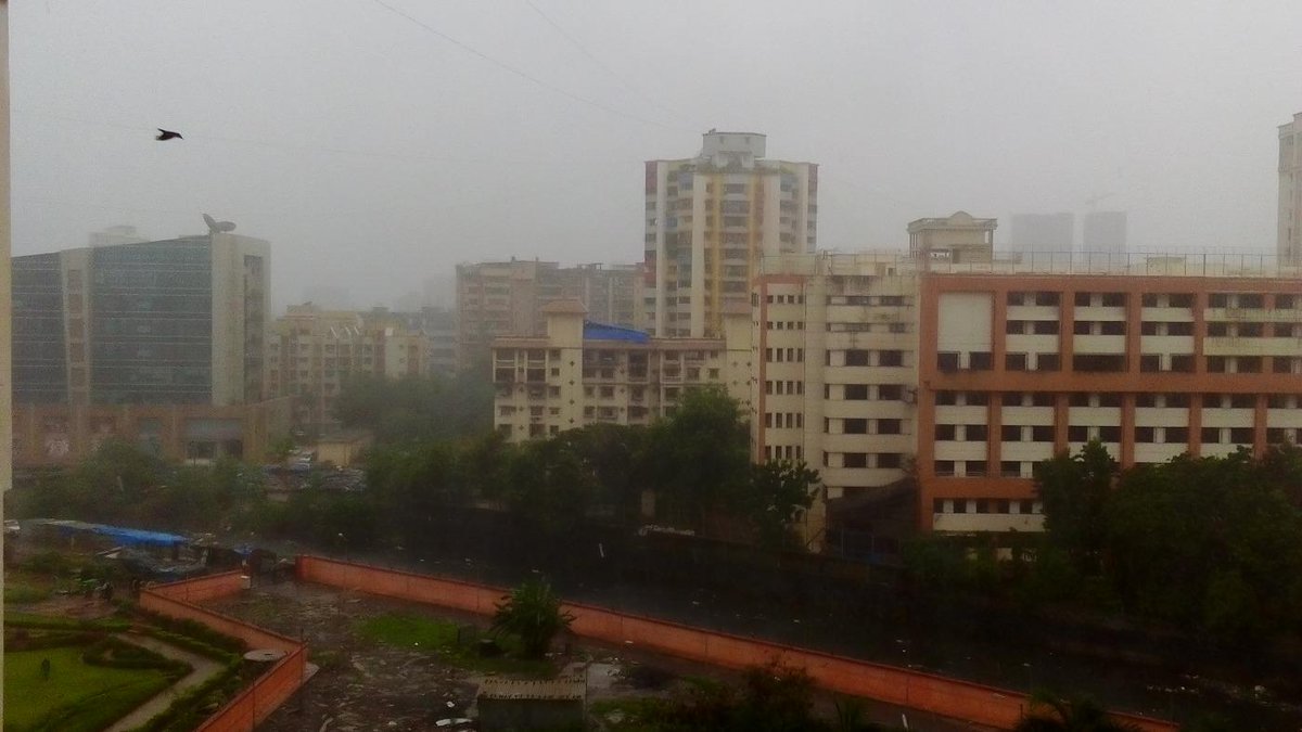
RT @malhotramona: @weatherofindia Mumbai rains now http://t.co/pKDkaUJDKq (8:57am)

RT @rdsouza11: Rain likely in #bangalore #monsoon skies r dark..  http://t.co/KjvrhdfKDz (12:19pm)
More rain ahead !! http://static.ow.ly/photos/normal/c1HHb.

Sunday, July 26, 2015

July 26, 2015 at 10:40PM

Chennai - 10:30pm, a heavy T shower with gusts now pushing into W,SW suburbs. #weather

from Instagram

July 26, 2015 at 10:38PM

Today evening, Kodaikanal, heavy rain. #weather

from Instagram

Friday, July 24, 2015

#Chennai - 9:30pm, Today's T shower swept across N-W,N suburbs of city and now its over Sea..


Weather of India http://ift.tt/1HYc3kL

July 24, 2015 at 01:18PM

#Chennai - Yesterday rainfall.. Airport = 17.4 mm Nungambakkam = 14 mm IWM Polichalur = 12 mm (16.2mm on 22-Jul) #iwm

More rain for W-central,central,East India and a WET week ahead

RT @sanjeevnaique: Heavy rain lashes in #Margao in #Goa south coast of India. Normal #Monsoon begins. @naikap (9:30am)

Today, the low,mid-level circulation seen over E,N-E Madhyapradesh and the S-W Gujarat coast circulation persists .. http://static.ow.ly/photos/normal/bZl52.jpg
Good West coast offshore trough seen from S Gujarat to central coast Kerala ... http://static.ow.ly/photos/normal/bZlMy.jpg

11:30am, Heavy rain over Madhyapradesh into S,S-E Rajasthan, W Gujarat, along Karnataka coast ... http://static.ow.ly/photos/normal/bZlTS.jpg

In next 36hrs, the circulation along S-W Gujarat coast is expected to drift West into N,N-W Arabian sea !
On Sunday, 26-Jul... the eastern end of monsoon axis is expected to drop a LOW along S Bangladesh coast, N Bay.. http://static.ow.ly/photos/normal/bZm3s.jpg
This is followed by a strong circulation, LOW along S,S-W Rajasthan and into S Pakistan... http://static.ow.ly/photos/normal/bZm8p.jpg

More importantly !!
GFS expects both these circulation to persist even till 30-Jul with minimal movement !... http://static.ow.ly/photos/normal/bZmdK.jpg

Rainfall alert for next 36hrs
~~~~~~~~~~~~~~~~~~~~~~~~~~~
Before morning, 25-Jul...
Heavy rain along Southern zones of axis..i.e.. many zones of Madhyapradesh, Chatisgarh, Odisha, Bengal, Bihar.
HEAVY rain forecast for E,S,S-E Gujarat, N,N-W,coastal Maharastra, Mumbai before morning of 25-Jul.. http://static.ow.ly/photos/normal/bZmrc.jpg
Towards early morning... HEAVY rain ahead for N,central,coastal Odisha.

For next 2 days, heavy rain to persist for Coast Karnataka and N,central Kerala coast. !

During next 24hrs, some of the HEAVY rain will push into S,central,S-E Rajasthan !

Today evening again...
Scattered T showers for S,S-E Karantaka, Bangalore, N,N-E,N-central Tamilnadu, Chennai and S, central Andhra.
More HEAVY T showers forecast for S Karnataka, Bangalore, N,N-E,N-central Tamilnadu, Chennai and S Andhra on 25-Jul !

On 25-Jul...
Rainfall intensity over Odisha, Chatisgarh, S Bengal to become HEAVY and widespread... http://static.ow.ly/photos/normal/bZmI7.jpg
On 25-Jul, HEAVY and widespread rain to occur over Madhyapradesh, especially over W,N-W,S-W zones.
More rain ahead for S,S-E Rajasthan on 25-Jul as well !
Some of heavy showers will also be over S,E,S-E Gujarat till night of 25-Jul.

Thursday, July 23, 2015

Night rain in Chennai

Today's [23/7/2015:: 2145 hrs IST] rainfall at Chennai played a decisive role.  Thunder clouds developed in NW of Chennai by 1600 hrs and rain was realised in North Chennai.  Later in the evening by 2000 hrs IST clouds developed in southern sub urb and moved in North / NEly direction to give rain with Thunder storm in the southern parts of the city. The winds were from Southerly to SWly direction

again cloud concentration below 13 Deg latitude.
As the SWM wind strength is diminishing light to moderate rain will be experienced in Kerala and TN.

However NCR region ,Haryana, East Rajastan & Parts of MP & Maharastra is to witness moderate to heavy rains.

TheShriram on Twitter

RT @shri611: 18.00hrs IST. RainGods coming with a vengence. Would it pour or fly away?!? #Chennai http://t.co/rHuIVYaAcE #iwm
Taken from Weather of India

July 23, 2015 at 06:42PM

Chennai - 6:30pm, a disintegrated rain system, now pushed into N,NW parts of city, moving SE. #weather

from Instagram