Monday, June 16, 2014

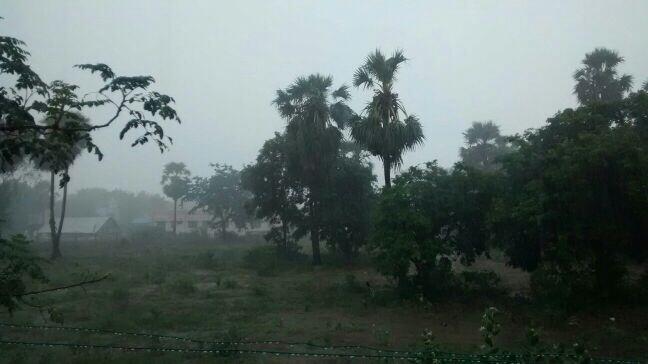
RT @AlluSirish: Mist + Rain + Clouds + Sunrise = Beautiful morning. 6:30AM, Kozhikode, Kerala. http://t.co/Xr5MahQ9be 

1:30pm, Showers seen along S,S-E Gujarat, scattered along coastal Maharastra and coastal Karnataka ... http://ow.ly/i/5UYBm 

Today, the mid, upper-level circulation persisting along S Gujarat coast over N-E Arabian sea ... http://ow.ly/i/5UZ1u 
17-Jun, the mid, upper circulation is expected to come close to N,central Maharastra coast and S,S-E Gujarat coast . http://ow.ly/i/5UZfT 

Tomorrow, the offshore trough along W, S-W coast is expected to be in good shape from N maharastra coast to N kerala http://ow.ly/i/5UZiK 
Monsoon will push into #Mumbai on Tuesday, 17-Jun !

Widespread moderate / heavy rain expected ALL along Maharastra coast from today evening.

@bublly89 >> #Pune - T showers expected today.

But it'll take 2/3 days for Monsoon current to push into Pune city after 17-Jun in #Mumbai.

N Bay is still silent !

Tomorrow, a mid, upper level circulation can be expected over N Bay along S Bengal coast ... http://ow.ly/i/5UZAz 
GFS expects "NO" North Bay LOW formation during next 5 days !!
This is needed for Bay wing of Monsoon to get activated and start pushing

Sunday, June 15, 2014

Remnant of Cyclone Nanauk and Monsoon for Mumbai


6:30pm, Less rain seen along S-W coast of India... "it seems monsoon is having a break from yesterday noon" ... http://ow.ly/i/5UDBc
6:30pm, Remnant circulation of Cyclone Nanauk is pushing some showers into S Gujarat coast .. http://ow.ly/i/5UDBc

The remnant of Nanauk is expected t merge with the offshore trough along W,S-W coast of India in next 24hrs.


WRF model suggests a upper level circulation along N-E Arabian sea along S Gujarat coast in next 24hrs... http://ow.ly/i/5UIq2 
WRF model even suggest that the upper level circulation to push upto Mumbai coast on 17-Jun... so Monsoon is near .. http://ow.ly/i/5UItX 
Already, 10:30pm, the remnant circulation is giving showers to #Mumbai, s,central-coast Maharastra ... http://ow.ly/i/5UIxj 
More rain ahead for #Mumbai on 16-Jun.
#Monsoon will be well and truly over the city, most of Maharastra coast on night of 16th or 17-Jun.

Bay is silent so far...
A mid, upper level circulation is persisting along N-E Bay along Myanmar coast....
N-E Bay upper, mid-level circulation may drift to N Bay along S Bengal coast on 17-Jun .. http://ow.ly/i/5UItX 
and this can activate Bay

Some weather reports from 14-Jun-2014

RT @Sailorabee: Nice. Bright and Sunny. Thank you for a dry Saturday! #Monsoons #Kochi @WeAreKochi @weatherofindia (14-Jun, 2pm)

RT @Arvind_LFC: @weatherofindia  Heavy rain in Nagapattinam after so many days! http://t.co/jpqprLTLYW (14-Jun, 5:56pm)

RT @rajugana: @weatherofindia Bangalore 14-Jun, 12.05pm, Bright Sunshine, pleasant breeze and puffy clouds.. a pic http://t.co/ylUl0e7zyS 

Weather Instagram at June 15, 2014 at 11:41AM

#chennai - 11:40am, a bright, hot and windy day so far. #weather


from Instagram

Saturday, June 14, 2014

Weather Instagram at June 14, 2014 at 01:08PM

#chennai - 1:06pm, hot and stuffy even though a fully cloudy day. #weather


from Instagram

Badlapur's first pre monsoon rain today(14-06-2014)


Badlapur received season's first Heavy rain with few lightning & thundering and with strong gusty winds for an hour in early morning period around 4 am today..


Badlapur mine gauge recorded 28 mms rainfall ending 8.30am today..


Huge Dust Devil in Punjab India

Friday, June 13, 2014

Some showers in Mumbai, 4:45pm - #instagrams

Cyclone Nanauk - weakening now !

ADT - Analysis at 2pm suggests that Cyclone Nanauk has almost lost all its energy.
"rapidly it has lost its fizz".
"Convective activity is very weak, center temperature around +9.1 C"


Pressure is still around 974 mb
Wind gusts upto 115 kmph
Now its over North Arabian sea, center located at 21.22N , 64.17E

2:30pm, visible photo shows the weakening Nanauk.
Heavy and widespread monsoon rain seen from N Karnataka coast to S-central Kerala.


Forecast and Monsoon
~~~~~~~~~~~~~~~~~~~~~~~~~~~~
GFS predicts that Cyclone will disintegrate in another 36hrs and then drift E-N-E towards S Gujarat coast on 15-Jun.
The remnant circulation is expected to get merged with the N-S offshore trough along W,S-W coast of India.
This will launch monsoon into entire coast of Maharastra and #Mumbai on 15-Jun, Sunday.
The circulation is then expected to travel N-N-E into Gujarat.
WRF model suggests that Nanauk will weaken to a Depression and then drift into Offshore trough and intensify again into deep depression along South Gujarat coast on 15-Jun.
This model also suggests Monsoon into coastal Maharastra on 15-Jun.


Weather Instagram at June 13, 2014 at 11:48AM

#chennai - 11:30am, a mild, windy and fully covered day. #weather


from Instagram