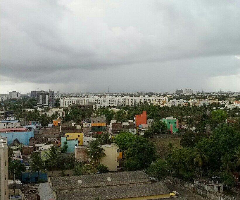
Looks awesome .. 07th May 2014 current wind at 850 hPa BB-1 Low Pressure Situated Close to Trivandrum , Kerela ///
RT @_poorvaja: Rains start again in #Madurai. It is pouring right now! @weatherofindia (1:08pm)
RT @rajugana: Bangalore 2.15pm, Some relief from the Summer.. Cloudy skies and slight drizzle yesterday... http://t.co/p9siGixhyo
RT @uzair432: @weatherofindia Clear blue sky with low level and medium level clouds in #hyderabad. http://t.co/BnU3CbtIDx (11:08am)
RT @nandhuajith: Such a heavy rain here in #Cochin, #kerala..! (2:23pm)
Latest analysis at 11:30am, suggests that LOW pressure system is now over S-E corner of Arabian sea very near to Trivandrum, Kerala. At present the pressure is around 1006mb and slightly disorganized. And NO sign of developing into a Depression or Cyclone in next 48hrs. 12:30pm, Satellite Visible shot reveals ... HEAVY rain continue over S tip, S,S-central,central,N,N-E Tamilnadu and over S, central-coast, W-ghats of Kerala.
GFS models suggests that, 91B will drift North along Kerala coast during next 36hrs and reach central Karnataka coast on Tomorrow noon. By 9-May, it'll drift inland into central Karnataka, N-central Andhra and weaken. The system is then expected to merge with the N-S trough extending from Bihar, E Uttarpradesh at that time.
Widespread HEAVY rain expected over MOST of Kerala, S,S-W, W-ghats, Nilgiris of Tamilnadu during next 24hrs. Scattered showers expected over central,N,N-E Tamilnadu during next 24hrs. Showers to continue along central,N Tamilnadu coast and #Chennai till tomorrow evening. VERY HEAVY rain expected along W-ghats of Kerala during next 24hrs.
#chennai - 8:10am, showers seen south of #Tambaram. More sharp showers expected. #weather http://t.co/2MFnWK7mIz
#chennai - 8:25am, sharp showers #now with #bright #sunlight. Polichalur zone. http://t.co/b7toPuSmwP IWM station Polichalur records 7.5mm till 8:40am.
Posted Tuesday 6th May, Night: BB-1 remains almost stationary since last position. Situated at 6.5N and 78E, and at 1002 mb pressure. Winds are at 25 knts around the centre. On Tuesday, Thiruvananthpuram received 71 mms in 9 hrs till 5.30 pm IST. Some of the heavy overnight rains ( mms) in Kerala, TN and Karntaka...Hosanagara 66, Mayiladuthurai 65, Muthupet 58, Karaikal 53, Londa 42, Neyyattinkara 38, Thiruvananthapuram AP 33 Currently, heavy rain is concentrated in the Far NW segment, off the Kerala/South Karntaka coast.
System will deepen into a depression in next 12 hrs, and track NW initially. By Wednesday evening, the upper trough from WD (already dipping to 23N), and the High pressure ridge, will prevent further movement Northwards , beyond Karnataka coast. As as mentioned earlier , BB-1 should cross the Karnataka coast to move inland by Thursday. Wednesday evening and Thursday will see very heavy rains in Karnataka, Kerala and to some extent in Goa. Coastal Karnataka and Kerala will get downpours amounting to upto 75 -90 mms in 24 hrs (Wed/Thurs). Unusually heavy rains in pockets along the Goa, Karnataka coastline may bring up to 50-60 mms in 24 hrs (Wed/Thurs). Light rains in South Konkan and Southern Maharashtra next 2 days. M-1, after being stationary for a day, is now "pushed" Eastwards by the trough of M-2. M-2, as a trough in the upper levels, is already formed and is over Iran. The trough from M-2 extends Southwards into the 23N region. Next 2 days, M-2 will approach Pakistan, with precipitation in the Northern regions.Rainfall gradually increases from Thursday. Islamabad remains cloudy with light rain, but increase in precipitation from Friday/Saturday. Friday and Saturday, precipitation extends into Sindh regions and NW plains of India. Delhi NCR may see showers on Friday and Saturday. Against earlier predictions, if M-2 is moving in, it may not permit the undue heating up of the Northern Plains of the Sub Continent in the immediate next few days. Mumbai, partly cloudy and stuffy. Very humid and cloudy on Thursday and Friday. Light rains expected in the Pune and Ghats areas on Thursday/Friday. Very squally weather over Kolkata on Wednesday and Thursday. Dust raising Squalls in Saurahtra and Kutch next 2 days.
#Chennai - 9:34pm, 2nd sharp shower now over Polichalur zone.
RT @naveenkumars84: Again started to rain at Tharamani #Chennai bit heavily this time.. CC @weatherofindia 10:45pm
[1] The WML is becoming deepened and may further strengthen to form as cyclonic circulation. However as it is very closer to 5 Deg latitude Coriolis effect will be less.
[2] But outer feeder ring, drawn from Bay of Bengal, is passing through Chennai and south CAP. Similarly other outer feeder in Arabian sea passes through SIK
Some max temp from the region below for today dated (06-05-2014): Thane IMD max temp 38.2°C with min humidity of 48% Thane Enviro max temp 38.6°C with min humidity of 48% Badlapur max temp 39.2°C with min humidity of 28% Karjat estimated max temp 41.0°C with min humidity of 28% Bhira max temp 42.0°C
Raining mad #kerala #trivandrum #rain # Water (2:52pm) RT @Iam_Divyesh: @weatherofindia started drizzling out here in chittoor #coolinsummer http://t.co/fci6VmYJ3x (5:59pm) RT @Sailorabee: Thundershowers in #kochi. @weatherofindia @WeAreKochi (5:42pm)