Wednesday, March 05, 2014

Intense brief thunder showers from NNE early morning. Still more clouds spewing out of the eastern seaboard. Dohnavur.
Records 27 mm in 13 minutes.


View Larger Map

Tuesday, March 04, 2014

Severe Hail Storm Lashed Parli -Ambejogai belt in Beed Dist, Maharashtra

 Severe Hail Storm lashed Beed Dist yesterday evening (03-03-14) : 1.5 feet layer hails disrupt road services !! View as if like in Kashmir.. Watch it's severity on video here 

Monday, March 03, 2014

#Chennai - Day temperature is expected to be around 32 C and minimum is expected to be around 23/24 C during next 3 days.

Rainfall continue over S Tamilnadu and adjoining S Kerala zones... Cheranmahadevi (Tirunelveli Dist) records a Super Heavy rainfall of 13 cm

Thiruvanathapuram Airport (S Kerala) rainfall...
2-Mar = 3 cm
1-Mar = 5 cm

Scattered Rainfall continue over Andhra as well.
Metpalli (dist Karimnagar) and  Venkatapuram (dist Khammam) records 6 cm till 8:30am today

Showers expected to continue for N Andhra during next 2 days.
And more rain ahead for W-ghats, S Kerala during next 3 days.
Light rain also expected for S,S-central Karnataka as well during next 2 days.
Rainfall expected for S, S-tip, Nigiris zones of Tamilnadu during next 2 days !

In 24hrs, an upper-level trough (induced by W.D) is expected along N Maharastra coast and S-E Gujarat coast ... http://ow.ly/i/4LJE9 
A low-level circulation is also expected along N,central Maharastra coast in 18hrs ... http://ow.ly/i/4LJHt 

Due to this, scattered moderate rain expected along S-W,W,central Maharastra and into N,N-W, central Karnataka during next 36hrs.
On Tuesday, showers expected over N,central,N-E Andhra, S Chatisgarh and into Odisha ... http://ow.ly/i/4LJNQ 

1:30pm, Rain due to mid-level trough for S,N Pakistan, and some rain pushing into W,S-W Rajasthan and Kashmir .. http://ow.ly/i/4LGMC


Mid-level W.D trough seen along 66E and dipping south upto 22N ... http://ow.ly/i/4LJ3t 
This mid-level trough is embedded with a low-level circulation over N-central Pakistan and into Afghanistan ... http://ow.ly/i/4LJ7A 

In 36hrs, W.D system is expected to pop more rain into N,N-W,N-central India .. and vanish before evening, 5-Mar .. http://ow.ly/i/4LJcz 
Till evening of Wednesday, scattered moderate rain expected for Kashmir, Himachal and Uttarakhand.
And light rain for Punjab, Haryana.

Friday, February 28, 2014

7:19pm, Malout (S-W Punjab) - "Clear weather now".
Reports of "Rain, hail and wind" from Central and East Punjab, Ludhiana.
#Chennai 's Day temperature stays around 31 / 32 C with mostly clear skies today !.
Today morning, Airport = 21.2 C.

Till 8:30am today, S,S-E Tamilnadu coast got moderate rain.. Pamban = 12.6 mm, Tuticorin = 21.3 mm.
Nanguneri = 1 CM.

During next 3 days... Warm mornings ahead for most of Tamilnadu except for N,N-W zones, S,S-central Andhra and for S,central Karnataka.

During next 2 days, showers expected for N,N-W,N-central and most W-ghats of Tamilnadu.
S,S-central and W-ghats of Kerala to get T showers during next 3 days.
S tip of Tamilnadu (Kanyakumari dist) is also expected to get T showers during today and next 2 days !

Today, the upper-level W.D circulation is seen over N-central Pakistan ... http://ow.ly/i/4K6cH 
This upper-level W.D circulation is expected to move East and vanish in 36hrs, meanwhile another circulation will move in on 2-Mar.
Today, the mid-level trough of W.D can be seen dipping South upto 17N, all along W India ... http://ow.ly/i/4K6rP 
This mid-level trough is expected to drift East and fizzle out over East or E-central India around evening of 1-Mar.

The low-level circulation embedded in W.D trough is seen over central,E-central Rajasthan today... http://ow.ly/i/4K6z8 
During next 24hrs, the low-level circulation is expected to vanish along #Delhi, W Uttarpradesh.

During next 36hrs, due to W.D trough, scattered moderate rain for Uttarpradesh, Bihar, N Chatisgarh, Jharkhand and N,central,W Bengal
Showers to continue for S Kashmir, Himachal, Uttarakhand and some zones of Haryana as well during next 36hrs.
Due to this eastward movement of W.D... showers expected for Sikkim and to N,central zone of N-E states.
And for N Bangladesh as well.
In next 36hrs, due to trough, moderate rain also for N-E,E Maharastra, N,central Andhra and even into N,N-W Tamilnadu.

2:30pm, Rain over E Rajasthan, S Harayana, #Delhi, S-E Uttarpradesh, Bihar, N Chatisgarh, Jharkhand.. http://ow.ly/i/4K4vK
2:30pm, Cloudy with moderate/light rain over E Maharastra, most of Chatisgarh, W,N Bengal, Kashmir, Punjab, Himachal http://ow.ly/i/4K4vK 

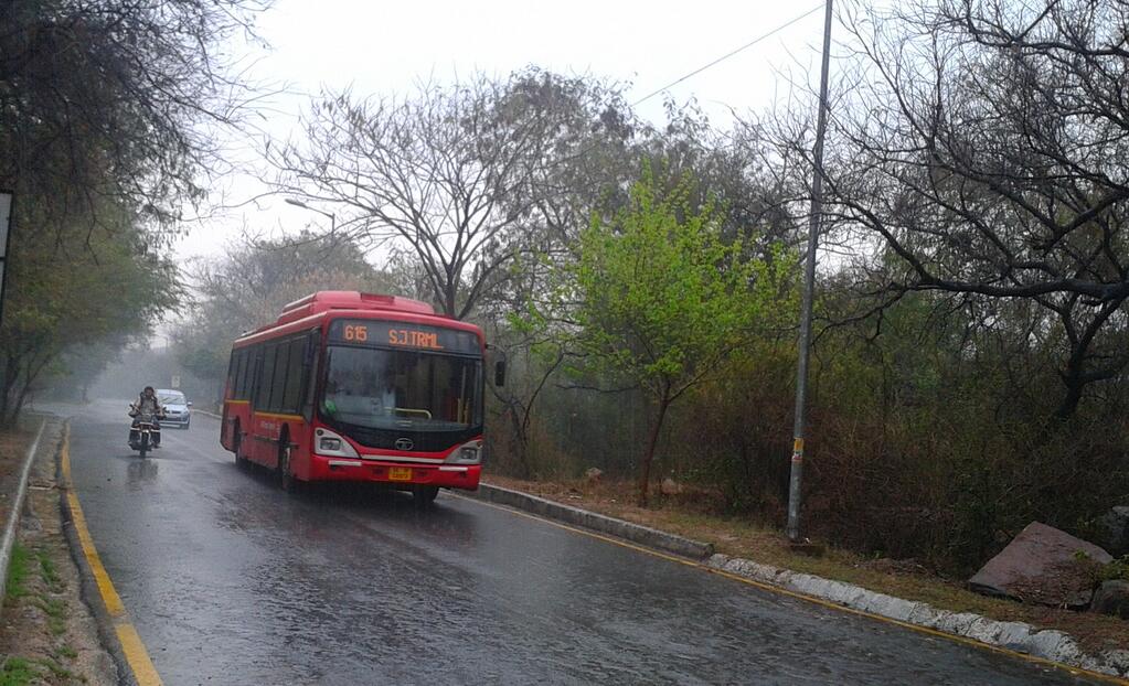
#Delhi Rain

RT @aknarendranath: @weatherofindia  Raining quite heavily in Delhi. (1:34pm)

RT @GanpatTeli1: It's raining heavily in #Delhi 
@weatherofindia http://t.co/KUYBrP33bI (2:21pm)

RT @binduw1: Rain drenched #Delhi = jammed Delhi (2:24pm)

RT @naturesdoodle: Delhi's mood right now. #Rain #clouds #grey http://t.co/06hZgkiSoe  (2:16pm)