Friday, January 24, 2014

Its a holiday weekend, and how is the weather going to be ?

The west coast trough which had moved inland in the last week will weaken, and the Northern WD system will move away.
No WDs, no troughs, so what do we expect ? And an anti cyclone (High Pressure) in the upper air at 850 hp level sitting over the Central region for 3/4 days. MSLP also around 1020 mb around the core over NW India/adjoining Pakistan, and at 1018/1016 in Central India.
Dry weather almost throughout the entire India/Pakistan and Nepal region next 4 days.

Next major system in the region will be F-1, expected to be effective in Pakistan and India and Western Nepal. F-1 expected around 2nd February in Pakistan.

The Northern Plains will see NW winds, and a marginal rise in day temperatures, prompted by clear sunny skies. Delhi NCR will see Republic Day as hazy sunshine (but cold morning) and temperature range rising to  22c and lows at around 10c.

The Central Region of India will get the normal Easterlies, keeping the interiors of Maharashtra pleasantly cool at around 28/29c.
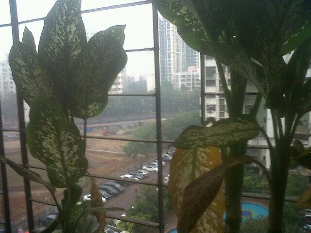
Mumbai will start to warm up this weekend, with sunny skies to around 32/33c. Morning East winds will become NE by evening.The west coast cities heating up to some extent.
Pune will be sunny, around 28/29c and nights will be at 13/14c.

The NW winds become Northerly by the time they reach Bengal. Cool and nippy, Kolkata will be warmish around 27c and 13c this weekend.

The Northern plains of Pakistan will see NNW winds, keeping the region dry and pleasantly cool. While the Sindh region with NE winds will be dry and cool.Day temperatures in Islamabad should range between 21c and 6/7c.
Karachi will be between 25c and 14c.

from vagaries

Thursday, January 23, 2014


The W.D trough has weakened today, but the moisture push from Arabian sea into W,central,E-central India persists.. http://ow.ly/i/4n19M 
Cloudy days with moderate rain expected over W,N-W Maharastra, S-E,E Gujarat, S,S-W,W,central Madhyapradesh till Friday night.
Meanwhile, showers / snow expected to persist over Kashmir, N Himachal during next 2 days.

2:30pm, Cloudy, foggy conditions over most of N,N-central India... http://ow.ly/i/4n1pc 
2:30pm, High cloud cover with or without moderate / light  rain seen right from Goa to Patna across India ... http://ow.ly/i/4n1pc

Today morning, Etawah (Uttar Pradesh) records a low of 4.8 C.
While, Najibabad (Uttar Pradesh) records a low day temp of 14 C on 22-Jan.

Rainfall due to W.D, till 8:30am of 22-Jan
----------------------------------------------------
PUNJAB: Amritsar 2, 
JAMMU AND KASHMIR: Banihal 7, Pahalgam 5, Jammu, Batote, Katra, Kukernag and Gulmarg 4 each, Srinagar, Kathua and Udampur 3 each and Bhaderwah 2, 
EAST RAJASTHAN: Sikrai and Sapotra 7 each, Gangdhar, Shahpura and mandrayal 6 each, Pirawa, Sapau, Bakani and Sarmathura 5 each, Pratapgarh, Bundi and Banswara 4 each, Vansthali, Sawai Madhopur and Kota 3 each and Jhalawar and Chittoragarh 2 each
WEST UTTAR PRADESH: Jasrana 5, Agra and Sikohabad 3 each and Aligarh, Khair, Etah, Jalesar 
and Hathras 2 each.

Rainfall till 8:30am of 23-Jan... 
-----------------------------------------------
Ambala = 32.8 mm
Chandigarh = 32.5 mm
Shimla = 23.1 mm
Srinagar = 25.4 mm
Ludhiana = 24.6 mm
Patiala = 31.4 mm
Dehradun = 24.9 mm

HARYANA: Chandigarh, Karnal and Ambala 3 cm.
PUNJAB: Patiala 3, 
JAMMU AND KASHMIR: Banihal, Bhaderwah and Pahalgam 6 each, Batote 5, Kukernag 4 
, Srinagar, Qazigund and Katra 3 each.
HIMACHAL PRADESH: Una 9, Dharamshala 7,Nahan 4, Sundernagar, Kalpa 

and Solan 3 cm.
WEST UTTAR PRADESH: Jhansi 4, Orai 3 cm.
UTTARAKHAND: Dehradun 3 cm.

Tuesday, January 21, 2014


RT @malhotramona: @weatherofindia early morning shower in bombay http://t.co/JOTVX5yMRj  (8:35am)
RT @siddhray: @weatherofindia its drizzling all over Mumbai. Freak weather (9:19am)

RT @Delhirious: @weatherofindia spot on! Already raining in Delhi. (9:39am)

RT @rajugana: Bangalore 9.25am, Fabulous weather, chill and breezy with dark passing clouds..Sun is out now.sky pic http://t.co/qy3e4TYBKg 

12:30pm, W.D is full swing over W,W-central, N,N-central, central India ... http://ow.ly/i/4lELG

Monday, January 20, 2014

Forecast and Weather for 21st january and 22nd January:

J-4 follows J-3...More rain/snow for the North after a cold spell and wintry weather, Another Western Disturbance, J-4, now lies as a trough over the 58E line, and will move Eastwards, tilting towards the North.
An UAC over South Rajasthan and Gujarat, will remain stationary,and would merge into the WD trough on Tuesday, 21st. Simultaniuosly, another Line of Wind discontinuity lies over the Arabian Sea off the West coast, and this wouls also move Eastwards towards the coastline.

Resultantly, we would see a rain belt tilting form the Gujarat coast North Eastwards.
Except in the extreme North, dry weather in Pakistan. Strong NE winds blowing in SE Sindh and Karachi on Tuesday, at 30 knts.

Wednesday Rains moving overall Eastwards and into Northern India and interior Maharshtra.

Mumbai: Weather getting cloudy and nights getting warmer ! Tuesday will be cloudy and day around 28/29c. Light drizzle in some parts by evening.
Wednesday will also be cloudy after a rise in night temperatures. Wednesday may also see light rain in some parts .(Around 3-5 mms).
Sharp drop in temperatures from Thursday..
Outer townships may see some patchy moderate rains on these days. Around 5-7 mms in some parts.
Pune will be cloudy with rise in temperatures. An evening drizzle on Tuesday and some drizzles and light rains on Wednesday will add up to around 5 mms.
Aurangabad will be cloudy on Tuesday and overcast with drizzles and light rain on Wednesday..substantial rise in night temperatures to 18c.

Surat and Bharuch vicinity will get overcast skies and rain and drizzles on Tuesday ( Possible upto 5-7 mms)and Wednesday.

Delhi NCR sees the bulk of thunder showers from Tuesday evening thru Wednesday night. Possibly around 25 -30 mms. Max and min between 19c and 12c.

Kolkata, almost clear and dry, with days rising to 28c by mid week...

Maps on Vagaries

#COLD Rajasthan ... Kota records a low day temperature of 13.4 C on 19-Jan.
While Narnaul (Haryana) records a minimum temp of 3.1 C.

Another good mid level W.D trough seen along 60E and dipping south upto 20N.
In next 18hrs, upcoming W.D trough is expected to push moisture into W,W-central,N-central India ... http://ow.ly/i/4l8ut 

Due to this W.D trough, scattered rain with cloudy skies expected for W-central,N,N-central India on tomorrow ... http://ow.ly/i/4l8zC 
Tomorrow, Wednesday - moderate rain expected over E,S-E Gujarat as well and into W,S-W,N-W Madhyapradesh.
Scattered moderate / heavy rain expected for Punjab, Haryana, #Delhi, Himachal, Kashmir, Uttarakhand and into W Uttarpradesh on 21,22-Jan

#Chennai - had some isolated drizzles around city and suburbs.
Now 12:16pm, its warm with low cloud formations and movement from N-E.

#Bangalore - 11:30am, Mild drizzles over Domlur, Electronic city zones !

12:20pm, "#Fog in NORTH Punjab and #sunny in SOUTH Punjab."

12pm, Thick FOG seen over most of Uttarpradesh, Bihar, E Haryana... now slowly easing ... http://ow.ly/i/4kX0F 
12pm, Low and medium high cloud cover seen over most zones of Tamilnadu, S Andhra, S Chatisgarh ... http://ow.ly/i/4kX6K 

Sunday, January 19, 2014

IMD: new image from INSAT 3D

IMD has introduced shortwave imagery from INSAT-3D.

Just in SSW to NNE direction medium and upper cloud coverage is seen.

[?] [??] [???]

There was (and is [?] ) a notable temperature gradient along west coast.

TV reported light intermittent drizzle along north coast / west interior TN
#Chennai - 8:10am, Madhavaram zone got a heavy drizzle.

Mid, upper level W.D trough has moved east , now over E-central India... moisture, cloudiness seen over East India. http://ow.ly/i/4kwe9 
7:30am, Cloudy over E Madhyapradesh, Jharkhand and S,central Bengal ... http://ow.ly/i/4kwgo 

Present moisture along S,S-E Peninsula is expected to persist for 2 days.

Light rain, Cloudy day, slightly high min temperature expected.

Saturday, January 18, 2014

Dense fog with cold conditions in Badlapur 18-Jan-2014

Badlapur min temp 10.8°C which is lowest min temp for current season till today. Also Dense fog engulfed the city with visibility dropping to 50mtr from 5.30am to 8.30am period today.


India's Wettest Places - Hulikal, Karnataka - Series No.3

Whenever people in India ask for wettest / Rainiest places they only know Cherrapunji or Mawsynaram or Agumbe. In these series, you will come to various places which i have identified to be wettest places of India. This series will be published every weekly. If you are fan of Heavy Rains and want to know more than Cherrapunji. Please Read it. Its only a compilation of data from various sources / articles / research materials.

Hulikal is a village located in the Hosanagara taluk of the Shimoga district in the Indian state of Karnataka and is known for its heavy rainfall. It is situated in the dense forests of the Western Ghats. Hulikal is heaven for nature lovers because the place is ultimate package of unlimited natural beauty. The real beauty of Hulikal can be seen only during in rainy season when small waterfalls come alive during monsoon. These waterfalls take birth during rainy season and vanish after the monsoon. Most of the waterfalls are beside the highway.  These temporary waterfalls do not have any name and they are very easily accessible. Here rains pour throughout the day without a break. Dense forests, small and attractive waterfalls provide rich treat to the eyes of those who pass through the road.


Heavy Rainfall
-----------------
Hulikal has been receiving more rain than Agumbe (which is called as wettest place in Karnataka) in most of times. In the rainfall recorded in the last 23 years, Hulikal has recorded the beaten Agumbe in 18 years barring 1995, 1996, 2003, 2005 and 2008. Hulikal has also received more number rainy days than Agumbe between 2008 and 2013. No doubt Hulikal is wetter than Agumbe. There are also other places which get heavy rainfall. One of which is Masthikatte, it sometimes receives more rainfall than Agumbe. The other places are Mani Dam and Yadur. While the Hulikal annual rainfall is over 8000 mm. Masthikatte annual rainfall is around 7700 mm. Mani Dam and Yadur gets around 6700 mm rainfall. These 4 places together makes it one of the wettest stretch in India or even in the world.

For Photos, vidoes and Rainfall data in Hulikal, Masthikatte, Mani Dam and Yadur visit the full article in the link below

http://tamilnaduweatherman.blogspot.in/2014/01/indias-wettest-places-hulikal-karnataka.html