Tuesday, June 18, 2013

#Chennai - 2:10pm, temperature around 36 C.. signs of Sea breeze before 4pm seen. Low level Cloud formations witnessed now.

Kolkata - Airport is reporting "Rain with thunderstorm" at 2:20pm.

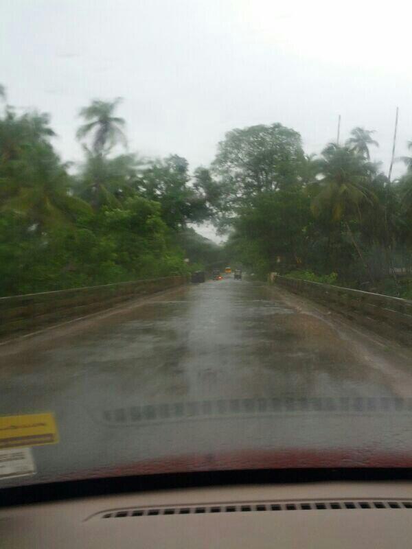
Trivandrum and Kochi airport has reported "Light rain" at 2:10pm.

RT @iamkanal: @weatherofindia Heavy Rain in Kochi for last 30 hours. #NonStopRain (2:55pm)

2:10pm, #Mumbai, Santa Cruz continues to get good rain.

2pm, Heavy and widespread rain ALL along S-W coast from S-E.Gujarat to S.tip Tamilnadu... http://ow.ly/i/2o4fq 

2pm, Heavy rain seen over E,S.Uttarpradesh, most of Bihar, central,E.Nepal and N.Bengal ... http://ow.ly/i/2o4fq

2pm, Heavy rain also seen pushing into most of N-E states as well.

Monday, June 17, 2013

#Bangalore - can expect "evening" sharp showers during next 3 days !

#Chennai - #HOT, today = 39.2 C. Yesterday it was 38.5 C.
Puttur - 7pm, "Non stop heavy rains from last night till now in Puttur." ... shared by Facebook reader.. http://facebook.com/indianweatherman 

Puttur - Where is it ??... http://ow.ly/m6s6R 

#Monsoon - clippings !!

RT @sanjeevnaique: @weatherofindia fishing boats anchored at #river Mandovi in heavy rain this evening at. 4.30pm http://t.co/6IgUc6zeR3 

RT @gsarkar: @weatherofindia Travelled from Kolkata to Pune. Its green, wet and cloudy everywhere. Marvelous Monsoon :) http://t.co/BvRSWvsnN7 

RT @rishal_twit: What a welcome to mallu land, Kerala... #rain #green #kerala http://t.co/6terKzbj1o 

RT @mytechnopark: Technopark, Trivandrum is much more beautiful, when its raining. http://t.co/kCdmReWrTw 

Today, #Chennai - tops the MAX temperature list of all the airport weather reports. At 2:40pm, it was around 37 C, persisting for past 3 hrs

3pm, Lucknow, Mumbai, Trivandrum and Kochi airports have reported "Heavy rain"

Evening sharp showers are expected to be back along N-E.Tamilnadu coast, #Chennai and S.Andhra coast from today !! http://ow.ly/i/2nuqs 

#Chennai - For evening showers, the Sea breeze should set in before 5:30pm. At present (3:15pm) " HOT breeze from West ".

#Delhi Monsoon - "Short lived ?? NO rain expected till 24-Jun !!

RT @ganpatteli1: @weatherofindia its raining in #delhi since afternoon. weather is pleasant. (7:33pm, 16-Jun-2013)

RT @ganpatteli1: Delhi is having its best monsoon opening. Drizzling through out the night. . http://t.co/RhinkAV0Xq  (6:57am)

RT @ganpatteli1: @weatherofindia happy #monsoon. raining in #delhi http://t.co/2fgcswzz7E (9:17am)

@ganpatteli1 >> #Delhi - Happy monsoon!, but the rains are expected to clear out from today evening and NO rain expected till 24-Jun !
Mid level trough from Delhi to S-E.Gujarat is expected to pop a mid level circulation over  W.Madhyapradesh in 24hrs. http://ow.ly/i/2ntqB

The upcoming mid level circulation over W.Madhyapradesh is expected to track into E,central Uttarpradesh on 19-Jun.. http://ow.ly/i/2ntMq 

Today, the offshore trough is seen from S.Gujarat to central Kerala coast ... http://ow.ly/i/2ntPt 

Next 12hrs, HEAVY rain expected for N,central Uttarpradesh N,central,N-E.Madhyapradesh, Uttarakand and Jharkand.. http://ow.ly/i/2ntRQ 

Tomorrow, heavy rain expected for E.Uttarpradesh, into Nepal and over scattered over most of E.India ... http://ow.ly/i/2ntTX 

From today, showers are expected to be widespread and heavy over most of N-E States of India .!

Showers for S,S-E.Gujarat and N.Maharastra coast are expected to reduce from tomorrow.

But HEAVY and widespread rain for Karnataka coast, Goa and Kerala to continue during next 2 days.

Tomorrow, very less rain expected over most of N,N-W,N-central India and expected to be that way till 21-Jun.. http://ow.ly/i/2nu0c 

During next 2/3 days, scattered rain expected over Bihar, Bengal, Jharkand, Chatisgarh, Odisha and Sikim.

Showers are also expected for N,N-E.Andhra , S.Andhra coast, N,N-E.Tamilnadu and low intensity rain over S,central.Karnataka as well.
1pm, Heavy & widespread showers are back along Karnataka coast, most of #Kerala and S.tip of Tamilnadu .. http://ow.ly/i/2nsJn 

1pm, HEAVY rain seen all along S,S-E Gujarat, Maharastra coast and into N-W Maharastra ... http://ow.ly/i/2nsJn

1pm, HEAVY rain continue over Uttarakand, All along N,N-W.Uttarpradesh, Nepal and into N.Bihar... http://ow.ly/i/2nsJn

10 people dead, 50 washed away as heavy rains lash Uttarakhand, pilgrims stranded... http://ow.ly/m5P2r 

Today morning, the low & mid level circulation is seen over #Delhi and it's trough extends up to E,N-E.Gujarat .. http://ow.ly/i/2nsYA 

Yesterday's upper level circulation over Central Madhyapradesh has fizzled out ... http://ow.ly/i/2nt18 

The low and mid level circulation is expected to persist over central,N-W Uttarpradesh during next 36hrs and vanish !

Meanwhile, the upper level W.D trough up to 27th parallel is slowly drift East and clear out in next 36hrs.

Sunday, June 16, 2013

1. BB-3 has fizzled out on sea level, but maintains strength as an UAC.
2. The UAC in the Arabian Sea, at the head of the off shore trough, will stabilise more prominently in the South Gujarat region, and get the trough in a "vertical" position.
The UAC will move NE and cross Gujarat coast near Veraval.

Resultantly: On Monday: Heavy rains in South Gujarat (Surat >100mms and Bharuch), South coastal Saurashtra (Veraval and East of it),  In Guj: Ahmadabad, Baroda, Surat, Bharuch, Gandhinagar, Bhavnagar and Palanpur).
Monday very heavy rains in Utterakhand and adjoining UP and some sharp showers in adjoining NCR.

Tuesday: Heavy rains in region where Guj/Raj/MP borders meet. In MP:Indore, Ujjain, Ratlam, Barwani and In Rajasthan:Kota, Udaipur and Banswara.
Wednesday; Rains move towards Delhi NCR as UAC gets weaker. The trough runs from Delhi SW towards Gujarat. 

Next 3 days: West coast gets good rainfall as trough remains intact.
Rainfall for a day more in Nagpur. Monday may see showers and about 5-10 mms of rain. But sharp decrease from Tuesday, and day temperature climbing to 34/35c in East Vidharbha again.Showers continue in Western Vidharbh.
South Eastern Peninsula remains almost dry. Chennai cloudy but just a stray shower possible.

city details on vagaries
Today, the upper level circulation is seen over central Madhyapradesh.. and another along N.Maharastra coast... http://ow.ly/i/2n8gA 

Circulation along N.Maharastra coast is expected to push into N-W.Maharastra, S-E.Gujarat in next 24hrs and continue into W.Madhyapradesh !

Meanwhile, the W.D trough over N.India up to 27th parallel is expected to drift East during next 2 days... http://ow.ly/i/2n8kM 

Present Madhyapradesh circulation is expected to drift North and will fizzle out near #Delhi in next 24hrs.. http://ow.ly/i/2n8nT 

During next 36hrs, the circulation along Maharastra coast is expected to move N-E into land and push into S-W,W.Madhyapradesh on 17-Jun.