
Tuesday, May 18, 2010
Cyclone "01B" (no-name)... will approach Andhra coast and then move North East ... http://ow.ly/1Mmka
RT @akshaydeoras: CYCLONE WILL PASS ABOUT 100KM EAST OF CHENNAI ON 19TH MAY AT 12PM. ALERT FOR ROUGH SEAS... http://bit.ly/8XRsig
Cyclone "01 B" .. Update #2
JTWC
--------------
Satellite shot at 7:30am IST
--------------------------------

JTWC projected path
----------------------

--------------
180300Z POSITION NEAR 11.9N 85.7E.
TROPICAL CYCLONE (TC) 01B, LOCATED APPROXIMATELY 370 NM EAST-
SOUTHEAST OF CHENNAI, INDIA, HAS TRACKED WEST-NORTHWESTWARD AT 09
KNOTS OVER THE PAST 06 HOURS. ANIMATED INFRARED SATELLITE IMAGERY
INDICATES THAT TC 01B HAS CONTINUED TO CONSOLIDATE WITH DEEP
CONVECTION INCREASING IN AREAL EXTENT. A 172338Z SSMIS 37 GHZ IMAGE
DEPICTS IMPROVED CONVECTIVE BANDING WRAPPING INTO A DEFINED LOW-
LEVEL CIRCULATION CENTER (LLCC), WHICH IS LOCATED ON THE EASTERN
EDGE OF THE DEEP CONVECTION. IMAGERY INDICATES THAT THE BULK OF THE
DEEP CONVECTION IS SHEARING WESTWARD. THERE IS GOOD CONFIDENCE IN
THE CURRENT POSITION AND MOTION BASED ON THE MICROWAVE IMAGERY. THE
CURRENT INTENSITY IS BASED ON DVORAK ESTIMATES OF 35 KNOTS FROM PGTW
AND KNES AS WELL AS THE 171600Z ASCAT 25 KM IMAGE SHOWING 35-KNOT
UNFLAGGED WINDS OVER THE NORTHERN SEMI-CIRCLE. TC 01B IS TRACKING
ALONG THE SOUTHWESTERN PERIPHERY OF THE LOW- TO MID-LEVEL
SUBTROPICAL STEERING RIDGE (STR) AND IS FORECAST TO TRACK WEST-
NORTHWESTWARD THROUGH TAU 36. THE SYSTEM SHOULD THEN RE-CURVE NORTH
TO NORTHEASTWARD AS THE STR RE-ORIENTS AHEAD OF AN APPROACHING
MIDLATITUDE SHORTWAVE TROUGH EXPECTED TO DEEPEN OVER CENTRAL INDIA
AFTER TAU 48. THE MAJORITY OF THE AVAILABLE MODELS (NOGAPS, GFS,
EGRR AND ECMWF) SUPPORT THIS SCENARIO. THE GFDN AND WBAR INDICATE A
MORE WESTWARD TRACK. TC 01B IS FORECAST TO INTENSIFY AT A 15-20 KNOT
RATE, THROUGH TAU 72, UNDER FAVORABLE CONDITIONS INCLUDING GOOD
RADIAL OUTFLOW AND HIGH SST/OCEAN HEAT CONTENT. MAXIMUM SIGNIFICANT
WAVE HEIGHT AT 180000Z IS 12 FEET. NEXT WARNINGS AT 180900Z,
181500Z, 182100Z AND 190300Z.
Satellite shot at 7:30am IST
--------------------------------

JTWC projected path
----------------------

01B Update
No longer the Deep Depression, the Bay system, 01B. now has matured to TC status, and at 996 mb core pressure, and winds at 35 knots (on minute average),is situated at 11.8N and 86E, 420 NM South-East of Chennai.

As the latest imagery of precipitation shows, its south-west quadrant is moisture heavy, and shows good signs of growth.
having tracked north-west till now, it should continue in the same direction initially, along the ridge which is steering it at present.
But, after 24 hrs, it may re-curve to the north-east direction, as it encounters a low trough aloft,(W.D.). This change of direction is totally based on the exact location of the W.D. then. It may turn and graze the coast as it moves on, or may just strike the coast at A.P. depends on the strenght and positioning of the trough aloft then.
NOGAPS and ECMWF theorise this scenario.
No longer the Deep Depression, the Bay system, 01B. now has matured to TC status, and at 996 mb core pressure, and winds at 35 knots (on minute average),is situated at 11.8N and 86E, 420 NM South-East of Chennai.

As the latest imagery of precipitation shows, its south-west quadrant is moisture heavy, and shows good signs of growth.
having tracked north-west till now, it should continue in the same direction initially, along the ridge which is steering it at present.
But, after 24 hrs, it may re-curve to the north-east direction, as it encounters a low trough aloft,(W.D.). This change of direction is totally based on the exact location of the W.D. then. It may turn and graze the coast as it moves on, or may just strike the coast at A.P. depends on the strenght and positioning of the trough aloft then.
NOGAPS and ECMWF theorise this scenario.
OI B
Indian
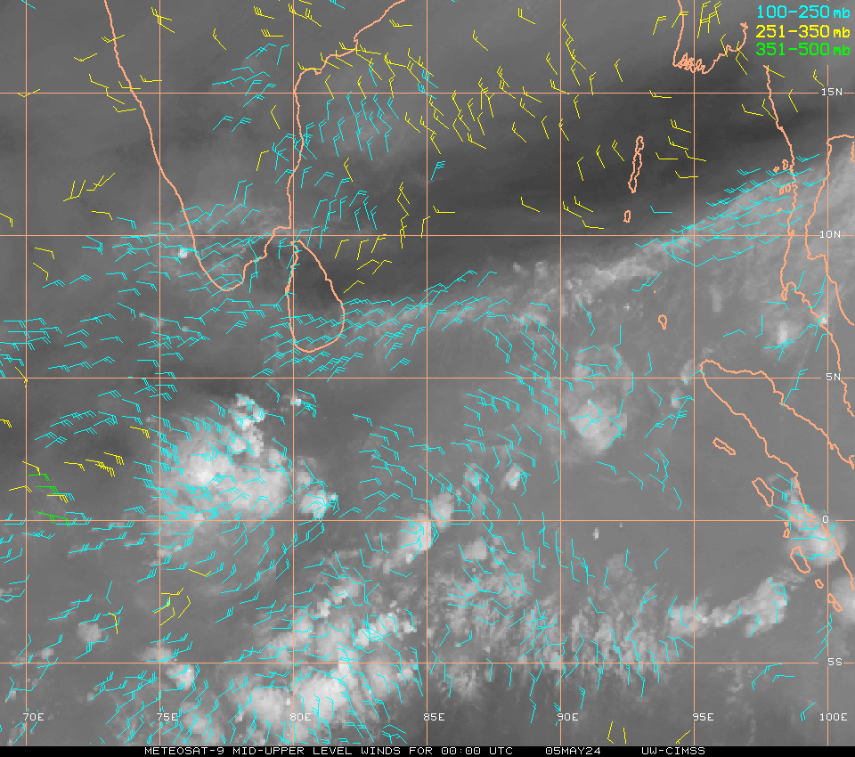
Now IT IS NO LONGER DD. The sustained winds at the core region crosses 35kts. This is named as storm [01B] As Shri. Rajesh pointed out the WD in the northern sector is a factor that may influence the movement of 01B. What may happen is, some time ,this may move towards WD and minkle with it. By that time as Shri Rajesh expected it may cross coast between AP and WB. The upper winds are SEly turning WESTERLY along the coast and it will ensure to drag the system towards coast. The high cloud [lead] over AP and WB is also visible.

Readings as on 17th. May:
Hottest in Asia:New Delhi (Palam) : 47.6c ..This is an all time high record for Palam for any month.And lots of stations in India and Pakistan recording 46c,
Allahabad/Bamhrauli 46°
Nawabshah (Pakistan) 46°
Bahawalnagar (Pakistan) 46°
Pbo Raipur (India) 46°
Hissar Airport ( India) 46°
Satna (India) 46°
Nagpur Airport (India) 46°
Gwalior (India) 46°
Chhor (Pakistan) 46°
Kota Aerodrome (India) 46°
Hottest Nights: Kota: 35c, Chandrapur: 33c, Hissar:32c, Palam: 31c, Amrisar:31c (+9c), Jaipur:31c..and due to long list, upgraded the base level from 30c to 31c :)
Day temp of Mumbai,Colaba: 35.0c, S'Cruz: 34.2c
It’s a sizzling summer:A searing heat wave across India: Read full write up.
Subscribe to:
Posts (Atom)