Friday, May 31, 2013

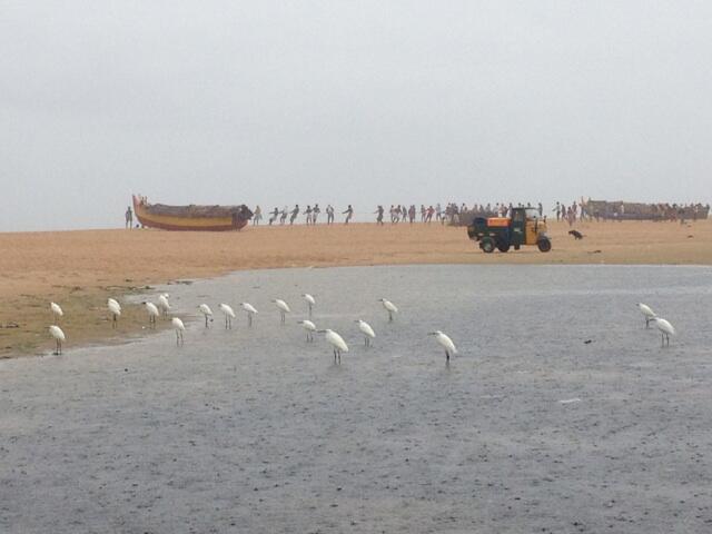
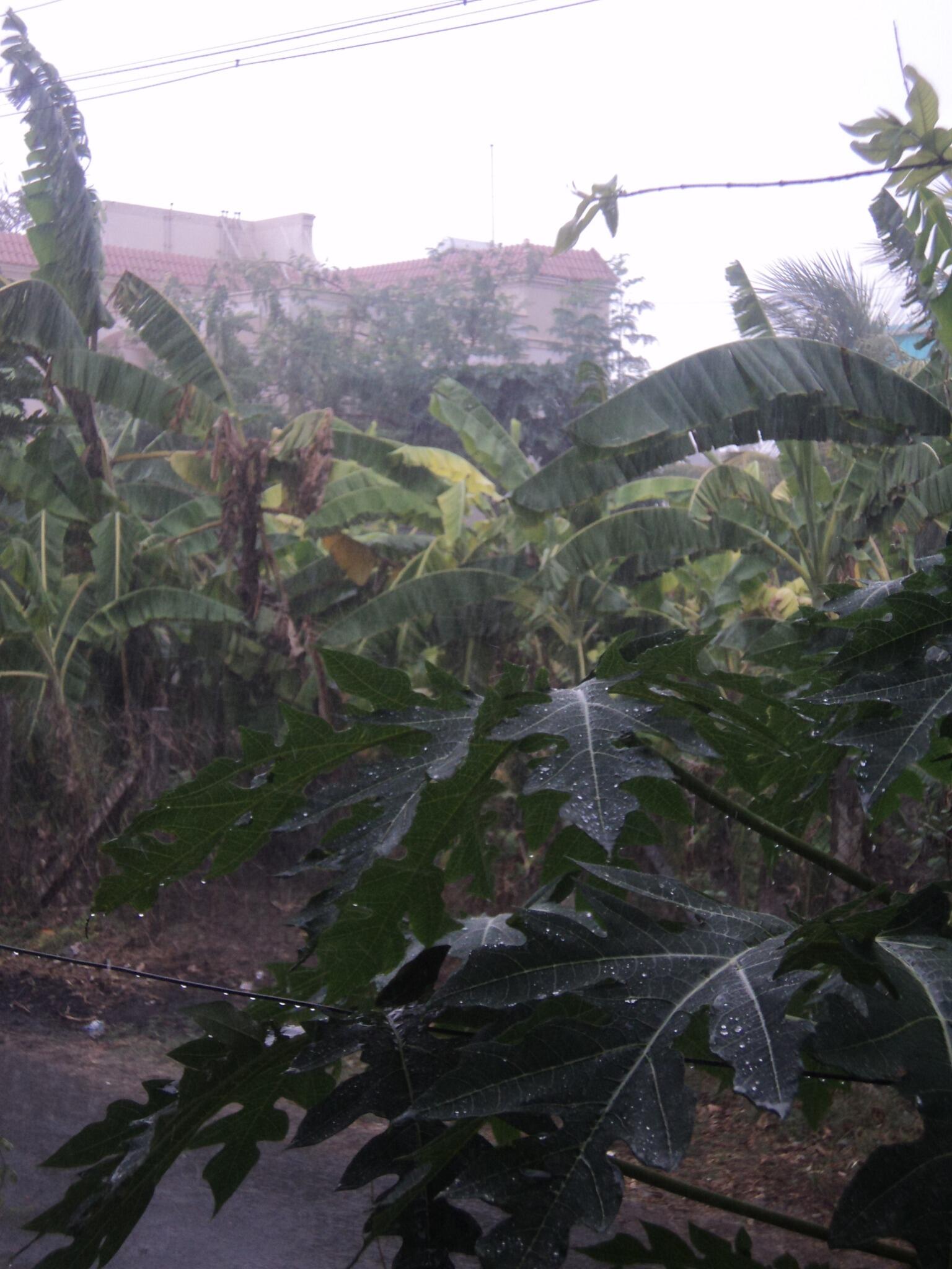
RT @AxPn: Continous rains since evng 6pm across all areas of Bangalore - heavy traffic jams/water logging @weatherofindia 10:30pm

RT @ValPrajj: @weatherofindia unabated rain since sunset in bangalore. @BBCHindi @BBCWorld 11:25pm

RT @___narayan___: @weatherofindia It is raining in #Allahabad (UP) at 6.10PM 

RT @aash_tvm: It is raining in #Trivandrum frm noon. #kerala #Malayalam @weatherofindia (5:42pm)

7pm, Heavy rain continue over most of Kerala, T.showers over N,N-E,N-W,central Tamilnadu , S,central Andhra ... http://ow.ly/i/2fmzw 

7pm, Showers also seen over Bihar, Jharkand, E.Uttarpradesh and Bengal ... http://ow.ly/i/2fmzw

RT @nidheeshn: Raining . Me fully drenched too. Stopped my car side, just to enjoy watching the rain #Kerala http://t.co/Q17h4evLcS (6:31pm)

Today's weather in #Kolkata !!

10:51am

Today very fine weather. little cloudy. temp around 28 degree. last night too cool. winds blowing from S-W .early morning little showers for few minutes seen in Howrah suburban district.

10:58am


11:26am

  • Sudden development of thick cloud in far north west kolkata in hoogly district and Barackpur.
    May b chance of  Few spells along with thunder shower reported in far north kolkata.
    To north dum dum zone

    11:54am


    Reported by 
3pm, Mild showers seen over S-W,W suburbs of #Chennai.

#Chennai - 3:30pm, Rain seen all along S-W,W,N-W at 40km from city.

3pm, Heavy rain continues over central Kerala, lots of T.showers seen over N,central,N-E.Tamilnadu ... http://ow.ly/i/2fgzm 
1:30pm, early T.showers popping over N,N-E.Tamilnadu and into S.Andhra !

Thiruchirapalli - Airport has reported "Rain with thunderstorm" at 1:10pm.

1:40pm, W,S,S-W suburbs of #Chennai is showing signs of an early T.shower. Temperarture is around 34 C now!

#Monsoon pushing into S.Kerala

12:30pm, #Monsoon pushing into S.extreme Tamilnadu and Kerala now ... http://ow.ly/i/2fdgw 

12:30pm, Very heavy pushing into S,Central Kerala ... http://ow.ly/i/2fdgw

RT @aratikumarrao: .@weatherofindia Hi there, Monsoon (or rain :)) Photo Updates on Tumblr: http://t.co/XZojZsBuNS :) 

RT @aratikumarrao: Very high waves & dark horizon, rain kovalam, #Kerala (1:17pm)

Some #Kerala #rain photos found in Instagram.


"94B" update ! More rain ahead for Bihar, Bengal and Jharkand !

Today as well, the remnant circulation of "94B" persists over Central.Bengal and along Bihar.

Here's a rainfall map showing the rainfall distribution on the day (29-May) when "94B" moved inland into S.Bengal.

Rainfall stats till 8:30am of 31-May-2013
Midnapore­11,   Jamshedpur­7 CM.
12pm, Satellite shows, more rain seen over E.Jharkand, central Bengal and into S.Bihar.

RT @shaan4me: Heavy rain in #kochi..  (10:27am) #kerala @weatherofindia They say monsoon have not yet reached the state. Haha 

#Monsoon rain over S.tip Tamilnadu, S.tip Kerala from early hours

Reports of heavy and moderate rain from 4am today over most parts of S.tip Tamilnadu (Kanyakumari district) and S.tip Kerala.
Below first 2 photos were taken in Nagercoil, Tamilnadu at around 6:30am.


RT @aratikumarrao: Flat light and pouring rain in kovalam #Kerala. for the fisherfolk, life goes on as usual. . http://t.co/ysMiYgrDIp (8am)

8am, Satellite IR shows showers lashing Southern most part of Kerala and Tamilnadu.

:: update at 10:21am ::
~~~~~~~~~~~~~~~~~
RT @robin_a_p: Monsoon rains !!! (at Trivandrum) [pic] — http://t.co/y30trfgIue (9:58am)

RT @shekki: Its raining in Trivandrum. The place looks so beautiful. (10am)

RT @lillyvgp: It's raining in Trivandrum.#mandatory rain tweet. *laughs at rest of India * (10:19am)

Thursday, May 30, 2013

BB-2 crossed land at the W. Bengal  coast on Wednesday at depression strength, and on Thursday evening, was at  a well marked low strength near Midnapore.
BB-1 will now move NW along the trough. Trough is situated from SE Uttar Pradesh running  SE  into the Bay thru BB-1.
The other system, AS-1 , has fizzled out over Oman, and no longer shows any pressure isobars.

Day temperatures to rise in Sindh region of Pakistan. Days may touch 48/49c in Dadu, Larkana and Nawabshah. Sukkar and Hyderabad could reach 45c.
Karachi wil be around 36c.

Fairly heavy rains for Kathmandu on Friday and Saturday.

Week end city and India forecast map on vagaries...
From tomorrow, entire S.Peninsula is going to change gears from active to very active ... more HEAVY rain for #Kerala http://ow.ly/i/2eQxY

HEAVY T.showers expected for central,N,N-W,N-E.Tamilnadu, S,central,W,N-W.Karnataka and into S.Andhra ... http://ow.ly/i/2eQCP

Widespread and Heavy rain expected for most of #Kerala, S,central Coastal Karnataka and Lakshadweep from 1-Jun... http://ow.ly/i/2eQGD #Monsoon

Heavy rain expected for S.tip Tamilnadu from tomorrow due to #Monsoon start .. and increase from 2-Jun.!.. http://ow.ly/i/2eRlo
From Saturday, the pre-monsoon T.showers are expected to line-up over N-W,W,S-W,S.Maharastra as well ... http://ow.ly/i/2eS27 
Latest analysis show that "94B" has weakened and persisting over S.Bengal and Jharkand .... http://ow.ly/i/2ePPG 

Heavy rain for most of Bihar, Jharkand and Bengal to continue for next 2 days ... http://ow.ly/i/2ePXD 

Scattered heavy rain for N-E states to continue during next 4 days!

Heavy rain expected for central,E.Nepal and odd rain may push into E.Uttarpradesh as well during next 2 days.
A new website by Kerala Tourism especially for #Monsoon ... http://when-it-rains.com/

"its raining in bangalore" .. 6:05pm, report and pic shared by our Facebook follower ... http://ow.ly/i/2eMZO 


6pm, Heavy rain over Jharkand, N.Odisha and into W,S.Bengal, S.Bihar... http://ow.ly/i/2eNrn 

6pm, Heavy T.showers seen over central,N,N-W.Tamilnadu, S,central,N-W.Karnataka, sharp showers continue over #Kerala http://ow.ly/i/2eNrn
RT @thisismmk: @weatherofindia 3.19pm T.showers ready to explode. Vellode - Erode district, N-W.Tamilnadu.. http://t.co/qobQbAXXoE 

RT @arvindrulz: @weatherofindia such a romantic weather in #coimbatore N-W.Tamilnadu with intermittent drizzle temp 26 C #monsoon (4:13pm)
#HOT at 2:45pm, Nagpur = 43 C, Ahmedabad, Jaipur = 41 C, Delhi, Thiruchirapalli = 40 C, Lucknow = 39 C, Hyderabad = 37 C, Amristar = 35 C.

#Chennai - Fully Cloudy till 1:30pm, Temperature is around 35 C at 2:45pm, Sea breeze slowly setting in and cloud cover has almost cleared!

#Chennai - Less chance of Rain today !

#Bangalore - sharp showers possible today towards late evening !

For #Mumbai, early hour or early morning scattered rain possible for tomorrow and Saturday. Heavy pre-monsoon rain expected after 1-Jun.

Monsoon, all good to set in on 2-Jun-2013 over #Kerala , S.Karnataka coast


Latest COLA model suggests that Monsoon will enter as FULL force into Kerala on 2-Jun-2013.
From 31-May or 1-Jun, very heavy and widespread rain expected for most of Kerala and along S,central Karnataka coast.

RT @abndnkmtr: .@weatherofindia heavy rains here for the part 2 hours. 22:46 #Sindhanur #Raichur #Karnataka (Night of 29-May)

"94B" - has moved into S.Bengal

Latest analysis show that the LOW pressure "94 B" has moved into S.Bengal during the past 12 hrs.

12:30pm, Satellite IR shows, heavy rain over S.Bengal, Jharkand and N,central Odisha.
Due to the pull effect of "94B" and Monsoon current , Heavy rain seen all along Karnataka coast and over N,central Kerala.


Report from our #Kolkata based Facebook reader at 9:02 am IST
Yesterday night 9 to 10 frequent showers seen in dum dum zone.
Then 11 to 11.30pm, light showers. From today morning light frequent showers seen in various pockets of kolkata.
very cool romantic weather here from morning.
Winds blowing strongly from S.east direction "


#Kolkata, airport at 1:20pm has reported "Light rain with stiff breeze from South"
#Patna, airport at 1:20pm, has also reported "Light rain, Rain with thunderstorm and stiff winds from East"

Wednesday, May 29, 2013

8pm, "94B" is moving inland thru S.Bengal ... Heavy rain over N,central.Odisha, S-coast.Bengal and E.Bangladesh.. http://ow.ly/i/2eho4

8pm, T.showers also seen over S.Chatisgarh, S-W,W.Andhra, N,central.Tamilnadu, N,N-W.Karnataka, W,S.Maharastra.. http://ow.ly/i/2eho4

#Kolkata today - "rain and windy"

" Yestrday.whole night kolkata lashed with light showers in all parts. again frm 7.30 a.m today Till now (5:30pm) its raining continiusly"

" Very Cool weather wit light rainfall continueslyyy and cool winds blowing from north esst 

direction " 

-- report shared by one of our Facebook reader.


RT @dsanjeevkumar: @weatherofindia raining at #kodaikanal , Tamilnadu 3.45pm 

RT @dsanjeevkumar: @weatherofindia mist covered mountains of Kodaikanal , Tamilnadu .. http://t.co/g2jExvjVWK (4:49pm)


RT @arvindrulz: @weatherofindia Its pouring down in #coimbatore , N-W.Tamilnadu.....Awesome climate #monsoon http://t.co/xdN5gybR7p (4:10pm)

#HOT at 2pm, #Delhi, Nagpur = 42 C, Jaipur, Varanasi = 41 C, Ahmedabad = 40 C, Amristar, Hyderabad, Thiruchirapalli = 39 C.

#Kolkata - Airport has reported "Light rain" at 1:50pm, Temperature is around 27 C.

#Chennai - 1:40pm, Temperature is around 37 C, NO Sea breeze yet ! Rain expected towards evening / late evening for S,S-W,W suburbs.

Today, Heavy T.showers expected for S,S-W,central.Karnataka, S,central,W.Andhra and N,N-W,central Tamilnadu ... http://ow.ly/i/2e7Mi 

Monsoon update, 29-May-2013 -- "Expected on 2-Jun-2013"

12pm, Showers seen along central Kerala coast and along Karnataka coast.
From tomorrow, the intensity of rain along Kerala, S.Karnataka coast is expected to increase.
On 2-Jun, the perfect Monsoon rains are expected to lash ALL Kerala coast and will push up to W.Ghats as well.
Heavy rain expected for S.tip of Tamilnadu as well (Kanyakumari district)
Latest models suggest that the FULL fury of #Monsoon is expected to reach Kerala and S,central Karnataka coast after 5-Jun-2013

LOW pressure "94B" and "95A"

"94B" - Lies just south of Bangladesh over N.Bay
~~~~~~~~~~~~~~~~~~~~~~~~~~~~~~~~~~~~~~~~~~~
Latest analysis of "94B" shows that it has almost become a Depression now.
Pressure is around 998mb according to Thailand met and around 1004mb according to JTWC.
Winds are gusting up to 45 kmph along S.Bengal and Bangladesh coast.
11:30am, Satellite visible shot reveals heavy convective activity near its center and over N-W, S,S-E quadrant of the system.

In next 24hrs, "94B" is expected to push inland into S.Bengal and S-W.Bangladesh coast.
On tomorrow, the circulation is expected to weaken, reach up to Bihar and then vanish.
During next 36 / 48 hrs... Heavy rain is expected for N,N-E.Odisha, S,central.Bengal, S.Bangladesh and over most parts of N-E states.
From tomorrow, heavy rain expected for most of Bihar, Jharkand, N.Bengal and Sikkim.

#Kolkata - Will experience heavy intermittent Rain from today till 31-May.

JTWC warning for "94B"
-------------------------------------
THE AREA OF CONVECTION PREVIOUSLY LOCATED NEAR 20.9N 89.8E 
IS NOW LOCATED NEAR 20.7N 89.4E, APPROXIMATELY 120 NM SOUTH-
SOUTHEAST OF KOLKATA, INDIA. ANIMATED MULTISPECTRAL SATELLITE 
IMAGERY (MSI) DEPICTS A BROAD, PARTIALLY-EXPOSED LOW-LEVEL 
CIRCULATION CENTER (LLCC) WITH FLARING BANDS OF BROKEN CONVECTION 
ALONG THE SOUTHERN PERIPHERY. CENTRAL CONVECTION HAS BEEN 
INTERMITTENT WITH THE LLCC SLOWLY TRACKING TOWARDS THE NORTHERN 
PORTION OF THE BAY OF BENGAL. A 280540Z OSCAT PASS SUPPORTS THE 
ELONGATION OBSERVED IN MSI, AND INDICATES WIND SPEEDS NEAR THE 
CENTER WERE BETWEEN 20 TO 25 KNOTS. UPPER LEVEL ANALYSIS INDICATES 
MODERATE TO STRONG (20 TO 30 KNOTS) VERTICAL WIND SHEAR (VWS). 
DYNAMIC MODELS INDICATE SLIGHT DEVELOPMENT AS THE SYSTEM 
TRACKS NORTHWARD INTO BANGLADESH OVER THE NEXT FEW DAYS. MAXIMUM 
SUSTAINED SURFACE WINDS ARE ESTIMATED AT 20 TO 25 KNOTS. MINIMUM SEA 
LEVEL PRESSURE IS ESTIMATED TO BE NEAR 1004 MB. DUE TO LAND 
INTERACTION AND VWS, THE POTENTIAL FOR THE DEVELOPMENT OF A 
SIGNIFICANT TROPICAL CYCLONE WITHIN THE NEXT 24 HOURS REMAINS LOW.

"95A" - Still along central Oman coast
~~~~~~~~~~~~~~~~~~~~~~~~~~~~~~~~~~~~~~
Latest analysis show, the circulation over "95A" is weak and persists along Central Oman coast.
11:30am IST, Satellite visible shot reveals, good convective activity seen near the central Oman coast.

Latest GFS model predicts that the circulation is expected to persist along Oman coast or just drift E-N-E for next 3 / 4 days... till 3/4-Jun.

RT @manibond32: @weatherofindia raining in Salem, Tamilnadu now 9:26pm

RT @Vinu4875: @weatherofindia monsoon style rain in Bangalore..no thunder...no heavy winds...coooool 9:41pm

RT @arvindjshah: @ramki_xlri @weatherofindia Has been raining in kochi, Kerala entire day till now. Quite heavy 10:08pm

Tuesday, May 28, 2013

BB-2 is stationary at 20.3N and 89.6E. Core pressure estimated at 998 mb and winds at 25 knts..already a well marked low, as mentioned yesterday, deepening further and could cross as a depression.Major clouding in West and SW quadrant while crossing. Intermittent rains for Kolkata on Wednesday and Thursday.

As BB-2 crosses, the LWD goes inland into the peninsula region, and the rainfall shifts to the interiors.
Chennai could get some relief from the sea breeze as the Easterlies would get stronger from Friday 31st.

3. Northern India, NWI and Pakistan remain dry next 3 days. But we see a rise of 2/3c in the Northern plains and NWI from Friday onwards.
Rise in day temperatures in Balochistan and Sindh from Thursday, possibly reaching 49/50c again.

More on vagaries

T.showers over S,S-central Peninsula and update on "94B"

7:30pm, T.showers seen over N,N-central,N-E.Tamilnadu, N,central Kerala, S,N-W,N.Karnataka, central Andhra ... http://ow.ly/i/2dGEL 

7:30pm, T.showers also seen over S-W, N.Maharastra, S-W.Madhyapradesh, S.Chatisgarh,  N,N-E.Odisha and N-E states ... http://ow.ly/i/2dGEL
RT @jayaprakashpv: Border of #palakkad, #malappuram & #thrissur 8:25pm just finished a medium #rain.. Lightning & cloudy sky #kerala 

"Heavy thunderstorm today in Belgaum with continuous 2 hr..during afternoon.." From our Facebook page ... http://ow.ly/lsWAZ 

RT @rajugana: @weatherofindia Bangalore 8.20 pm, Partially cloudy skies, heavy wind, chillness in the air.. Evening skies a pic http://t.co/8dZvkGgyZI 

"94 B" has intensified slightly. Winds now reaching upto 45 kmph along S.Bengal, Bangladesh coast. Will start to move inland in next 18hrs !

@isaakshi >> #Mumbai - 1 or 2 showers expected before 4-Jun.. more rain expected after that !
6:20pm, Heavy Rain seen along 25 / 30km S-W from #Chennai city.. now it is over Poonamalle and Sriperumpudur zones.

6:15pm, Lots of T.showers has lined up over N,N-E.Tamilnadu and into S.Andhra ... http://ow.ly/i/2dDCp 

:: UPDATE ::
#Chennai - 6:40pm, #Rain now over Meenambakkam to Guindy road!

RT @divakarchennai: @weatherofindia #Chennai Raining @ Pallilaranai & ECR.Heavy wind & lightning too. (7:17pm)
#HOT cities of #India on 27-May, Allahabad­ 45.5 C, Hamirpur (UP) & Banda 45.2 C, Khajuraho­ 45.0 C

#HOT at 2:15pm, Nagpur = 44 C, #Delhi = 42 C, Amristar, Jaipur, Varanasi = 40 C, Ahmedabad, Thiruchirapalli = 39 C.

#Kolkata - 2:20pm, airport has reported "Light rain" with temperature around 29 C.

#Chennai - 2:10pm, temperature around 36 C, Good sea breeze seen from E-S-E.

@vigneshmohan >> #Chennai - Models indicate a good chance of T.shower towards late evening !! It may be restricted over S-W,W suburbs alone!

Monsoon update - 28-May-2013

Up to today morning, the South West Monsoon over Bay is progressing very well.
The LOW "95A" near Oman coast is slightly hindering the Somali jet flow towards the Kerala coast.
Today, the Somali low level jet is very active and pushing N-N-E into central Arabian sea.
As per the latest model analysis, the strong monsoon current is expected to reach Kerala coast on evening of 1-Jun-2013.

Today, 1:30pm, Showers seen all along Kerala, Karnataka coast, Goa. Most of the showers have not pushed into land.

The low intensity showers along Kerala and Karnataka coast is expected to persist till 31-May.
Today's COLA model also predicts the Monsoon to reach Kerala coast with Very heavy rains on evening  / night of 1-Jun-2013.

Update on LOW - "95A" and "94B"

"95A" - Along Central Oman coast in Arabian sea
~~~~~~~~~~~~~~~~~~~~~~~~~~~~~~~~~~~~~~~~~~~~~
11:30am IST, Satellite visible shot shows good T.showers have pushed into central Oman coast.

Latest IMD - GFS predicts that the system along Oman coast is expected to persist for another 4 days, almost in that same position. This is amazing, for a circulation to persist in that same zone for a long period of time.
The system is expected to intensify on 31-May, and it may push fully into Oman on 3-Jun.

If this system intensifies, the Monsoon current reaching Kerala coast may get weakened (or) may not reach as well on 3-Jun.

"94B" - Over N.Bay, just south of Bangladesh coast.
~~~~~~~~~~~~~~~~~~~~~~~~~~~~~~~~~~~~~~~~~~~~~~~
12pm IST, Satellite visible shows heavy convective activity over most of N.Bay, pushing into S.Bangladesh.
Latest analysis show that "94B" is a marked LOW pressure system with strong circulation extending from low levels to upper levels.
Pressure is around 1000mb, according to Thailand met.
The "94B" is expected to push N-N-W into S.Bengal in next 24hrs.
By 30-May, the system is expected to push upto Bihar and vanish.

In next 24hrs and till 1-Jun, Heavy and Very heavy rain expected for S,central Bengal, N,N-E.Odisha, S.Bangladesh and over most places in N-E states of India.
In following days 30,31-May, the heavy rain will push into Jharkand and Bihar as well.


Monday, May 27, 2013

Today, the W.D circulation is seen over N.Pakistan,.. expected to drift into Kashmir on 28-May ... http://ow.ly/i/2dbEO 
Scattered rain expected for Kashmir till tomorrow evening ... !
@ambaarsaria >> Amristar - at 3pm, the temperature was around 36 C.

#Delhi - Airport, 5pm, is still reporting "Dust storm, Rain with thunderstorm"

#Kolkata - Airport, 5:50pm, has reported "Rain with thunderstorm" .. May be in vicinity !

Nagpur - Airport, 5:10pm, has also reported "Rain with Thunderstorm".
During next 3 days, Showers expected all along Kerala and Karnataka coast ... http://ow.ly/i/2d7vu 

T.showers expected over N,N-E Tamilnadu, S,S-W,N-W,central Karnataka, S,central,N-E.Andhra in next 2 days... http://ow.ly/i/2d7yV 

From Tuesday evening, Heavy wind and rain expected to push into S.Bengal, S.Bangladesh and N,N-E.Odisha due to "94B". http://ow.ly/i/2d7BW 

#Mumbai - From tomorrow, the chance of 2 or 3 showers is high till 1-Jun.

Update on "94B" , "95A" and #Monsoon

4pm, T.showers seen over Jharkand, S.Bihar, most places over N-E states, N-N-E Odisha and N-W.Karnataka.. http://ow.ly/i/2d6Bw 

Today, a strong circulation is seen over N.Bay ... http://ow.ly/i/2d6CE 

The N.Bay circulation is tracked as "94 B" for Depression / Cyclone formation... NOT possible due to close proximity to land.

Present cloud mass over N,N-central, central, W.Bay is due to this "94B".. http://ow.ly/i/2d6Ii 

Another circulation is over Arabian sea near Oman coast... tracked as "95 A" ... http://ow.ly/i/2d6KO 

Here's the latest satellite visible shot of "95A" along Oman coast ... http://ow.ly/i/2d6Mq 


"94B" is good for the Bay and S.Arabian sea wing of Monsoon.. The N.Bay system is expected to persist there for 2 days and intensify.

"94B" is expected to push into S.Bengal and S-W.Bangladesh on 28/29-May ... http://ow.ly/i/2d6RB 

Meanwhile, the "95A" is expected to persist along Oman coast even till 31-May.. with slight intensification ... http://ow.ly/i/2d6U7 

Bay wing of Monsoon is getting a move ahead. By 29 / 30-May, it'll enter in N.Bay along with "94B".

During the past week, the Somali jet has continuously picking strength .. Today, it is well established over S-W,S-central Arabian sea !

By 31-May, the wind speed along S,central Kerala coast will be picking up to near Monsoon strength ... http://ow.ly/i/2d7cT 

Models suggest that the #Monsoon current is expected to reach Kerala,S.Karnataka coast by noon of 3-Jun... http://ow.ly/i/2d7ft