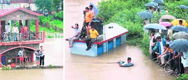
"A developing La Nina effect will bring normal rain to the country in August and September", weather experts at the India Meteorological Department (IMD) said on Saturday.
Some other forums and weather experts are also gung-ho about the develoing La;Nina, and have already concluded that the remaining 2 months of the monsoon will be of plentifull and bounty rains.
But wait, read the IMD wordings--"Developing" La-Nina. Meaning still
not yet developed fully. It can develop in a month, or may take as much as

3 months to fully blow up.
What is the current position of the La-Nina ? why is everyone suddenly talking about it now ? Most days, the population lives on without thinking about it.
But in a year like 2010, it makes headlines.
It's the weather phenomenon El Niño, or in this case, La Niña.Both have the same purpose but with different results.
La Niña is appropriately the opposite of the much discussed El-Nino. The Pacific waters are cooler than normal. Currently the National Oceanic and Atmospheric Association is providing data that suggests we are in a growing La Niña

phase, with water temperatures as much as 2 degrees below normal.
Typically, but not every time, El Niño and
La Niña alternate and match intensity and numbers. After a showing of a moderate El Niño last year, its counterpart has made a comeback and experts say it will just get stronger, or cooler in this year's case.
Current Situation:
Report from Australian Bureau:
The central and eastern tropical Pacific Ocean continued to cool during June.
Tropical Pacific Ocean temperatures continued to cool over the past fortnight, and are now approaching levels typical of a La Niña. Similarly, other ENSO indicators are also at or exceeding La Niña thresholds. As computer models predict the central Pacific will continue to cool over the coming months, it is now highly likely that the Pacific is in the early stages of a La Niña event, and that 2010 will be considered a La Niña year.
Signs of an emerging La Niña event have been apparent in the equatorial Pacific for several months. Pacific Ocean temperatures have cooled steadily throughout the year and are now more than 1°C cooler than average in some areas on the equator. Trade winds continue to be stronger than average and cloudiness has remained suppressed over the central Pacific.
All of these key indicators are at levels typical of the early stages of a La Niña event.
The 30-day Southern Oscillation Index [SOI] to 24 July was +18, the highest value since 2 March 2009. Normally, value over +10 ,(for a period of 10/15 days) would indicate a developed La-Nina. The Southern Oscillation Index (SOI) has increased in value and is currently around +14,
Effects of La-Nina:
During the northern hemisphere summer season, the Indian monsoon rainfall tends to be greater than normal, especially in northwest India. Drier than normal conditions are observed along the west coast of tropical South America, and at subtropical latitudes of North America (Gulf Coast) and South America (southern Brazil to central Argentina) during their respective winter seasons.
Some of the other weather effects of La Niña include abnormally heavy monsoons in India and Southeast Asia, cool and wet winter weather in southeastern Africa, wet weather in eastern Australia, cold winter in western Canada and northwestern United States..

La Nina is the exact reverse of El Nino, and has been traditionally associated with a good monsoon for India, though without direct cause-effect relationship.Never been certain of that !
To put this in perspective, the country faced the worst drought in three decades last year when an El Nino was in full swing in the Pacific.
In line with its La Nina outlook, the Tokyo-based Research Institute for Global Change (RIGC) has said that India would join a few other nations to be bracketed along for a watch on near-flooding rains in parts of the country.


