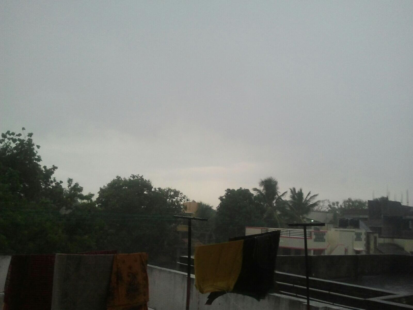
#Chennai - lots of T.showers seen over S-S-W from city at 60,70,80km. 7pm, Showers seen just south of Chengelpet.

Sunday, June 30, 2013
India's Wettest Places - Walakkad, Kerala - Series No.1
Whenever people in India ask for wettest / Rainiest places they only know Cherrapunji or Mawsynaram or Agumbe. In these weekly series, you will come to various places which i have identified to be wettest places of India. This series will be published every weekly. If you are fan of Heavy Rains and want to know more than Cherrapunji. Please Read it. Its only a compilation of data from various sources / articles / research materials.
Walakkad which it has crossed 9000 mm rainfall in 5 years of the 12 years available rainfall data is the first in the long series.
Dhar et al (1978) carried out a study ot the heavy rainfall stations in India. For the purpose of the study, stations with mean annual raintall of 5000 mm were considered as heavy rainfall stations. Of the total 14 stations across India, Only two were from KeraIa namely Neeriamangalam (5880 mm) and Peermade (5000 mm). The rainfall data was available only for less number of years. Over the years the averages have caught up with these two stations and their averages have fallen less than 5000 mm considerably. But rain gauges were installed at many other locations which were experiencing very heavy rains during the monsoons.With the data obtained and analysed, these stations were experiencing more rainfall than Agumbe (7640 mm) called as Cherrapunji of South India. One such place is Silent Valley, where rainfall data is available for Walakkad, Pochipara, Silent Valley, Neelikkal and Sairandhri.
More on
http://tamilnaduweatherman.blogspot.in/2011/09/silent-valley-wettest-place-in-kerala.html
Evening showers expected for S.Karnataka, S.Andhra, N,N-E.Tamilnadu during next 3 days.
12:30pm, Rain seen over S,central Uttarpradesh, N-E.Madhyapradesh, Jharkhand, S.Bengal and coastal Odisha.. http://ow.ly/i/2uf3W
12:30pm, Rain seen over S,central Uttarpradesh, N-E.Madhyapradesh, Jharkhand, S.Bengal and coastal Odisha.. http://ow.ly/i/2uf3W
During next 24 / 48hrs.. Heavy widespread rain for Most of E,central,N.Uttarpradesh, N,N-E,E.Madhyapradesh, Chatisgarh, Bihar.
During next 36hrs, Heavy rain expected to be focussed over N,N-E,E.Madhyapradesh and into E,central Uttarpradesh.. http://ow.ly/i/2ueUZ

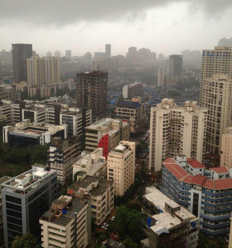
Heavy and widespread rain for most of Maharastra coast, #Mumbai, #Goa and coastal Karnataka .. http://ow.ly/i/2ueW5
During next 18hrs, some rain expected to persist over Punjab, Kashmir, Himachal and Haryana!
Heavy rain to continue for Sikkim, N.Bengal and North zones of N-E states during next 2 days !
Scattered rain expected for Odisha, N,N-E.Andhra and into Chatisgarh in next 2 days.
During next 2 days, Less rain expected for central,S. Kerala but N.Kerala is expected to get more scattered rain.
S,central.Bengal is also expected to get scattered rain with medium intensity during next 3 days.
During next 36hrs, Heavy rain expected to be focussed over N,N-E,E.Madhyapradesh and into E,central Uttarpradesh.. http://ow.ly/i/2ueUZ

Heavy and widespread rain for most of Maharastra coast, #Mumbai, #Goa and coastal Karnataka .. http://ow.ly/i/2ueW5
During next 18hrs, some rain expected to persist over Punjab, Kashmir, Himachal and Haryana!
Heavy rain to continue for Sikkim, N.Bengal and North zones of N-E states during next 2 days !
Scattered rain expected for Odisha, N,N-E.Andhra and into Chatisgarh in next 2 days.
During next 2 days, Less rain expected for central,S. Kerala but N.Kerala is expected to get more scattered rain.
S,central.Bengal is also expected to get scattered rain with medium intensity during next 3 days.
Today, low level circulation is seen over the eastern end of axis over N,central.Bengal, Bihar and E.Uttarpradesh .. http://ow.ly/i/2ueIT
The upper level circulation is seen over N.Bay and into S.Bengal... another circulation over E.Uttarpradesh .. http://ow.ly/i/2ueKm
In 24hrs, the low level circulation is expected to consolidate and move (W-N-W) along the axis into E.Uttarpradesh.. http://ow.ly/i/2ueMd

In 48hrs, 2 upper level circulation, one to move into S.Odisha,N-E.Andhra coast, another over N-E.Madhyapradesh.. http://ow.ly/i/2ueNd
Today, a weak upper level circulation is seen along N.Maharastra coast, this is expected to persist for another 48hrs http://ow.ly/i/2ueON
Present weak offshore trough along S-W coast is expected deepen during next 2 or 3 days.. HEAVY widespread rain ahead http://ow.ly/i/2ueQL
RT @aknarendranath: Put off yatra, evacuate pilgrims, Met said, but govt sat on warning - The Times of India http://t.co/0rdQkedYy3 @weatherofindia
RT @aknarendranath: Near-perfect June monsoon till now.
http://t.co/k8iAz8riQ7
RT @aknarendranath: Near-perfect June monsoon till now.
http://t.co/k8iAz8riQ7
Rainfall in and around Chennai
in mm ending 8.30 am 30.06.2013
North Chennai was battered.
Ponneri - 100
Uthiramerur - 60
Ellapuram - 44
Cholavaram - 33
Ennore - 32
Madurantakam - 31
Redhills - 28
RK Pet - 20
Kalavai - 15
Sholinghur - 13
Cheyyar - 12
Kolapakkam - 11
Gummidipundi - 10
Thiruvalangadu - 10
Thamaraipakkam - 10
Chennai AP - 9
Madhavaram - 7
Mailam - 7
Chennai - 6
Kancheepuram - 6
Tiruttani - 6
Cheyyur - 4
Taramani - 3
Katupakkam - 3
Saturday, June 29, 2013
RT @remil4remil: Rain in #Kerala. Through the camera. Mathrubhumi.com Super pics collection .. http://t.co/wkQV2C6sEl
#Chennai - 6:02pm, Rain started over Pallavaram(South Chennai) zone.
#Chennai - 6:08pm, Heavy rain now over Pallavaram.. RAIN all around city and moving in ..latest RADAR scan http://ow.ly/i/2tZAq

#Chennai - can expect a prolonged shower well into midnight !!
#Chennai - 6:08pm, Heavy rain now over Pallavaram.. RAIN all around city and moving in ..latest RADAR scan http://ow.ly/i/2tZAq

#Chennai - can expect a prolonged shower well into midnight !!
#HOT at 1pm, #Delhi = 37 C, Thiruchirapalli = 36 C, Ahmedabad = 35 C.
#Chennai - having a humid day so far 1:10pm, temperature around 33 C.
1:30pm, Less rain over entire S-W coast, showers continue over E,N.Uttarpradesh, T.shower over N.Punjab,W.Himachal. http://ow.ly/i/2tWRy
#Chennai - having a humid day so far 1:10pm, temperature around 33 C.
1:30pm, Less rain over entire S-W coast, showers continue over E,N.Uttarpradesh, T.shower over N.Punjab,W.Himachal. http://ow.ly/i/2tWRy
Rainfall in and around Chennai
in mm ending 8.30 am on 29.06.2013
Vellore - 35
Tiruttani - 24
Kalavai - 22
Katupakkam - 20
Poonamalle - 18
Kelambakkam - 15
RK Pet - 12
Sholinganallur - 11
Arakonam - 10
Tiruvalangadu - 10
Uthiramerur - 10
Kaveripakkam - 10
Meenambakkam - 9
Taramani - 8
Chembarabakkam - 7
Cholavaram - 6
Redhills - 5
Kancheepuram - 5
Guindy - 4
Tiruvallur - 4
Kolapakkam - 3
Cheyyar - 3
Nungambakkam - 2
Poondi - 2
Madhavaram - 2
Friday, June 28, 2013
Today (28-Jun) morning's Heavy rainfall report
Pradeep's Morning HRF update
1. Karnataka Heavy Rains in Shimoga and Udupi district
Agumbe Nilkund to post around 60-70 mm rainfall. Not much of rain in Hulikal. Kodagu district rains continue but with less intensity. Talacauvery has got over 2200 mm and is the SWM leader. Watch out for it again.
2. Arunachal Pradesh second day of very heavy rains.
Its been poor SWM for Arunachal so far. Last 2 days its raining a lot. Tezu, Along and Basar all have got over 100 mm. Watch out for Passighat and Tuting rainfall.
3. Kerala gets consistent rain to continue.
Expect rainfall to be around 60 mm for most of the stations. A surprise 100+ mm station cant be ruled out.
4. West Bengal to get rain in HRF places.
As usual Cooch Behar, Darjeeling and Jalpaiguri districts got good rains. Most stations put around 70-80 mm rains. All HRF stations to post good rainfall numbers. Dont be surprised if any stations get very heavy rainfall.
Already posted in out Facebook http://facebook.com/indianweatherman
Heavy rain for E,S,N.Uttarpradesh, Bihar during next 2 days
10:30pm, Rain seen S,S-W,N-E.Uttarpradesh, Rain continues over S.coast Karnataka, N.Kerala ... http://ow.ly/i/2tEwu
On Monday, the E.Uttarpradesh circulation is expected to strengthen again and persist for 2 days then drift S-W.. http://ow.ly/i/2tECJ
Till Sunday evening, Heavy, Widespread rain expected for N,E,S,central Uttarpradesh, most of Bihar, N,central Bengal http://ow.ly/i/2tEKw
Till Sunday, Heavy rain also expected for N,central N-E states, Sikkim and into Jharkand, S.Bengal and scattered over Odisha.
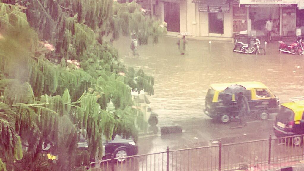
On Saturday, Sunday... widespread medium intensity rain expected for most of Maharastra coast, #Mumbai
On Monday till Wednesday, HEAVY and widespread rain expected for S,central.Maharastra coast, #Goa and most of Karnataka coast.
Some showers may pop over Punjab, Himachal, Uttarakhand, S.Kashmir during next 2 days!
Less scattered and medium intensity rain expected for most of Kerala during next 2 days.
RT @thisismmk: @weatherofindia @sakthivelss Heavy rains lashes Erode, N-W.Tamilnadu 5.30pm. http://t.co/kSAcHGkmP6

RT @arvenky: Started raining steadily here in Malleswaram, Bangalore @weatherofindia (6:54pm)
RT @dsanjeevkumar: @weatherofindia Heavy rains in #Guindy #Chennai.. Since past 10 mins.. Just Like yesterday evening. (7:17pm)
RT @rangats: @weatherofindia heavy rains from 7.15 till now at Adayar, #Chennai (7:32pm)
RT @rajanramaswami: @weatherofindia we have nice rains and thunderstorm here now at Pallikaranai, #Chennai (8:26pm)
#Chennai - at around 7:45pm, zones South of Tambaram got HEAVY thunder storm. Polichalur zone got some steady drizzles today.
#HOT at 3pm, Thiruchirapalli = 37 C, Ahmedabad, Jaipur, #Chennai = 36 C, Amristar, #Delhi = 35 C.
3:10pm, #Mumbai - Santacruz has reported "Rain".
3pm, Heavy rain seen over central,N,E.Uttarpradesh, Bihar and into central,N.Bengal ... http://ow.ly/i/2tnTJ
3pm, Rain continues over S.coastal Karnataka and over most of Kerala ... http://ow.ly/i/2tnTJ
During last 7 days, Heavy rain seen over central India, N-E.Peninsula, S-W coast, most of N-E states, Uttarakhand. http://ow.ly/i/2tnXv
 #Chennai - 3:45pm, T.showers seen at around 80km S-W,W from city.
3:10pm, #Mumbai - Santacruz has reported "Rain".
3pm, Heavy rain seen over central,N,E.Uttarpradesh, Bihar and into central,N.Bengal ... http://ow.ly/i/2tnTJ
3pm, Rain continues over S.coastal Karnataka and over most of Kerala ... http://ow.ly/i/2tnTJ
During last 7 days, Heavy rain seen over central India, N-E.Peninsula, S-W coast, most of N-E states, Uttarakhand. http://ow.ly/i/2tnXv

Thursday, June 27, 2013
Possible FLOOD warning for E.Uttarpradesh !!!
Showers along coastal karnataka to get minimal during next 3 days, but isolated evening rain expected over S,S-W,S-central karnataka
In next 24hrs, HEAVY rain expected for most of N,S,E,central Uttarpradesh, N-E,E.Madhyapradesh, N.Chatisgarh, Bihar http://ow.ly/i/2sTQ0
Heavy rain also expected for most of Nepal, N,central.Bengal and Medium rain for Jharkand, Odisha during next 24hrs.
#Mumbai - medium intensity rain or NO rain expected for city on Friday ! Intermittent sharp showers expected Saturday, Sunday.
Less rain expected for central,S.Kerala till 30-Jun. Showers to continue for N.Kerala.
If the circulation persists along E.Uttarpradesh during next 3 days, then HEAVY rain expected for next 4 days in that same zone.
Possible FLOOD warning for E.Uttarpradesh, W.Bihar, N-E.Madhyapradesh and N.Chatisgarh zone during next 4 days !
Today's, E,S-E.Uttarpradesh low,mid level circulation is expected to deepen,persist almost in same for another 3 days http://ow.ly/i/2sTbU
IMD-GFS even suggests that the circulation may persist along east end of axis with deepening over E.Uttarpradesh even till 1-Jul.
In next 24hrs, a LOW is expected along the eastern end of monsoon axis over Bihar, E.Uttarpradesh ... http://ow.ly/i/2sTqq

Models have not predicted a W-N-W movement of the upcoming LOW over Bihar, E.Uttarpradesh.. in fact it's predicting a S-W drift after 1-Jul
#Chennai - evening rain tweets.
RT @fourvees91: @weatherofindia Its raining at Madippakkam for the past 15mts. http://t.co/DNBkdB90m4 (5:36pm)
RT @rangats: Good rains at chennai - Saligramam , virugambakkam 5.40 PM @weatherofindia
RT @congicrooks: @rangats @weatherofindia here in KKNagar stop -start rains very windy #Chennai (5:48pm)
RT @abdulrahmanmb: @weatherofindia Started raining in T.nagar, #Chennai area....stuck inside office (5:49pm)
RT @aknarendranath: @weatherofindia Raining moderately in Delhi. (12:55pm)
Today, the Low, medium level circulation is seen over S-E Uttarpradesh, N-E.Madhyapradesh and N.Chatisgarh.. http://ow.ly/i/2sM1G
Today, the LOW has merged with the monsoon axis along E.Uttarpradesh !
Today, the upper level 500hpa circulation is seen over E.Madhyapradesh, N.Chatisgarh !
2:30pm, Heavy rain seen over central,N-E,N.Madhyapradesh, central,S,E.Uttarpradesh, S.Bihar, N.Bengal, Uttarakhand
Today, the LOW has merged with the monsoon axis along E.Uttarpradesh !
Today, the upper level 500hpa circulation is seen over E.Madhyapradesh, N.Chatisgarh !
2:30pm, Heavy rain seen over central,N-E,N.Madhyapradesh, central,S,E.Uttarpradesh, S.Bihar, N.Bengal, Uttarakhand
Wednesday, June 26, 2013
Today, the upper level 500hpa circulation is seen over S,central Madhyapradesh.... http://ow.ly/i/2sat2
The LOW pressure and low, mid level circulation is seen over E.Madhyapradesh, S-E.Uttarpradesh, N.Chatisgarh.. http://ow.ly/i/2saBR
1pm, Due to LOW and circulation, Heavy rain seen over S,central.Bihar, most of Madhyapradesh, W.Uttarpradesh.. http://ow.ly/i/2saEO

1pm, Showers also seen over central,N.Bengal, most of Maharastra coast, and scattered over Kerala ... http://ow.ly/i/2saEO
#HOT at 1:30pm, Thiruchirapalli = 36 C, Amristar, Lucknow = 35 C.
Varanasi - Airport, 1pm, has reported "Light rain"
Patna, airport at 12:20pm has reported "Rain with Thunderstorm"
#Kolkata - after morning showers, now (2pm) it is overcast.
Atlast inflow into Mettur, but the second biggest dam Bhavanisagar gets over 12000 cusecs inflow. Sholayar to overflow
1. Mettur dam gets inflow of 1100 cusecs after water was released from Kabini dam after it got full. More rain in Wayanad. So more inflow for Kabini and more for mettur.
2. Bhavanisagar gets huge inflow after super rains in kerala. Inflow is over 12200 cusecs.
3. Its raining more in Sholayar than in Cherrapunji it gets 100 mm heavy rainfall today also. It adds 17ft in one day and is now at 145 ft against full level 160 ft. (Inflow is over 9000 cusecs and stored water is 4200 mcft against full capacity of 5100 mcft)
4. Papanasam inflow is around 3700 cusecs. The Dam level is at 110 ft against full level 143 ft. (Stored water is 3600 mcft against full capacity of 5500 mcft)
5.Other dams
Periyar ~ 5200 cusecs and getting good rains.
Amaravathy ~ 3500 cusecs
Parambikulam ~ 2000 cusecs
Aliyar ~ 1200 cusecs
Pechiparai and Perunchani ~ 1000 cusecs.
Over all its a good day for Tamil Nadu Dams

-BB-4 Situated on Tuesday Night in the Northern Chattisgarh and adjoining East Mp region. An UAC lies to the SW of this system, where maximum clouds are associated.
2. -System likely to move N/NW and enter Southern Up. Consequently it will merge with the monsoon axis.
3. -West Coast off shore trough persists in current strength.
4. - Heaviest rainfalls ( 70-120 mms) next 2 days will be concentrated in the Central Up (Lucknow) area, Northern Bihar and Northern West Bengal.
5. - Moderate (30-70 mms) heavy rains along west coast of India, Southern regions of Uttarakhand.
6. - Light to medium rains (10-30 mms) in West UP, Delhi NCR, Interior Maharashtra, Saurashtra , Gujarat Region and Kerala.
City forecast on vagaries..
Tuesday, June 25, 2013
#Mumbai today !
RT @iamthemixmaster: From where am standing.. #theview #mumbai #rain http://t.co/AbYGYGFNYM (5:07pm)
RT @hornnotokplease: Just 15 mins of rain and this what happens outside my office #Mumbai #BMC http://t.co/nSZar0Gtnx
RT @hornnotokplease: Just 15 mins of rain and this what happens outside my office #Mumbai #BMC http://t.co/nSZar0Gtnx
Kolkata - today !
Kolkata, 5pm
"very typical weather in kolkata here from morng..specialyy in north kolkata..clouds r
orgintng frm s.west direction and rapidly moving towards north directns,,,,,,all over ganga
belt (hooghly belt at westrn part of river)..rains r havng there for maxmum 15 mints than
disappearng, but fine spells......this is happening constantly frm morng till now,,in central
kolkata we r recvng rimjhm rainfall,,,but very much humidity and warm not any sunshn frm
morng till now "
The offshore trough along S-W coast is expected to weaken after 27/28-Jun.!
In 12hrs, WRF model expects a upper level circulation along central Maharastra coast... http://ow.ly/i/2rBni
Widespread rain expected to continue for central,S.Maharastra coast, #Goa during next 2 days. Intermittent showers expected for #Mumbai.
In 12hrs, WRF model expects a upper level circulation along central Maharastra coast... http://ow.ly/i/2rBni
Widespread rain expected to continue for central,S.Maharastra coast, #Goa during next 2 days. Intermittent showers expected for #Mumbai.
Today, the LOW and low,mid level circulation is seen over Odisha ... http://ow.ly/i/2rATJ

The upper level circulation at 500hpa is slightly titled S-S-W and lies over N,N-E Andhra ... http://ow.ly/i/2rAXg
The LOW and circulation is expected to move North from today and expected to enter Bihar, E.Uttarpradesh on 26/27-Jun http://ow.ly/i/2rB1g
During next 12hrs, HEAVY rain expected for S,S-E,E.Madhyapradesh, N,central,E.Maharastra, Chatisgarh, Jharkand.. http://ow.ly/i/2rB5l
From tonight, Heavy rain expected to push into most of Madhyapradesh, N.Chatisgarh, Jharkand and central.Bengal,Bihar http://ow.ly/i/2rB9h
During next 3 days, heavy and widespread rain to continue ALL along Himalayan foothills, Nepal, N.Bihar, N.Bengal, Sikkim, North N-E states.
On 27-Jun, Heavy rain expected for N.Chatisgarh, E,N-E,central.Madhyapradesh, E,central Uttarpradesh, Bihar, N.bengal http://ow.ly/i/2rBf5
#HOT on 24-Jun, highest Maximum temperature of 45.0 °C was recorded at Churu (Rajasthan)
#HOT at 1:30pm, Jaipur = 37 C, Ahmedabad, Amristar = 36 C, While #Delhi and Patna is at 33 C.
#Kolkata airport has reported "Rain with Thunderstorm" at 1:50pm.
At 1:10pm, Nagpur airport has also reported "Rain with thunderstorm".
#Chennai - #HOT, at 1:40pm temperature was around 36 C. Mild breeze from W-S-W.
#Chennai - Today as well, there's a chance of evening short sharp shower over some parts of city.
1:30pm, Heavy rain over N-W,W.Uttarpradesh, Cloudy with mild rain over Uttarakhand, T.showers over S,central Bengal. http://ow.ly/i/2rAeK

1:30pm, HEAVY rain over S.chatisgarh, E,N,central Maharastra, S,S-E.Madhyapradesh and into S.Jharkand .. http://ow.ly/i/2rAeK
1:30pm, Heavy rain along S,central Maharastra coast, scattered along Karnataka coast and over Kerala .. http://ow.ly/i/2rAeK
Super rains in Coimbatore and Nilgris
Coimbatore and Nilgris district continued to witness rain along the places which are in Western Ghats
in mm places which have got above 100 mm
Avalanche - 251
Parsons Valley - 248
Valparai - 202
Sholayar - 200
Chinnakallar - 160
Devala - 160
Porthimund - 154
in mm places which have got above 100 mm
Avalanche - 251
Parsons Valley - 248
Valparai - 202
Sholayar - 200
Chinnakallar - 160
Devala - 160
Porthimund - 154
Uttarakhand news update !
Uttarakhand: 10 LATEST DEVELOPMENTS ... "helicopter operations resume" ... http://ow.ly/mm5iw
Uttarakhand: Search and rescue operations in Kedarnath over ... http://ow.ly/mm5mD
Uttarakhand : "Final toll could be over 10,000, those involved in rescue operations say" ... http://ow.ly/mm5to
Uttarakhand: Search and rescue operations in Kedarnath over ... http://ow.ly/mm5mD
Uttarakhand : "Final toll could be over 10,000, those involved in rescue operations say" ... http://ow.ly/mm5to
Less rain over Bihar, Most of N-E states, Karnataka !!
The rainfall anomaly map from 9-Jun-2013 to 23-Jun-2013, suggests some interesting DRY zones in India.
Very less rain seen over most of Bangladesh and over most of N-E states, S,coastal.Tamilnadu, S,S-central Andhra and over S,central Karnataka.
Excess over Uttarakand, Himachal, coastal Maharastra, Kerala, S,S-E-coastal Gujarat, E.Maharastra, S,S-E.Madhyapradesh and S.Chatisgarh.

Very less rain seen over most of Bangladesh and over most of N-E states, S,coastal.Tamilnadu, S,S-central Andhra and over S,central Karnataka.
Excess over Uttarakand, Himachal, coastal Maharastra, Kerala, S,S-E-coastal Gujarat, E.Maharastra, S,S-E.Madhyapradesh and S.Chatisgarh.

Monday, June 24, 2013
Today, low, mid level circulation and LOW pressure at 994mb is seen along N,central Odisha coast .. http://ow.ly/i/2r028

The upper level circulation of Odisha coast is tilted S-S-W and seen along N-E.Andhra coast ... http://ow.ly/i/2r0dh
Odisha LOW, After initial movement in W-N-W direction it's expected to track more North or N-N-W movement ... http://ow.ly/i/2r0eS
As of latest models, the low, mid level circulation is expected to end up over central Uttarpradesh on 27-Jun ... http://ow.ly/i/2r0lM
Today's rain upto Uttarakand, Himachal and all along Himalayan belt is expected push into S.Kashmir and persist for next 5 days.
During next 2 days, Heavy rain expected for N,N-E,E.Maharastra, most of Chatisgarh and into most of Madhyapradesh... http://ow.ly/i/2r0tj
During next 2 days, Heavy rain to continue for most of Odisha and some heavy showers also expected to push into Jharkand as well.
#HOT at 1:15pm, #Delhi = 39 C, Jaipur, Amristar, Varanasi = 37 C.
#Chennai - High cloud cover from morning till now. Temperature around 34 C. Humid !
Lucknow airport has reported "Light thunderstorm" at 1:30pm.
At 1:10pm, Hyderabad airport has reported "Drizzle". And at 1:50pm, #Kolkata has reported "Light thunderstorm".
1:30pm, Showers again over Uttarakand, more rain over central,N.Uttarpradesh, Heavy over S,central Chatisgarh, Odisha http://ow.ly/i/2qZr5
RT @aash_tvm: Morning is bright, without rain, here!#attingal #Trivandrum #kerala @weatherofindia(10:18am)
8:30am, Heavy rain over N-W.Uttarpradesh, S.Chatisgarh, S.Odisha,E.Maharastra and S.Madhyapradesh ... http://ow.ly/i/2qUMm
Today, Heavy and widespread rain for Odisha, Chatisgarh, E,N,N-E.Maharastra and S,central,E.Madhyapradesh ... http://ow.ly/i/2qUQK
Today, most of S-W coast of India from N.Maharastra to S.kerala coast to get heavy scattered rain ... http://ow.ly/i/2qUQK
Today, Heavy and widespread rain for Odisha, Chatisgarh, E,N,N-E.Maharastra and S,central,E.Madhyapradesh ... http://ow.ly/i/2qUQK
Today, most of S-W coast of India from N.Maharastra to S.kerala coast to get heavy scattered rain ... http://ow.ly/i/2qUQK
Sunday, June 23, 2013
BB-4 is positioned off the Orissa coast and at 996 mb pressure. It has an associated Upper Air Trough towards the SW, in the interior Orissa and Chattisgarh/Vidarbha region.
The system moves Westwards on Monday.
Sunday Night/Monday, we see heavy rains in Orissa State, with concentrated heavy rain in the Sambhalpur-Rourkela belt.Southwards towards Balangir we see heavy rains. The rain belt stretches along the coast into Coastal W.Bengal. Kolkata gets increased rainfall on Monday.
Tuesday, as BB-4 moves inland, we see precipitation in the Vidharbh and Marathwada regions of Maharashtra. Nagpur,Gondia, Khamgaon and Akola regions get heavy showers.
By Tuesday evening, rainfall moving into adjoining MP, with Ujjain region and the Indore -Itarsi belt getting heavy rains.
Rains move into Eastern Gujarat also.
From Vagaries
RT @aknarendranath: @weatherofindia Delhi is overcast, humid and temp at 40 C (5:52pm)
6:30pm, Showers seen over central.Andhra, most of Chatisgarh, E.Maharastra, Central,N.Odisha, E.Uttarpradesh, N.Bihar http://ow.ly/i/2qH44
6:30pm, scattered showers seen over Uttarakand, E.Madhyapradesh, central,S zones of N-E states and over Kerala .. http://ow.ly/i/2qH44
RT @sanjeevnaique: it just started raining here at #Margao #Goa (7.15pm) after overcasty conditions throughout the day. Got chance to plant
RT @naikap: fast approaching dark clouds heralding wet times ahead tonight at #Benaulim Beach #Goa #monsoon http://t.co/Sed9dkyR4n
RT @aknarendranath: Uttarakhand cloudburst, computer foretells disaster but unheard http://t.co/HzVXLXtiqs >> This is what happened !
HOT Tamil Nadu
Tamil Nadu Highest Maximimum Temperature Averages for June Month till 23/6/2013...
1.Puducherry and Nagapattinam - 37.6c
2.Nungambakkam(Chennai) and Madurai - 37.5c
3.Tiruchirapalli - 37.1c
#Coastal TN particularly burning!!
1.Puducherry and Nagapattinam - 37.6c
2.Nungambakkam(Chennai) and Madurai - 37.5c
3.Tiruchirapalli - 37.1c
#Coastal TN particularly burning!!
#Hyderabad rain
RT @bumblme: raining cats and dogs... #Hyderabad #monsoon @weatherofindia 2:38pm
RT @uzair432: @weatherofindia raining heavily in surrounding hyderabad http://t.co/yaOUaZseu8 (3:22pm)

RT @uzair432: @weatherofindia raining heavily in surrounding hyderabad http://t.co/yaOUaZseu8 (3:22pm)
All India SWM rainfall Toppers from 01.06.2013 to 20.06.2013
Rainfall in mm (Minimum of 1000 mm)
1.Chatav (Maharashtra) - 1475
2.Talacavery (Karnataka) - 1470
3.Dapoli (Maharashtra) - 1467
4.Tulshi (Maharashtra) - 1372
5.Vadakara (Kerala) -1362
6.Mahabaleshwar (Maharashtra) - 1348
7.Khed (Maharashtra) - 1344
8.Kannur (Kerala) - 1339
9.Naladi (Karnataka) - 1321
10.Kollur (Karnataka) - 1282
All top 50 toppers and state wise toppers are only in the following blogs.
http://rajesh26.blogspot.in/p/stats-and-figures.html
http://tamilnaduweatherman.blogspot.in/2013/06/all-india-swm-rainfall-toppers-from_23.html
Saturday, June 22, 2013
Due to Bay LOW moving in tomorrow, Heavy rain expected for most of Odisha, N,N-E.Andhra, S.Chatisgarh, E.Maharastra.. http://ow.ly/i/2qn3g
Scattered rain expected to persist for Jharkand and parts of S,central Bengal, Heavy over N.Bengal on 23,24-Jun.
Monday, HEAVY and widespread rain expected for central,N,E.Maharastra and push into S,S-E.Madhyapradesh, Chatisgarh http://ow.ly/i/2qn6a
Till 25-Jun, Heavy rain to continue over Kerala and scattered along Karnataka coast.
COLA, WRF models suggests NO spike in rains along N,central Maharastra coast, S,S-E Gujarat coast and #Mumbai for next 3 days !
Today, the N.Bay circulation is very well established from Low to upper levels in height ... http://ow.ly/i/2qmKI
In next 24hrs, the LOW pressure will get marked along S.Bengal, N.Odisha coast .. expected to enter land thru N.Odisha coast on 23-Jun.
On 23-Jun (tomorrow), evening, the circulation and LOW will enter into N.Odisha ... http://ow.ly/i/2qmOl

Upper level circulation at 500hpa is slightly tilted S-S-W and expected to push inland thru central,S.Odisha coast.. http://ow.ly/i/2qmQF
When the Bay circulation drives inland on 23-Jun, a weak circulation is expected near central Maharastra coast ... http://ow.ly/i/2qmQF
The Bay LOW and circulation is expected to drive towards #Delhi from 24-Jun.. but the system may not reach #Delhi !
#Kolkata - 2:55pm, "raining here in kolkata and dum dum ,severe thunderstorm in barrackpur region" ... http://ow.ly/mhAUr

#Delhi - #HOT ... 40.2 C at 2:30 pm
#Delhi - #HOT ... 40.2 C at 2:30 pm
Davangere - 2:25pm, "light showers happening,after a week! "
RT @sanjeevnaique: @weatherofindia its hot n sunny here in #Margao in. #Goa . No sign of rain today. Its sweating @naikap (2:28pm)
#Chennai - 2:10pm, #HOT at 37 C, Less humidity at around 35% with Breeze from W-N-W.
Today and next 24hrs, sharp showers expected along S,central Andhra coast, N,central Tamilnadu coast, #Chennai ... http://ow.ly/i/2qlkc
#Chennai - expected to be #HOT at around 37 C for next 3 days, chance of high cloud cover, Small chance of evening shower on 23,24,25-Jun.
Some WET places in Tamilnadu, 1-Jun-2013 to 20-Jun-2013 (stats)
Valparai - 785 mm
Upper Bhavani – 726 mm
Chinna Kallar – 650 mm
Pechiparai – 331 mm
Naduvattam – 310 mm
Nature’s Fury In Uttarakhand – Devastation Beyond Comprehension (Analysis) ... http://ow.ly/mhxlZ
1pm, Heavy rain seen all along Kerala, S.tip of Tamilnadu and S,central coast of Karnataka ... http://ow.ly/i/2qkSR
Rainfall map of 21-Jun (3:30am, 21-Jun to 3:30am, 22-Jun) ... http://ow.ly/i/2qkUo
 1pm, Heavy rain seen over S.Bengal, Odisha coast. Fresh rain over Bihar as well... http://ow.ly/i/2qkSR
#HOT at 1:30pm, Amristar, #Delhi = 39 C, Jaipur, Varanasi = 37 C, Lucknow, Patna = 36 C.
#Kolkata - airport has reported "Rain with thunder storm" at 1:50pm.
1pm, Heavy rain seen all along Kerala, S.tip of Tamilnadu and S,central coast of Karnataka ... http://ow.ly/i/2qkSR
Rainfall map of 21-Jun (3:30am, 21-Jun to 3:30am, 22-Jun) ... http://ow.ly/i/2qkUo

#HOT at 1:30pm, Amristar, #Delhi = 39 C, Jaipur, Varanasi = 37 C, Lucknow, Patna = 36 C.
#Kolkata - airport has reported "Rain with thunder storm" at 1:50pm.
Friday, June 21, 2013
On 22,23,24,25-Jun, More HEAVY rain ahead for Odisha, Chatisgarh, N,N-E.Andhra, E.Maharastra and S,S-E.Madhyapradesh. http://ow.ly/i/2pXzw
N.Bengal and N.Bihar can expect more rain during next 2 days.
From 23-Jun, rain expected to push into E.Uttarpradesh and central,E.Nepal as well.
N.Bengal and N.Bihar can expect more rain during next 2 days.
From 23-Jun, rain expected to push into E.Uttarpradesh and central,E.Nepal as well.
RT @kironz: Smell of fresh rain @ Palakkad, Kerala.. Nice overcast. @weatherofindia (4:31pm)
#Bangalore - "Raining heavily here at Jalahalli (N.Bangalore)... 7:10 PM... :)"
7:30pm, Heavy rain seen over N,central Bengal, Odisha, S,central Chatisgarh and over N,N-E.Andhra ... http://ow.ly/i/2pWx6
7:30pm, T.showers also seen over E.Madhyapradesh and N-W.Bihar. Heavy rain continue over Kerala ... http://ow.ly/i/2pWx6

#Mumbai and its surroundings today !
Almost non - stop rain lashes Badlapur today from 12.30pm to 5.30pm with intensity varying from heavy to medium to light consistently & thundering also in between. So overall an nice cool rainy day here.

#Mumbai outskirts, eastern suburbs from Thane to Badlapur belt was having heavy rains today.
#Mumbai - Santacruz max temp 31.6c with 0.10mm rain till 5.30pm today
Shared by our Facebook reader in http://facebook.com/indianweatherman
#Mumbai outskirts, eastern suburbs from Thane to Badlapur belt was having heavy rains today.
#Mumbai - Santacruz max temp 31.6c with 0.10mm rain till 5.30pm today
Shared by our Facebook reader in http://facebook.com/indianweatherman
Offshore trough along S-W coast of India from N.Maharastra coast to central Kerala coast persists, but weak ... http://ow.ly/i/2pNvL
On 23-Jun, a LOW pressure is expected along S.Bengal coast ! and move inland in W-N-W direction along the monsoon axis.
Today, a low and mid level circulation seen over N,N-E Bay ... http://ow.ly/i/2pNPy
On 23-Jun, the low, mid level N-N-E Bay circulation is expected to enter inland thru N.Odisha coast ... http://ow.ly/i/2pNTd

Tomorrow, an upper level circulation expected along central Maharastra coast ... http://ow.ly/i/2pNVW
Tomorrow, Due to circulation along Maharastra coast, some heavy and widespread rains expected along S-E.Gujarat, Maharastra coast and Goa.
On 23,24,25-Jun, Less rain expected along S,S-E.Gujarat coast, N,central Maharastra coast.
Meanwhile, scattered rain along Karnataka and Kerala coast to continue till 25-Jun ... http://ow.ly/i/2pPFB

#HOT on 20-Jun, highest maximum temperature of 44.0°C was recorded at Ganganagar (Rajasthan)
#HOT at 1:30pm, #Delhi = 39 C, Amristar, Jaipur, Nagpur = 37 C.
#Chennai - 1:30pm, Temperature around 36 C (feels like 38.9C), Humidity around 38% and breeze from West.
Latest COLA model suggests that #Chennai is expected to have #HOT days for next 5 days, with 10 or 20% chance of evening sharp shower.
1pm, Cloudy over S,S-W.Madhyapradesh, isolated rain over S.Bihar and scattered rain over Karnataka coast and Kerala. http://ow.ly/i/2pKl5
1pm, some rain also seen along S-E.Gujarat coast and N.Maharastra coast .. http://ow.ly/i/2pKl5
Thursday, June 20, 2013
Today's #Kolkata thunderstorm !
Kolkata, today at 12:40pm, "thunderstorm , packing with 77km/h per hour !! Now in south kolkata raining heavily for last 1 hour"
#Kolkata - 11:30am to 1pm, "today's severe thunderstorm in kolkata .. looks so beautiful" from our Facebook ... http://ow.ly/mdvsL

#Kolkata - 11:30am to 1pm, "today's severe thunderstorm in kolkata .. looks so beautiful" from our Facebook ... http://ow.ly/mdvsL
Subscribe to:
Posts (Atom)