Monday, June 30, 2014

Badlapur Overall June 2014 Weather.


 Hottest ever June was seen & with the combination of lowest Rainfall was recorded..


Rainfall deficit is -72% to normal June average !


Weather Instagram at June 30, 2014 at 06:22PM

#chennai - 6:10pm, 3rd day of T showers. Heavy rain now pushing across N-central city. #weather


from Instagram

Sunday, June 29, 2014

Chennai - 11:27pm, light steady rain continue over polichalur zone for past 1hour.

Weather Instagram at June 29, 2014 at 03:34PM

#chennai - 3:30pm, a heavy T shower is now sweeping N-W suburbs. #weather


from Instagram

#Chennai - 2:25pm, T showers seen now over N,N-W suburbs, at around 30 to 60km from city.

-- update at 3:37pm --
#Chennai - 3:30pm, A super T shower is now over W,N-W suburbs and some over central zones of city ... http://ow.ly/i/63WGH 

RT @vasudevan_k: Heavy rains in Perambur area now. #ChennaiRains @weatherofindia (3:38pm)


More T showers possible today for S,S-E Karnataka, S Andhra, N,N-E,N-central Tamilnadu.

Chennai can expect a T shower today as well, after 4pm

Bangalore city is also expected to receive a T shower today evening.
Not expected to be widespread.

Saturday, June 28, 2014

Tornado & thunder storm

­Tornadoes don't just pop into existence -- they develop out of thunderstorms, where there's already a steady, upward flow of warm, low-pressure air to get things started. It's kind of like when a rock concert erupts into a riot. Conditions were already volatile; they merely escalated into something even more dangerous.
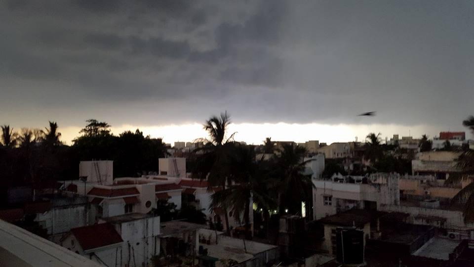
­Thunderstorms themselves form like many other clouds: A warm, moist air mass rises and cools, causing the water vapor to condense into clouds. However, if the updraft continues, this cloud mass will continue to grow and rise 40,000 feet (12,192 m) or more up into the troposphere, the bottommost layer of the atmosphere that we live in. A typical thunderstorm cloud can accumulate an enormous amount of energy. If the conditions are right, this energy creates a huge updraft into the cloud, but where does the energy come from?
Clouds are formed when water vapor condenses in the air. This change in physical state releases heat, and heat is a form of energy. A good deal of a thunderstorm's energy is a result of the condensation that forms the cloud. Every gram of water condensed results in about 600 calories of heat -- and another 80 calories of heat per gram of water results from freezing in the upper atmosphere. This energy increases the updraft temperature, as well as the kinetic energy of upward and downward air movement. The average thunderstorm releases around 10,000,000 kilowatt-hours of energy -- the equivalent of a 20-kiloton nuclear warhead [source: Britannica].
In supercell thunderstorms, the updrafts are particularly strong. If they are strong enough, a vortex of air can develop just like a vortex of water forms in a sink. This precursor to the tornado is called a mesocyclone, and is typically 2 to 6 miles (3 to 10 kilometers) wide. One a mesocyclone forms, there's a roughly 50 percent chance that the storm will escalate into a tornado in around 30 minutes.
Some tornadoes consist of a single vortex, but other times multiple suction vortices revolve around a tornado's center. These storms-within-a-storm may be smaller, with a diameter of around 30 feet (9 meters), but they experience extremely powerful rotation speeds.
The tornado reaches down out of a thundercloud as a huge, swirling rope of air. Wind speeds in the range of 200 to 300 mph (322 to 483 kph) aren't uncommon. If the vortex touches ground, the speed of the whirling wind (as well as the updraft and the pressure differences) can cause tremendous damage, tearing apart homes and flinging potentially lethal debris.
The tornado follows a path that is controlled by the route of its parent thundercloud, and it will often appear to hop. The hops occur when the vortex is disturbed. You've probably seen that it is easy to disturb a vortex in the tub, but then it will reform. The same thing can happen to a tornado's vortex, causing it to collapse and reform along its path.
Smaller tornadoes may only thrive for a matter of minutes, covering less than a mile of ground. Larger storms, however, can remain on the ground for hours, covering more than 90 miles (150 km) and inflicting near continuous damage along the way.
At this point, you might be wondering just how tornadoes eventually dissipate. Scientists still debate exactly how these deadly storms die, but one of the prime suspects is none other than the parent thunderstorm: the rotating mesocyclone. Tornadoes need instability and rotation. Disrupt the airflow, take away its moisture or destroy its unstable balance of hot and cold air, and it can't function. Often, a tornado will die because the cold outflow of air from falling precipitation upsets the balance.

#Chennai - T shower report and photos !!

#Chennai - 5:24pm, IWM Polichalur station has recorded 52.5 mm of rainfall so far. Drizzling even now!

#Chennai - Yesterday's T shower rainfall stats...
Nungambakkam = 25.5 mm
Airport = 62.6 mm
IWM Polichalur = 52.8 mm


@weatherofindia This is what South Chennai looked like, at about 4 PM. pic.twitter.com/hmLrHpNflw


Only in our colony its not raining yet. But heavy rains all over chennai. @weatherofindia

@weatherofindia its pouring cats and dogs at Ambattur Chennai


Sudden rainfall in Chennai. 4:00 pm pic @weatherofindia pic.twitter.com/QLO0O3H6Dv


Its pouring heavily in #Chennai. Some respite from those extremely hot and humid days since April. @weatherofindia pic.twitter.com/R0AlopVKZA


@weatherofindia #Chennai Thunderstorms at Nanganallur pic.twitter.com/7HbY4vOEkX

@weatherofindia lightening dark clouds thunder with heavy rain just started at Pallikaranai Chennai.

It's so dark outside... Looks like it's gonna pour!! @weatherofindia @chennaiweather


@weatherofindia Its raining now at Madippakkam. pic.twitter.com/XMq0mEgvT3


Weather Instagram at June 28, 2014 at 05:19PM

#chennai - 5:17pm, now drizzling after 1.5hrs of heavy T.Shower. Polichalur. #weather


from Instagram

Thunder storm at Chennai

சுமார் 0.8 கி மீ உயரத்தில் மேற்கிலிருந்து காற்று இடி மழை மேகத்தை இழுத்து வந்து மழை.

Weather Instagram at June 28, 2014 at 02:26PM

#chennai - 2pm, now showing promising signs of T shower before 6/5pm. #weather


from Instagram

#Chennai - 1:20pm, Mini T showers have started popping over N-W from city at around 80 to 100km.
@ShrirangSamant >> Entire W,S-W coast of #India is expected to remain dry till 1-Jul.
A revival expected for Maharastra coast on 2-July.

@ShrirangSamant >> A better organized revival along West coast is expected only after 4-Jul !!

Today, a low,mid-level trough seen from N Bengal to N-E Tamilnadu ... http://ow.ly/i/63AvC 
Today, an upper-level circulation seen along N,central Andhra coast ... http://ow.ly/i/63AC6 


Rainfall alert for next 36hrs
~~~~~~~~~~~~~~~~~~~~~~~~

In next 12hrs...
Heavy, scattered T showers expected over most of S,central Bengal, Odisha and Jharkhand... http://ow.ly/i/63AH6 
Before midnight today...
T showers expected over N,N-central,N-E Tamilnadu, S Andhra and S,S-E Karnataka ... http://ow.ly/i/63AHY 
Today, Sunday... T showers also expected over N-E Andhra !

#Chennai - S,W,S-W,N-W suburbs can expect a T shower today after 4pm.
#Bangalore - Evening T showers expected on today, Sunday!

Entire W,S-W coast is expected to get very LESS rain during next 48hrs.
Scattered showers expected only along Kerala coast and W-ghats.
Tonight, T showers also expected to pop over central,E Karnataka as well!
Sunday - Afternoon - Scattered T showers expected over Nilgiris (Tamilnadu) and into S,S-E Karnataka, #Bangalore.
Odisha to get more scattered T showers on Sunday ... http://ow.ly/i/63AMN 

Friday, June 27, 2014


7:30pm, scattered rain over E-central India and over N,central, S Peninsula ... http://ow.ly/i/634BI 
#Chennai - 8pm, Heavy T showers seen S-W of Chengelpet, around 90km from chennai city... http://ow.ly/i/634JW 

Weather Instagram at June 27, 2014 at 04:14PM

#chennai - 4:12pm, W, N-W, W having some light showers. Photo taken facing West. #weather


from Instagram

Why is the IMD feeding the media outright spin regarding rainfall deficiency?


Speculation of the monsoon performance has become the central focus of our economy so much our Prime Minister is reported to monitor reports almost real time. So why is it so central? According to industry body Assocham, a 1 per cent deficit in rains could hurt India's economic growth by 0.35 per cent. Assuming a 20% deficiency, our GDP will no doubt be deeply in the red, given that last year GDP was within the sub 4 range. 


#chennai - 3:58pm, lots of mini showers seen over W, N-W and S-W within 60km from city. Moderate rain expected to push into city after 5pm.

Weather Instagram at June 27, 2014 at 02:02PM

#chennai - 2pm. A hot day again. West is getting ready for a evening shower. #weather


from Instagram

El Nino and the coupling between Nino SSTs and SOI


Though the lack of coupling between the Nino SSTs and atmosphere (SOI) one of the principal reasons why the current El Nino struggles to emerge seems resolved as of now, WMO offers a caveat that it may rebound into positive territory by next week as Jose Bastardi, WeatherBell tweet informs:
“WMO site EC indicates after SOI back and forth next 7 days, major burst of anti nino positive develops late next week”


El Nino Modoki crosses threshold and its emergence now irreversible


Daily values for Nino Sea Surface Temperatures (SSTs) and SOI have crossed Nino threshold though their 30 day mean values may still show a lag. Southern Oscillation Index (SOI) which till very recently reflected La Nina values have now flipped into El Nino mode. 

According to the Australian Met yesterday daily SOI was a whopping (-) 20.6. It is now clear that we are not having a canonical El Nino, but a Modoki (pseudo El Nino), Type II variety wich would be very devastating for the Indian monsoon. To accentuate the problem, both the Indian Ocean Dipole (IOD) and Equatorial Indian Ocean Oscillation (EQUINOO) have turned adverse for rainfall, compounding the adverse effect of the Modoki.