RT @Valprajj: It's raining at , JP Nagar. Bangalore. 9.05 pm @weatherofindia http://t.co/sSb4EuQpEK

Tuesday, March 31, 2015
Monday, March 30, 2015

7:30pm, HEAVY T showers over W Uttarpradesh, N-E Madhyapradesh, Bihar, S Bengal, Bangladesh, W-ghats Kerala & TN.. http://ow.ly/i/a9xMm
The circulation over Bihar is expected to be weak for next 2 days.
Fresh low-level circulation expected over N Bengal on 1/2-Apr. !
Meanwhile, T showers to continue over N,central zones of N-E states during next 2 days.
Low-level N-S trough from N Bengal to S Odisha coast along coast is expected on 2-Apr ... http://ow.ly/i/a9yrx

----------------
For N,N-W India...
A weak WD trough is expected to drop over N,central Pakistan on 2/3-Apr and drift east... http://ow.ly/i/a9yO1
A low-level circulation is expected over central Pakistan and adjoining N-W India on 2-Apr and will drift East ... http://ow.ly/i/a9yYZ
----------------
Afternoon, evening of 31-Mar...
T showers again for S-tip, W-ghats Tamilnadu, W-ghats Kerala, W-ghats Karnataka, N-E Andhra, S Odisha.
More W.D rain ahead for Kashmir, Punjab, Himachal and over N-central India from 1-Apr and may continue upto 5-Apr... http://ow.ly/i/a9ALZ

Sunday, March 29, 2015

Today, the LWD is seen from S tip Tamilnadu to N-W Karnataka and then a slight re-direction towards N-E into N-N-W Maharastra due to WD.
Today evening's HEAVY rain over Nagercoil (S tip Tamilnadu) is due to good easterlies feed and LWD ... http://ow.ly/i/a8PQU

Good easterlies moisture feed for S Tamilnadu can be observed here ... http://ow.ly/i/a8PUK
More T showers ahead ALL along W-ghats from S tip Tamilnadu to W,N-N-W Maharastra on monday, 30-Mar... http://ow.ly/i/a8PXi
#Chennai - Today morning it was 25 C, day 34.5 C.
As long as there's easterlies the Temp will not cross 36 C. In next 14 days this'll change

The upper-level WD trough is seen along 78E and upto 23N over N,central Pakistan... http://ow.ly/i/a8OCX
In next 24hrs this WD trough is expected to drift East into N,N-central India and fizzle out !
WD's low-level circulation is seen over N,N-W Rajasthan, S,W Punjab and adjoining Pakistan... expected to drift East, vanish in 24hrs.
Monday, due to W.D ... scattered rain for Himachal, Uttarakhand, Haryana, #Delhi, W,central,E Uttarpradesh.
Some scattered rain also for N,E,central Madhyapradesh before evening of 30-Mar.
For Kashmir, less rain forecast from night of 30-Mar ! but heavy scattered rain expected before evening !
~~~~~~~~~~~~~~~

In the East, in 24 hrs the present weak circulation over Bihar is expected to intensify and drop trough to S Odisha http://ow.ly/i/a8Pdx
In next 24hrs, this trough/circulation also gets feed from the dying WD trough over N,N-W India ....So the T showers over E India, Odisha on Monday are going to be HEAVY and Damaging !! ... http://ow.ly/i/a8PiZ

For East India..HEAVY T showers expected over many zones of Bihar, Odisha, S Chatisgarh, Jharkhand, central,N Bengal !
During next 36hrs... HEAVY scattered T showers will continue over N Bangladesh, Sikkim and over N-E states (heavy over N,central zones).
RT @SkymetWeather: #Delhi gears up for a three-day spell of #rain FULL REPORT: http://t.co/exE12fWPX2 @weatherofindia #Noida #Gurgaon
Saturday, March 28, 2015
Friday, March 27, 2015

2015's Kal Baisaki is here .. scattered T showers over Bihar, W,central Bengal, Jharkhand into N,S Odisha, N-E Andhra http://ow.ly/i/a7oyU
4:30pm, T showers also seen over W-ghats of N-W,W Maharastra, N-W, S W-ghats of Karnataka .. http://ow.ly/i/a7oyU

Today, in low-levels a circulation has formed over Bihar.. and this is seasonal and has started the Kal Baisakhi .. http://ow.ly/i/a7oR0
This low-level circulation will start the "violent" T showers over Bihar, Jharkhand, Bengal, N Odisha and into central, N zones of NE states
The low-level circulation over Bihar is expected to persist and will drop a N-S trough upto S Tamilnadu in next 10 days !
Kal Baisakhi is already happening and more T showers for Bengal, Bihar, Odisha, N-E states expected during next 24hrs !
Weather Instagram at March 27, 2015 at 09:24AM
Chennai - mild mornings continue, morning temp will rise by 1 C in next 10 days. #weather
Wednesday, March 25, 2015

5:30pm, T showers over coastal,S,N-E Odisha, N-E Andhra, S-W Bengal, N-W,W-ghats Karnataka and N Uttarakhand... http://ow.ly/i/a5uzQ
Tuesday, March 24, 2015
Seasonal LWD seen ALL along W-ghats from S-tip Tamilnadu to N-W Maharastra.
Another along N-E Andhra to N-E Odisha http://ow.ly/i/a4yuR
This LWD will pop T showers over coastal Odisha, N-E Andhra.
W-ghats S-W Karnataka, W-ghats Kerala, W-ghats Tamilnadu http://ow.ly/i/a4yLZ
Another along N-E Andhra to N-E Odisha http://ow.ly/i/a4yuR
This LWD will pop T showers over coastal Odisha, N-E Andhra.
W-ghats S-W Karnataka, W-ghats Kerala, W-ghats Tamilnadu http://ow.ly/i/a4yLZ
Some cities that touched #Hot 40 today !
Jaisalmer = 40.6 C
Barmer = 41.4
Ahmedabad = 40.5
Rajkot = 40.7
Surat = 40.5
Sholapur = 41.2
#Chennai - Airport records 35.2 C today !
Yesterday it was 34.3 C
#HOT N,N-W,N-central,central Tamilnadu ...
On 23-Mar...
Karur = 38.8 C
Salem, Tiruchy = 38.6 C
Coimbatore = 37.3 C

As of today, the day temp over most of India has crossed 35 C.
Even more HOT days ahead for W,central,E-central zones http://ow.ly/i/a4xNt
Next W.D system is expected to affect N,N-W India on Sunday, 29-Mar... this can "again" reduce the rising temps over those zones !
For Tamilnadu, an easterly moisture push is expected from 27-Mar... this'll pop T showers over S,central, w-ghats,N-W Tamilnadu.
Jaisalmer = 40.6 C
Barmer = 41.4
Ahmedabad = 40.5
Rajkot = 40.7
Surat = 40.5
Sholapur = 41.2
#Chennai - Airport records 35.2 C today !
Yesterday it was 34.3 C
#HOT N,N-W,N-central,central Tamilnadu ...
On 23-Mar...
Karur = 38.8 C
Salem, Tiruchy = 38.6 C
Coimbatore = 37.3 C
As of today, the day temp over most of India has crossed 35 C.
Even more HOT days ahead for W,central,E-central zones http://ow.ly/i/a4xNt
Next W.D system is expected to affect N,N-W India on Sunday, 29-Mar... this can "again" reduce the rising temps over those zones !
For Tamilnadu, an easterly moisture push is expected from 27-Mar... this'll pop T showers over S,central, w-ghats,N-W Tamilnadu.
Monday, March 23, 2015
RT @SkymetWeather: #Ahmedabad recorded 40°C, temperatures expected to soar for next 3-4 days. FULL REPORT: http://t.co/fWJRxdBPbs #weather
Sunday, March 22, 2015
Saturday, March 21, 2015
Friday, March 20, 2015
20.03.2015 / 2245 UTC summar Equinox
During an equinox, the Earth's North and South poles are not tilted toward or away from the Sun and the duration of daylight is theoretically the same at all points on Earth's surface.
Today is 20 March 2015 /22.45 UTC. Today occurs summer Equinox. From tomorrow onwards SUN will be in NORTHERN hemisphere and start heating the vast land area in Northern hemisphere.

Today is 20 March 2015 /22.45 UTC. Today occurs summer Equinox. From tomorrow onwards SUN will be in NORTHERN hemisphere and start heating the vast land area in Northern hemisphere.
Wednesday, March 18, 2015
World Meteorological Day
http://www.imdchennai.gov.in/
World Meteorological Day is observed every year on 23 March. This year
India Meteorological Department, Regional Meteorological Centre,
Chennai is celebrating World Meteorological Day on 23.03.2015 [Monday]. Please click the link above for more details.

From 19-Mar, the min temp along W India, N,N-central Peninsula will rise ... meaning HOT day and Nights ahead ... http://ow.ly/i/942sA
From 20-Mar, most of #India will come under above 32/33 C day temp.. getting #hot !
#HOT conditions with temp around 37 to 40 C is expected over N,N-E Andhra, S chatisgarh, S,central Odisha .. http://ow.ly/i/942Fl
#HOT conditions also for Gujarat, W,N-W,E Maharastra and coastal Karnataka from Friday, 20-Mar !
No W.D system expected till 23-Mar, Monday for N,N-W India !
#Chennai - 2:15pm, A #HOT day so far. Temp at 34 C (feels like 38.8 C) half an hour back it felt like 40 C.
2:30pm, T showers over N-E Odisha ... http://ow.ly/i/93Y6M
Today, a weak low-level circulation seen along Goa, and LWD from N-W W-ghat Karnataka to N-W Maharastra along W-ghats http://ow.ly/i/93Yhe
During next 24hrs... almost NO rain for MOST zones of India, except for T showers along S coast Karnataka, N Kerala.
Monday, March 16, 2015

4:30pm, T showers over S,W-ghats Tamilnadu, W-ghats Kerala and into S-W-ghats of Karnataka ... http://ow.ly/i/92110
5pm, Some T showers of W.D seen over E Rajasthan, Haryana, E Punjab, Himachal, Uttarakhand ... http://ow.ly/i/922aG
5pm, T showers seen over E,N-E Maharastra into S-E,E Madhyapradesh ... http://ow.ly/i/922aG
T showers are back again over S Tamilnadu, S Kerala...
rain till 8:30am, 15-Mar..
Ayikudi (Tirunelveli), Kamudhi (Ramanathapuram) 8 cm

For next 24hrs, LWD is expected to be from S tip Tamilnadu to N-N-W Maharastra running thru central Karnataka... http://ow.ly/i/91z01
Good moisture feed from S-W Bay into S Tamilnadu, S Kerala is causing HEAVY T showers ... expected till today night http://ow.ly/i/91z4c

More T showers before night of 16-Mar, for S,W-ghats,N-W Tamilnadu, S,w-ghats Kerala into S-W,W-ghats Karnataka.. http://ow.ly/i/91z8U
rain till 8:30am, 15-Mar..
Ayikudi (Tirunelveli), Kamudhi (Ramanathapuram) 8 cm
Tamil Nadu: Ayikudi (Tirunelveli Dist), Kamudhi (Ramanathapuram Dist) 8 each, Papanasam (Tirunelveli Dist) 7, Valparai taluk office (Coimbatore Dist) 5, Ramanathapuram (Ramanathapuram Dist), Nanguneri (Tirunelveli Dist), Dindigul (Dindigul Dist) 4 each, Manimutharu (Tirunelveli Dist), Kamudhi arg (Ramanathapuram Dist), Thiruchuzhi (Virudhunagar Dist), Peraiyur (Madurai Dist), Mylaudy (Kanyakumari Dist), Kadaladi (Ramanathapuram Dist), Illayangudi (Sivaganga Dist), Periyakulam (Theni Dist) 3 each, Paramakudi (Ramanathapuram Dist), Sivaganga (Sivaganga Dist), Tirumangalam (Madurai Dist), Nagercoil (Kanyakumari Dist), Melur (Madurai Dist), Ottapadiram (Toothukudi Dist), Kovilpatti (Toothukudi Dist), Aruppukottai (Virudhunagar Dist), Mudukulatur (Ramanathapuram Dist), Shencottah (Tirunelveli Dist), Natham (Dindigul Dist), Tirupathur (Sivaganga Dist), Cheranmahadevi (Tirunelveli Dist), Thenkasi (Tirunelveli Dist) 2 each, Tuticorin (Toothukudi Dist), Kodaikanal (Dindigul Dist), Ambasamudram (Tirunelveli Dist), Radhapuram (Tirunelveli Dist), Kovilpatti AWS (Toothukudi Dist), Tondi (Ramanathapuram Dist), Tirumayam (Pudukkottai Dist), Chittampatti (Madurai Dist), Tiruvadanai (Ramanathapuram Dist), Thoothukudi port AWS (Toothukudi Dist), Bhoothapandy (Kanyakumari Dist), Periyakulam AWS (Theni Dist), Tirupuvanam (Sivaganga Dist), Devakottai (Sivaganga Dist), Kovilankulam (Virudhunagar Dist), Colachel (Kanyakumari Dist), Surangudi (Toothukudi Dist), Virudhunagar (Virudhunagar Dist), Aranmanaipudur (Theni Dist), Manamadurai (Sivaganga Dist), Sivagiri (Tirunelveli Dist), Uttamapalayam (Theni Dist) 1 each.
Kerala: Chengannur (Alappuzha district) 4, Thiruvananthapuram Airport 3, Thiruvananthapuram City, Neyyattinkara (Thiruvananthapuram district), Ponnani (Malappuram district) & Mancompu (Alappuzha district) 2 each and Chalakudy & Vadakkancherry (both in Thrissur district) & Kozha (Kottayam district) 1 each.
For next 24hrs, LWD is expected to be from S tip Tamilnadu to N-N-W Maharastra running thru central Karnataka... http://ow.ly/i/91z01
Good moisture feed from S-W Bay into S Tamilnadu, S Kerala is causing HEAVY T showers ... expected till today night http://ow.ly/i/91z4c
More T showers before night of 16-Mar, for S,W-ghats,N-W Tamilnadu, S,w-ghats Kerala into S-W,W-ghats Karnataka.. http://ow.ly/i/91z8U
RT @NeoAshish: आज दोपहर ने फिर से मौसम ने डराया और बारिश ☔ अभी तक..
#rainyday
@rranjan_in @subodh1945 @DaringDeepa http://t.co/E62CtjMimY

At present upper-level W.D trough seen over N-W India, central Pakistan ... http://ow.ly/i/91yd1
The present W.D system will fizzle out before noon of Tuesday !
The low-level circulation associated with W.D is seen over Punjab and adjoining Pakistan ... http://ow.ly/i/91yks
The low-level circulation is expected to persist even till midnight of Monday !
11:30pm, 15-Mar, Heavy rain over Punjab, N,N-E Rajasthan (moving into Haryana, Delhi, N Madhyapradesh) ... http://ow.ly/i/91yoy
11:30pm, Showers also seen over central,S,E Uttarpradesh, N-E Madhyapradesh, N Chatisgarh and Uttarakhand.

W.D rainfall till 8:30am, 15-Mar...
Kota 6 cm
Jammu, Jaipur 4 cm
Katra, Ajmer 3 cm
In next 24hrs...
Heavy rain ahead for many zones of Uttarpradesh, Punjab, Haryana, himachal, Uttarakhand, #Delhi.. http://ow.ly/i/91yBT
Scattered rain also for N-E,E Madhyapradesh, N chatisgarh into Bihar before evening of 16-Mar.
Saturday, March 14, 2015
Pre monsoon rainfall

The imagery is taken at 140315 / 1930 hrs IST. The corresponding rainfall in [TAMILNADU] at 1930 hrs IST is given below: [IMD ARG]
1. Manimuthar Dam 32.0 mm
2. Nagercoil 19.0 mm
3.Kamudhi 16.0 mm
4. Radhapuram 10.0 mm
5. Sivakasi 07.0 mm
6. Nilakottai 05.0 mm &
Rajapal;ayam, Nilakottai, Andipatti, Kayathar, Dindigual 01.0 mm each
5.
Friday, March 13, 2015

6:30pm, T showers over W,N-W Maharastra, central,E,N-E Madhyapradesh, W,S,central Uttarpradesh ... http://ow.ly/i/90aYW
#Chennai - Airport today records 33.1 C. #HOT
#Mumbai (Santacruz) - #HOT again at 37 C.
Thursday, March 12, 2015
A weak low-level circulation expected over Gulf Mannar, W Srilanka on friday into Saturday... a strong moisture push expected into Tamilnadu

Heavy T showers for S,W-ghats Tamilnadu, S,W-ghats Kerala from Friday noon to Monday night... http://ow.ly/i/8Zdq8
Meanwhile, the W.D trough will give heavy rain for central,N India on 14,15,16-Mar and expected to fizzle out around Monday evening.
Some T showers also possible for Bangalore, S,S-W Karnataka on 14,15,16-Mar !
RT @SkymetWeather: #Winter rains deficit in #Odisha, temperatures on the rise. READ MORE: http://t.co/vmOyNJwFhQ @weatherofindia
Today, It was a #hot day along Maharastra coast ..
#Mumbai = 38.8 C
Ratnagiri = 39 C
Goa = 36.6 C
6:30pm, T showers seen over many zones of Gujarat, S-W,W,N-W Madhyapradesh... http://ow.ly/i/8ZbuU

A fresh W.D trough is now over S Iran and affecting S Afghanisthan, W-S-W Pakistan ... http://ow.ly/i/8ZbEr
This W.D trough is expected to give cloudy weather with rain from Friday noon/evening for W, N-W India.
Today, It was a #hot day along Maharastra coast ..
#Mumbai = 38.8 C
Ratnagiri = 39 C
Goa = 36.6 C
6:30pm, T showers seen over many zones of Gujarat, S-W,W,N-W Madhyapradesh... http://ow.ly/i/8ZbuU
A fresh W.D trough is now over S Iran and affecting S Afghanisthan, W-S-W Pakistan ... http://ow.ly/i/8ZbEr
This W.D trough is expected to give cloudy weather with rain from Friday noon/evening for W, N-W India.
Upcoming W.D is expected to a strong one.. Heavy widespread rain expected for W,central, N-central,N,N-W India from Friday evening to Sunday
Tuesday, March 10, 2015
RT @SkymetWeather: #Delhi records lowest minimum temperature in March. READ NOW: http://t.co/IXo4DK8y8f @weatherofindia #weather #Noida #NCR

4:30pm, Expected T showers over W,S-W,W-central,N-W Maharastra has arrived ... http://ow.ly/i/8X6Wz
Pune - 4:28pm, #raining #pune #fantastic #weather #feeling #amazing ... https://instagram.com/p/0C2_qpgf_b/
4:30pm, Expected T showers over W,S-W,W-central,N-W Maharastra has arrived ... http://ow.ly/i/8X6Wz
Pune - 4:28pm, #raining #pune #fantastic #weather #feeling #amazing ... https://instagram.com/p/0C2_qpgf_b/
Monday, March 09, 2015
Present W.D's upper,mid-level trough, circulation has almost fizzled out over Punjab ... http://ow.ly/i/8WbDp
Next "strong" W.D system is expected to reach W,N-W India on 12/13-Mar ... http://ow.ly/i/8WbKs
Next "strong" W.D system is expected to reach W,N-W India on 12/13-Mar ... http://ow.ly/i/8WbKs

Today, a classic LWD seen from S tip Tamilnadu to N-W Maharastra all along W-ghats ... http://ow.ly/i/8W9Zz
Another LWD seen from N-E Andhra to N-E Odisha thru Odisha !
These LWD are expected to persist for next 2 / 3 days.

6:30pm, As expected T showers seen along the LWD over W-ghats, N Maharastra, E Madhyapradesh, Chatisgarh... http://ow.ly/i/8WajZ
From now and before morning...
scattered rain for W,N,N-W Karnataka, S,S-central,E Maharastra into N,N-W Andhra .. http://ow.ly/i/8Wb97
Around early hrs of 10-Mar, HEAVY T showers expected over Lakshadweep and one or 2 can pop along N,central Kerala coast.
On evening of 10-Mar...
More scattered T showers over W,N-W Karnataka and scattered rain for S,S-W,W,W-central,N-W Maharastra !
Sunday, March 08, 2015
Saturday, March 07, 2015

During next 24 to 36hrs, the LWD over Peninsula is expected to be from S tip Tamilnadu to N-W Karnataka along W-ghats http://ow.ly/i/8VbBf
Some of its (LWD) can also be over W,S-W Maharastra even to N-W Maharastra !

RT @SaifArash: Banana trees which suffered a damage due to heavy wind at Areekode #Malappuram #Kerala http://t.co/4FSNIIxIdi
Due to LWD, Tamilnadu rainfall till 8:30am today...
Devala (Nilgiris Dist) 5 cm.
Anjatti (Krishnagiri Dist), Hogenekal (Dharmapuri Dist) 3
Kerala rainfall till 8:30am, 7-Mar...
Kayamkulam_Agri (Alappuzha Dist) 5 cm.
Chengannur (Alappuzha Dist) 4.
Karnataka rain stats till 8:30am, 7-Mar...
Malur (Kolar Dist) 6 cm.
Mysuru, Srirangapatna (Mandya Dist), Dudda (Hassan Dist) 3 cm.

Before Sunday midnight...
HEAVY T showers ahead for.. central,N,W-ghats Kerala, N-W,W-ghats Tamilnadu ... http://ow.ly/i/8VbOL
HEAVY T showers also for W,S-W,N-W,W-ghats Karnataka into S-W,W,N-W,central Maharastra before Sunday midnight !
Today evening #Delhi recorded a HEAVY T shower... 79.4mm recorded till 5:30pm.

Today, upper-level trough of W.D is seen along 76E and dipping to 28N over Pakistan ... http://ow.ly/i/8VbfG
This W.D trough is expected to drift East into N,N-W India in 36hrs and fizzle out on Monday afternoon ... http://ow.ly/i/8Vbib

In this process a low-level circulation will be induced over Punjab, adjoining Pakistan and drift East in next 36hrs http://ow.ly/i/8VbmI

From now and before Monday noon...
Scattered rain for Punjab, Haryana, W Uttarpradesh, Uttarakhand... http://ow.ly/i/8Vbrz
More snow & rain for Kashmir, Himachal and upper reaches of Uttarakhand !
Today, upper-level trough of W.D is seen along 76E and dipping to 28N over Pakistan ... http://ow.ly/i/8VbfG
This W.D trough is expected to drift East into N,N-W India in 36hrs and fizzle out on Monday afternoon ... http://ow.ly/i/8Vbib
In this process a low-level circulation will be induced over Punjab, adjoining Pakistan and drift East in next 36hrs http://ow.ly/i/8VbmI
From now and before Monday noon...
Scattered rain for Punjab, Haryana, W Uttarpradesh, Uttarakhand... http://ow.ly/i/8Vbrz
More snow & rain for Kashmir, Himachal and upper reaches of Uttarakhand !
Thursday, March 05, 2015
Weather Instagram at March 05, 2015 at 04:43PM
Chennai - 4:39pm, warm and humid at 30.3C. T showers over sw,w,nw from city at 50km. #weather
Next moderate W.D system is expected to affect N,N-W,N-central India from noon of 7-Mar... http://ow.ly/i/8T4k7

Today, the LWD is seen along W-ghats of Kerala upto S-W Karnataka..
And
from N-E Andhra to N-E Odisha coast... http://ow.ly/i/8T2Pc
Same kind of LWD feature over Peninsula is expected during next 2 days !
Tamilnadu rainfall stats till 8:30am, 4-Mar
Palacode (Dharmapuri Dist), Sankarankoil (Tirunelveli Dist) 4 cm.
Hogenekal (Dharmapuri Dist) 3.
Kerala rainfall till 8:30am, 4-Mar...
Mavelikara(Alapuzha dt) 9, Thodupuzha (Idukki dt.) 8, Kozha (Kottayam dt.) 5, Anchal (Kollam dt.) 3 CM
Tamilnadu rainfall till 8:30am, 5-mar...
Sankaridurg, Palacode (Dharmapuri Dist) 6 cm.
Erode, Kangeyam, K.paramathi (Karur Dist) 5.
Andhra rainfall till 8:30am, 5-Mar...
Kuppam (dist Chittoor) 6, Rapur (dist Nellore) 5, Santhipuram (dist Chittoor) 5 cm.
Before Friday, Morning...
Scattered T showers for N,central,S,W-ghats Tamilnadu, Kerala into S,S-W Karnataka, S,N-E Andhra.
Friday as well scattered T showers for W-ghats, S,N Tamilnadu, S Andhra, S karnataka, #Bangalore ... http://ow.ly/i/8T3AC

2:30pm, T showers popping over N-E Andhra, W-ghats, S Tamilnadu ... http://ow.ly/i/8T3T1
Tuesday, March 03, 2015
Last of the present W.D is seen affecting E-central India.
Showers expected to linger over Himachal, N Uttarpradesh, Uttarakhand for 24hrs.
Next strong W.D system is expected to affect N,N-W India from 8/9-Mar ... http://ow.ly/i/8R62r
Showers expected to linger over Himachal, N Uttarpradesh, Uttarakhand for 24hrs.
Next strong W.D system is expected to affect N,N-W India from 8/9-Mar ... http://ow.ly/i/8R62r
RT @AxPn: Heavy rain lashes various parts of Bengaluru since early morning - Welcome Rain ! @weatherofindia (9:31am)

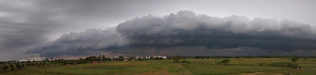
RT @rajugana: Bangalore 11.20am,Dark clouds and rain in the morning. fabulous weather.. pic http://ow.ly/i/8QVnx http://ow.ly/i/8QVpT
RT @rajugana: @weatherofindia Bangalore 11.45am, Overcast sky and slight drizzle at the moment.. http://ow.ly/i/8QVVh

3:30pm, T showers seen along LWD from S Tamilnadu, S Kerala to N,N-E Tamilnadu to N-N-E Andhra to Odisha ... http://ow.ly/i/8R4L5

#Chennai - 4pm, RADAR shows T showers over W,W-S-W,N-W from city at around 120 to 200km over N Tamilnadu, S Andhra.. http://ow.ly/i/8R4Rz

Today, LWD is seen from S tip Tamilnadu to S Karnataka (thru W-ghats kerala) to central,N-E Andhra to N-E Odisha http://ow.ly/i/8R58z
Tomorrow as well the LWD is expected to stay in same place.
From 5-Mar, the LWD will be back over W-ghats from Maharastra to S tip Tamilnadu

Showers expected ALL along the LWD on today, tomorrow... and its already happening ... http://ow.ly/i/8R5oF
Scattered HEAVY T showers expected over W-ghats Kerala, Tamilnadu and S tip Tamilnadu, S Kerala on today, tomorrow.
On 4-Mar, Chennai and its Suburbs can have a T shower before 5pm.
RT @rajugana: Bangalore 11.20am,Dark clouds and rain in the morning. fabulous weather.. pic http://ow.ly/i/8QVnx http://ow.ly/i/8QVpT
RT @rajugana: @weatherofindia Bangalore 11.45am, Overcast sky and slight drizzle at the moment.. http://ow.ly/i/8QVVh
3:30pm, T showers seen along LWD from S Tamilnadu, S Kerala to N,N-E Tamilnadu to N-N-E Andhra to Odisha ... http://ow.ly/i/8R4L5
#Chennai - 4pm, RADAR shows T showers over W,W-S-W,N-W from city at around 120 to 200km over N Tamilnadu, S Andhra.. http://ow.ly/i/8R4Rz
Today, LWD is seen from S tip Tamilnadu to S Karnataka (thru W-ghats kerala) to central,N-E Andhra to N-E Odisha http://ow.ly/i/8R58z
Tomorrow as well the LWD is expected to stay in same place.
From 5-Mar, the LWD will be back over W-ghats from Maharastra to S tip Tamilnadu
Showers expected ALL along the LWD on today, tomorrow... and its already happening ... http://ow.ly/i/8R5oF
Scattered HEAVY T showers expected over W-ghats Kerala, Tamilnadu and S tip Tamilnadu, S Kerala on today, tomorrow.
On 4-Mar, Chennai and its Suburbs can have a T shower before 5pm.
Subscribe to:
Posts (Atom)