Saturday, October 31, 2015

Today's Chennai rain


arunjaOct 31, 2:41pm via Twitter for Android
Flooded roads #Chennai Adyar heavy rains @weatherofindia @TrafflineCHN

@weatherofindia Heavy rain in nugambakkam..

Finally,........ Heavy downpour. Anna Nagar, Chennai @weatherofindia@TrafflineCHN

Raining in #Chennai Adyar 1:00pm @weatherofindia @CNNweather@weatherchannel

~~ Update 11:05am, 1-Nov-2015 ~~
#Chennai - Rainfall till 8:30am...
Nungambakkam = 51.8mm
Airport = 10.2mm
IWM Polichalur = 5.4mm


sorry for the wrong figures in last post !

Cyclone Chapala Intensifying in Arabian Sea; Unusual Tropical Threat to...

Cyclone Chapala Remains a Powerful Storm in the Arabian Sea; Rare Destructive Landfall Threat to Yemen, Oman http://ow.ly/U4RvN #iwm
Taken from Weather of India

More HEAVY rain ahead for Tamilnadu and Kerala


Latest.. the SW Bay circulation has drifted West into SE corner Arabian sea and its easterly trough seen upto N Bay .. https://d2jhuj1whasmze.cloudfront.net/photos/normal/e7Auj.jpg

Present easterly trough from SE Arabian sea to N Bay has 2 more embedded circulations, 1 along central-coast Andhra and another over N Bay.

7:30pm, IR shows the convective activity all along Easterly trough from N Bay to #Maldives.. https://d2jhuj1whasmze.cloudfront.net/photos/normal/e7B7W.jpg

In next 24hrs, the SE corner Arabian sea circulation is expected to drift NW and fizzle out !
... while the N Bay circulation is expected to persist in that zone for another 2 days giving some rain for S Bengal, Bangladesh.
For next 36hrs, the low,mid-level winds over most of Tamilnadu will be from S,SSE... https://d2jhuj1whasmze.cloudfront.net/photos/normal/e7BEX.jpg

More HEAVY scattered T showers ahead for Kerala, W-ghats of Kerala, Karnataka, Tamilnadu, S,SW Karnataka in 24hrs.. https://d2jhuj1whasmze.cloudfront.net/photos/normal/e7C5B.jpg
More HEAVY rain for Kanyakumari dist of Tamilnadu and scattered T showers for W,S,NW,N,N-central zones of Tamilnadu on Sunday !

:: HEAVY rain #alert ::
for Eastern,SE slopes of Nilgiris (Coonoor) and W-ghats Tamilnadu, Kerala during next 36hrs. 

N,central-coast Tamilnadu can get a moderate rain during early hrs, morning of Sunday.
#Chennai - can get a moderate rain towards early morning and after 12pm on Sunday.
Noon showers will be for W,S-W,NW suburbs of city.

Central,N-coast Andhra and coastal Odisha can expect some more rain in next 36hrs.
S Bengal, S Bangladesh can expect scattered rain from Sunday to 3-Nov... https://d2jhuj1whasmze.cloudfront.net/photos/normal/e7CyU.jpg

Cyclone Chapala inching towards war torn Yemen's coast


Extremely Severe Cyclone #Chapala at present..
Pressure.. 952mb
Pos.. 13.45N, 57.48E
Winds upto .. 200 kmph #wow .. https://d2jhuj1whasmze.cloudfront.net/photos/normal/e7xXc.jpg

At present #Chapala is tracking West towards "War torn" Yemen coast ... landfall expected by evening, 2-Nov.. https://d2jhuj1whasmze.cloudfront.net/photos/normal/e7y8V.jpg
Cyclone Chapala is expected to cross the Yemen coast as severe Cyclone with winds upto 150 kmph.

#Chapala to cross this location in Yemen coast .. "less populated, desert, dry mountains".. https://d2jhuj1whasmze.cloudfront.net/photos/normal/e7yna.jpg

Latest, 6:30pm, satellite IR of Cyclone #Chapala ... https://d2jhuj1whasmze.cloudfront.net/photos/normal/e7yOP.jpg

Friday, October 30, 2015

October 30, 2015 at 11:48PM

Chennai - 4pm, Chromepet, after heavy T showers. IWM Polichalur got 27.6mm. #weather

from Instagram

October 30, 2015 at 06:51AM

Cyclone #Chapala has undergone good intensification in last 12 hrs. Pressure 971mb, winds 160kmph, moved West. #weather

from Instagram

October 30, 2015 at 02:37AM

Latest IR imagery suggests the formation of easterly trough from S Sri Lanka to N bay. #weather

from Instagram

October 30, 2015 at 02:32AM

Some heavy spells of rain ahead for Tamilnadu coast, interiors, Chennai and S-coast Andhra on today and Saturday. #iwm

October 30, 2015 at 02:27AM

GFS now expects the bay circulation to drift into SE corner Arabian sea in 2 days.. Heavy rain ahead for Tamilnadu coast, Andhra coast. #iwm

October 30, 2015 at 02:17AM

SW bay circulation moving WSW into Comorin sea is a good scenario for NE monsoon along Tamilnadu coast and interiors and W-ghats. #iwm

October 30, 2015 at 02:11AM

Remnant of 93B circulation is now drifting WSW into SW of Sri Lanka with easterly trough up to N bay. #weather

from Instagram

Thursday, October 29, 2015

October 29, 2015 at 05:49PM

3:40pm, heavy downpour near Kovilpatti travelling from Tirunelveli. #weather

from Instagram

October 29, 2015 at 05:41PM

10:37am, Chennai - just before moderate showers in Pallavaram zone. #weather

from Instagram

October 29, 2015 at 05:37PM

10:11am, Chennai - heavy showers. #Monsoon #weather

from Instagram

October 29, 2015 at 04:50PM

Today morning moon set view from S-tip Tamilnadu W-ghats. #weather

from Instagram

October 29, 2015 at 04:44PM

Shahdol - 10am, light rain now. Overnight rain 25mm. #weather

from Instagram

Cyclone Chapala over Arabian sea


94A over S-central Arabian sea has intensified rapidly into a Cyclone .. now named as #Chapala .. https://d2jhuj1whasmze.cloudfront.net/photos/normal/e3Nxs.jpg

ADT analysis of #Cyclone #Chapala...
pos.. 13.4N, 63.4E
Pressure .. 995mb (JTWC says 981mb)
Winds upto .. 95 kmph.

Models suggest that Cyclone Chapala will intensify further and move W-N-W towards Oman & Yemen coast ... https://d2jhuj1whasmze.cloudfront.net/photos/normal/e3NQl.jpg

Chapala may degrade due to dry air interaction after next 48hrs (before landfall)... https://d2jhuj1whasmze.cloudfront.net/photos/normal/e3NXn.jpg

October 29, 2015 at 07:40AM

Bareilly - 7:20am, cloudy with passing showers due to WD. #weather

from Instagram

Wednesday, October 28, 2015

94A is expected to become Cyclone in 36hrs, move towards Oman


94A, over S-central Arabian sea is now a Depression and JTWC has issued a cyclone formation alert ... https://d2jhuj1whasmze.cloudfront.net/photos/normal/e2CFd.jpg

10:30pm, 94A, Depression is having good convective activity, slowly intensifying and has drifted North.. https://d2jhuj1whasmze.cloudfront.net/photos/normal/e2Unj.jpg

In next 48hrs, 94A is expected to develop into a Cyclone and spin towards Oman coast... https://d2jhuj1whasmze.cloudfront.net/photos/normal/e2UMl.jpg


IMD has announced that NE Monsoon has reached S-coast Andhra, #Chennai and Coastal Tamilnadu.!
Even now, the easterlies are weak over #Chennai.
6:15pm, a mini shower is sweeping over S-central Chennai .. https://d2jhuj1whasmze.cloudfront.net/photos/normal/e2mpU.jpg

5:30pm, T showers seen over S,central,N-central Tamilnadu and all along W-ghats from SW Karnataka to S Kerala.. https://d2jhuj1whasmze.cloudfront.net/photos/normal/e2mZl.jpg

For Tamilnadu coast and S-coast Andhra.. moderate scattered rain forecast from now till mid-morning of 29-Oct.

#Chennai, Polichalur - 6:31pm, a sharp shower now.. 2.4mm of rain from this... https://d2jhuj1whasmze.cloudfront.net/photos/normal/e2o0E.jpg

Today as well, low-level circulation 93B persists over SW Bay along SE Srilanka coast .. https://d2jhuj1whasmze.cloudfront.net/photos/normal/e2oop.jpg
93B over SW Bay is expected to drift SW and form a easterly trough from S-W Bay to N Bay... https://d2jhuj1whasmze.cloudfront.net/photos/normal/e2p1p.jpg
This can drop a low,mid-level circulation over N Bay in next 36hrs !
And
May not happen due to approaching WD circulation, trough from West.

NE Monsoon showers along Tamilnadu coast, #Chennai are expected to be moderate, scattered for next 36hrs.

5:30pm, wind analysis of 93B shows a circulation over S Tamilnadu and another SW of Srilanka.. https://d2jhuj1whasmze.cloudfront.net/photos/normal/e2BVB.jpg

Strong WD circulation travelling East across N-central India


Latest, a mid,upper-level WD trough and circulation seen along N-W India, N Rajasthan and drifting ESE.. https://d2jhuj1whasmze.cloudfront.net/photos/normal/e2jxz.jpg
In next 2 days, this WD circulation, trough will travel across E-central,East India and even affect NE states.. https://d2jhuj1whasmze.cloudfront.net/photos/normal/e2jN6.jpg

4:30pm, Due to WD..
HEAVY T showers over E,N-E Rajasthan, N,E,NE Madhyapradesh, Haryana, W,S,E Uttarpradesh.. https://d2jhuj1whasmze.cloudfront.net/photos/normal/e2k07.jpg

Due to WD, Next 2 days.. scattered T showers expected over E,NE Madhyapradesh, S,E Uttarpradesh, N Chatisgarh, Jharkhand, N Odisha.
By Friday afternoon and into Saturday, Rain will push into S,central Bengal as well ... https://d2jhuj1whasmze.cloudfront.net/photos/normal/e2kCa.jpg

October 28, 2015 at 04:35PM

3:52pm, Badlapur - high cloud cover due to outer bands of depression 94A.. #weather

from Instagram

October 28, 2015 at 04:33PM

3:10pm, Tirunelveli - T showers. #weather

from Instagram

October 28, 2015 at 04:30PM

1:22pm, Shahdol - T showers. #weather

from Instagram
Tropical Update :-
28th Oct 2015
1 PM IST

1. The System in Arabian sea is a well marked Low Pressure
and will develop into a depression in next 24 hours , and we are expecting it to drift to Oman coast and Gulf of Aden ..
(It wont Affect the Indian Sub-continent Directly )

2. An UAC over North and east MP and South and east UP and Adjoining Bihar is posing a major threat in next 24 hours , it may produce major hailstorms and Thunderstorms over the given areas below :-
1. Guna , MP
2. Satna , MP
3. Damoh , MP
4. Khajuraho, MP
5. Rewa , MP
6. Jabalpur , MP
7. Gwalior , MP
8. Kanpur , UP
9. Mirzapur , UP
10 , PAtna , BH

3. The Low pressure Right now over Bay of bengal and adjoining
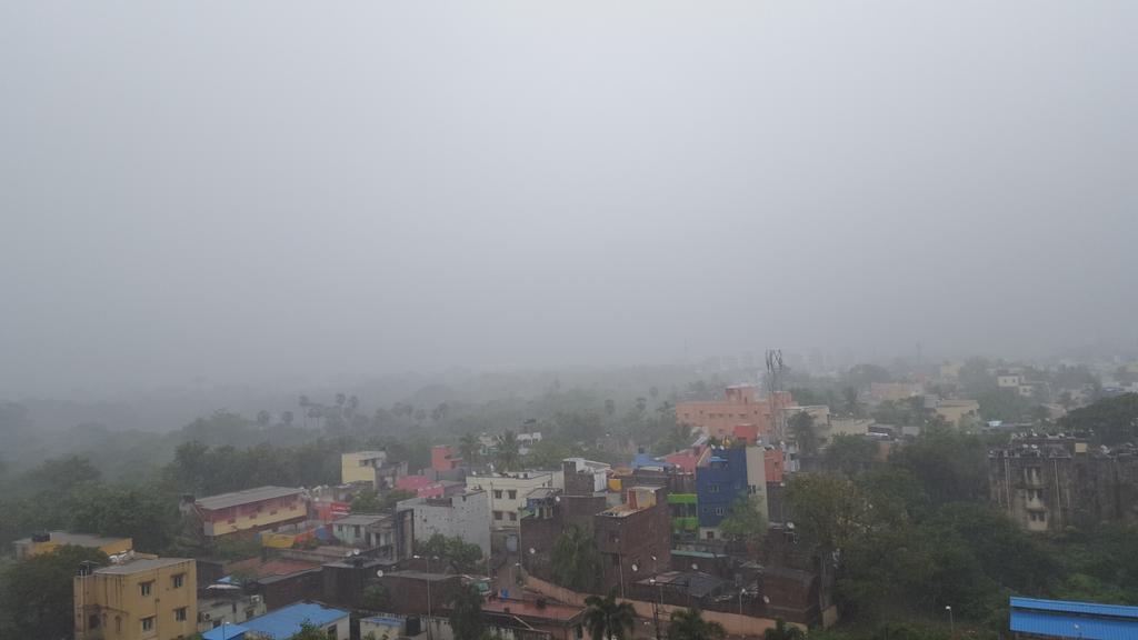
Sri Lanka and TN will move north - north east slightly in next 24 hours , and from that there will be another Pulse that will Form a Fresh Low pressure on 30th OCT 2015 close to North AP and south Orissa Coast , it will Drift towards Coastal WB and Bangladesh by 1st NOV 2015 , resulting to that we can expect Brisk winds and Light to moderate rainfall in the City of Kolkata ,
and other Districts of South bengal also ...
Kolkata and other western districts of WB like birbhum and Burdwan and purulia may be affected by some isolated thunderstorms on 31st OCT 2015 due to the Affect of UAC over East MP and East UP .....
for more go to https://www.facebook.com/WeatherOfKolkata/

October 28, 2015 at 07:24AM

Chennai - many zones of southern suburbs got moderate rain during early hrs. IWM Polichalur got 31.8mm so far. #iwm

Tuesday, October 27, 2015

October 27, 2015 at 09:52PM

9pm, Suddenly three things arrived here lightning ⚡ Thunder and drizzle at #Shahdol , MP. #iwm

October 27, 2015 at 07:49PM

#Chennai - 7:30pm, mini showers seen along coast and may push inland. #weather

from Instagram

Heavy rain ahead for Madhyapradesh, W,S,central Uttarpradesh due to WD


A strong upper-level WD trough embedded with a circulation is expected to push into NW India in 20hrs.. https://d2jhuj1whasmze.cloudfront.net/photos/normal/e0qvZ.jpg
In next 48hrs, this WD circulation is expected travel E-S-E into Uttarpradesh, NE Madhyapradesh and then weaken ... https://d2jhuj1whasmze.cloudfront.net/photos/normal/e0rcH.jpg

In next 2 days... scattered T showers for E,NE Rajasthan, many zones of Madhyapradesh, W,S,central Uttarpradesh .. https://d2jhuj1whasmze.cloudfront.net/photos/normal/e0rrM.jpg

S-coast Andhra, N,central coast Tamilnadu to get showers in next 15hrs


As of now, 93B continues to be active, thanks to easterlies ... https://d2jhuj1whasmze.cloudfront.net/photos/normal/e0oxL.jpg

Now, GFS expects the LOW, 93B to drift NW in next 72hrs and push upto central-coast Tamilnadu .. https://d2jhuj1whasmze.cloudfront.net/photos/normal/e0oMN.jpg

#Chennai - at present the wind speed has increased and direction is from NNE upto 3km above sea.. expected to change to more East in 15hrs
#Chennai - 4pm, Showers seen over E,NE,SE over sea and SW over land at around 100 to 200km.. https://d2jhuj1whasmze.cloudfront.net/photos/normal/e0ppZ.jpg
For S-coast #Andhra , #Chennai , N,central coast #Tamilnadu .. heavy rain expected to push in after midnight today ... https://d2jhuj1whasmze.cloudfront.net/photos/normal/e0pzE.jpg


The twins update...
94A - Position 9.5N, 65E, "No intensification seen"
93B - Position 9N, 81.3E, "LOW, moved North" ... https://d2jhuj1whasmze.cloudfront.net/photos/normal/e0f18.jpg

1pm, Satellite IR shows, 94A is weak along W,NW quadrant, 93B is getting active due to easterlies feed ... https://d2jhuj1whasmze.cloudfront.net/photos/normal/e0fbE.jpg

Monday, October 26, 2015

94A slowly intensifying, NE monsoon showers are near for Tamilnadu, S-coast Andhra


3pm, 94A over S Arabian sea is slowly getting a shape, while 93B over SW Bay remains as circulation ... https://d2jhuj1whasmze.cloudfront.net/photos/normal/dYwIc.jpg

Present location of 94A is 7.2N, 66E.
Pressure around 1004mb.
Winds gusting to 45 kmph.

94A is expected to intensify into a Cyclone in next 2/3 days and drift N-W and then W-N-W towards Oman / Yemen coast .

Easterlies over Bay is nearing Tamilnadu coast and S Andhra coast.
Heavy / moderate rain expected from mid-morning or afternoon of 27-Oct
Heavy / Moderate rain for N,central coast #Tamilnadu , #Chennai , and S-coast #Andhra from noon/ evening of 27-Oct .. https://d2jhuj1whasmze.cloudfront.net/photos/normal/dYAfk.jpg

By midnight of 27-Oct... NE #Monsoon will be over S-coast Andhra and Tamilnadu coast !