RT @iamkanal: @weatherofindia sir here heavy rain. For last 1 hour #kochi (8:28pm)

Thursday, May 09, 2013
Upcoming Western Disturbance, Temperature dip over N.India and movement of "92B"
A strong W.D system is nearing N-W India, it's upper level circulation is expected to reach Rajasthan by tomorrow ... http://ow.ly/i/24IIm

Scattered rain due to W.D is expected for N,N-W Rajasthan, Punjab, Kashmir, Himachal, Haryana from 10-May till 13-May http://ow.ly/i/24IPo
The upcoming W.D is expected to travel across N-Central India to East India before 13-May, .. this system may affect the movement of "92B"
Due to upcoming W.D system, temperatures are expected to Dip over N,N-W,N-Central India from tomorrow till 13-May.

Scattered rain due to W.D is expected for N,N-W Rajasthan, Punjab, Kashmir, Himachal, Haryana from 10-May till 13-May http://ow.ly/i/24IPo
The upcoming W.D is expected to travel across N-Central India to East India before 13-May, .. this system may affect the movement of "92B"
Due to upcoming W.D system, temperatures are expected to Dip over N,N-W,N-Central India from tomorrow till 13-May.
Today as well, the North-South trough seen from E.Uttarpradesh, Bihar upto S-W Karnataka ... http://ow.ly/i/24HuH
Tomorrow, this North-South trough is expected to drift slightly to East and will run from S.Bihar thru Central Andhra http://ow.ly/i/24Hzv
After 12-May, the North-South trough may get disturbed due to forecast intensification of "92B".
On 10,11-May, some T.showers are expected over N,N-W,N-central,N-E Tamilnadu ... http://ow.ly/i/24Ikk
T.showers over Kerala will be less during next 3 days, But scattered T.showers expected for N,N-W, Interior Tamilnadu in these days!
Strong Cross Equatorial Low level winds seen rushing towards S,S-E Bay ... Good Signs of S-W Monsoon for S,S-E Bay .. http://ow.ly/i/24IyW

Tomorrow, this North-South trough is expected to drift slightly to East and will run from S.Bihar thru Central Andhra http://ow.ly/i/24Hzv
After 12-May, the North-South trough may get disturbed due to forecast intensification of "92B".
On 10,11-May, some T.showers are expected over N,N-W,N-central,N-E Tamilnadu ... http://ow.ly/i/24Ikk
T.showers over Kerala will be less during next 3 days, But scattered T.showers expected for N,N-W, Interior Tamilnadu in these days!
Strong Cross Equatorial Low level winds seen rushing towards S,S-E Bay ... Good Signs of S-W Monsoon for S,S-E Bay .. http://ow.ly/i/24IyW

Bangalore evening !
RT @rajugana: Bangalore 6.30pm, After a hot n humid day, dark clouds hover menacingly in the eve...will it rain???? http://t.co/23updTbEmf
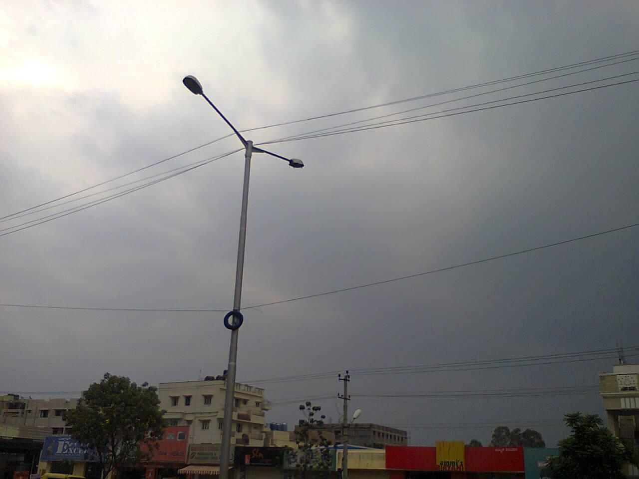
#Bangalore - 6:30pm, Temperature around 32 C, with "Few cumulonimbus clouds". Showers possible !
6:30pm, Heavy T.showers seen all over S,S-W,S-central Karnataka .. near to #Bangalore as well ... http://ow.ly/i/24GCN
Bangalore needs a Doppler Radar soon !
Update :: 7:30pm
---------------------------
RT @rajugana: Bangalore 7.30pm, Rumbling, thunder and lightning- raining now, with cool breeze, Intoxicating Smell of soil !!!
Update :: 10:30pm
---------------------------
RT @ganesh_jrg: 8:53pm Bangalore. Peaceful cloudy evening turning into a thunderous night, with a series of lightning &thunder. Drizzling
RT @valprajj: Continous rains for 2 hours @ bangalore @weatherofindia #rains #BangaloreRains #Bangalore 10:16pm
Pre-monsoon squalls kill two, injure 14 in Tripura ... http://ow.ly/kR9im
Landslides after heavy pre-monsoon rain in Mizoram ... http://ow.ly/kR9pf
Today as well the Low level circulation over Northern N-E states persists and will continue for another 3 days ... http://ow.ly/i/24Dz5
For next 3 days, Scattered Heavy rain to continue for N-E states, Sikkim and some may push into N,central Bengal.. http://ow.ly/i/24E6p
Landslides after heavy pre-monsoon rain in Mizoram ... http://ow.ly/kR9pf
Today as well the Low level circulation over Northern N-E states persists and will continue for another 3 days ... http://ow.ly/i/24Dz5
For next 3 days, Scattered Heavy rain to continue for N-E states, Sikkim and some may push into N,central Bengal.. http://ow.ly/i/24E6p
"92 B" - Persists as a weak LOW over S-S-E Bay
12:30pm, Latest analysis show that "92 B" is still a weak LOW pressure system with pressures around 1007 mb.
Latest (1:30pm) satellite IR shows "Good convective activity seen along its Southern, Western quadrants"

Current Position is 7.0N , 90.9E.

Latest COLA model suggests that the system will become as a Depression on Saturday, 11-May and expected to track N-N-W into Bay. It may end up along Bangladesh or Myanmar after 15-May.


Latest (1:30pm) satellite IR shows "Good convective activity seen along its Southern, Western quadrants"

Current Position is 7.0N , 90.9E.

Latest COLA model suggests that the system will become as a Depression on Saturday, 11-May and expected to track N-N-W into Bay. It may end up along Bangladesh or Myanmar after 15-May.

IMD-GFS model also suggests the same as that of COLA, and predicts a landfall as Depression along Bangladesh and Bengal coast on 16-May.

Latest NOGAPS model suggests that the system will become as a Deep Depression and cross Central Andhra coast on 16-May..!

On 8-May, highest maximum temperature of 46.3°C was recorded at Nagpur (Maharashtra)
#HOT at 1pm, Nagpur = 47 C, Lucknow = 42C, #Delhi = 41C, Ahmedabad,Jaipur = 40C, Amristar, Thiruchirapalli = 39C, Kolkata = 36C, Patna = 35C
#Chennai - Yesterday max = 37.7 C, Today at 1:10pm, it was around 37 C (but feels like temp is HIGH at 47.7 C with Humidity around 54%.
Yesterday, Vellore (Tamilnadu) recorded a max temp of 42.3 C.
#Delhi on 8-May, recorded a max temp of 42 C.
#HOT at 1pm, Nagpur = 47 C, Lucknow = 42C, #Delhi = 41C, Ahmedabad,Jaipur = 40C, Amristar, Thiruchirapalli = 39C, Kolkata = 36C, Patna = 35C
#Chennai - Yesterday max = 37.7 C, Today at 1:10pm, it was around 37 C (but feels like temp is HIGH at 47.7 C with Humidity around 54%.
Yesterday, Vellore (Tamilnadu) recorded a max temp of 42.3 C.
#Delhi on 8-May, recorded a max temp of 42 C.
Wednesday, May 08, 2013
"92B" - Now a LOW pressure system over S-S-E Bay.
Latest analysis show, that "92 B" is now a LOW pressure system with pressures around 1004 mb.
Present location is over S-S-E Bay.... 5.4N , 89.8E


JTWC warning at 11:30pm
--------------------------------------
COLA, IMD and NOGAPS Model agree that the system will be weak till Friday noon, before intensifying into a Depression and moving N-W into Bay on Saturday, 11-May.


Present location is over S-S-E Bay.... 5.4N , 89.8E


JTWC warning at 11:30pm
--------------------------------------
THE AREA OF CONVECTION PREVIOUSLY LOCATED NEAR 5.4N 89.8E, IS NOW LOCATED NEAR 5.2N 90.0E, APPROXIMATELY 620 NM EAST OF COLOMBO, SRI LANKA. ANIMATED MULTISPECTRAL SATELLITE IMAGERY SHOWS FORMATIVE BANDING HAS CONTINUED TO WRAP INTO AN ELONGATED LOW LEVEL CIRCULATION CENTER (LLCC).
CONVECTIVE BANDING HAS CONTINUED OVER THE PAST 12 HOURS. RECENT SCATTEROMETRY PASSES INDICATE WINDS OF 20 TO 25 KNOTS.  UPPER LEVEL ANALYSIS INDICATES APPROXIMATELY 10 KNOTS VERTICAL WIND SHEAR AS WELL AS EXCELLENT POLEWARD OUTFLOW. SEA SURFACE TEMPERATURES REMAIN ABOVE 28 DEGREES CELSIUS.
MAXIMUM SUSTAINED SURFACE WINDS ARE ESTIMATED AT 20 TO 25 KNOTS. MINIMUM SEA LEVEL PRESSURE IS ESTIMATED TO BE NEAR 1004 MB. THE POTENTIAL FOR THE DEVELOPMENT OF A SIGNIFICANT TROPICAL CYCLONE WITHIN THE NEXT 24 HOURS REMAINS MEDIUM.
COLA, IMD and NOGAPS Model agree that the system will be weak till Friday noon, before intensifying into a Depression and moving N-W into Bay on Saturday, 11-May.

According to COLA model, the Depression is expected to move North (from 11-May) towards Odisha coast and it may re-curve N-E towards Bangladesh or Myanmar coast and sees a weakening around N-W or N-Central Bay.

NOGAPS model also suggests the same path as that of COLA, and also suggests a weakening over N-W or N-Central Bay.

Monsoon Update ::
----------------------------------------
Once the system moves into Bay, the South West Monsoon is expected to set into S,S-E Bay and over South Andaman Islands on 12 / 13-May-2013
Rain in Hyderabad !
RT @bumblme: Wednesday 5:00 PM :: raining in #Hyderabad, hot summer cools down @weatherofindia #SummerMustHaves
6:10pm, @IPL #PepsiIPL , Hyderbad Airport is reporting " Light rain with Thunder storm "
RT @rajugana: Bangalore 6.50pm, Sunny, hot and humid day. Development of T. Clouds.. will it rain??? sky pic http://t.co/3ZgWgFnRdY

6:30pm, Bangalore Airport is reporting " Showers in vicinity "
6:10pm, @IPL #PepsiIPL , Hyderbad Airport is reporting " Light rain with Thunder storm "
RT @rajugana: Bangalore 6.50pm, Sunny, hot and humid day. Development of T. Clouds.. will it rain??? sky pic http://t.co/3ZgWgFnRdY
6:30pm, Bangalore Airport is reporting " Showers in vicinity "
"92B" is still a low level circulation and situated over S.Bay ... http://ow.ly/i/244cg >> More on it, in our 7:30pm update !
Strong cross equatorial winds are seen gushing into S.Bay along the Southern quadrant of the Circulation "92B"... http://ow.ly/i/244cg

3:30pm, Due to Cross Equatorial winds, convective activity seen over Maldives, zones South of Srilanka & over "92B".. http://ow.ly/i/244pI

3:30pm, T.showers seen over Coastal,S.Odisha, N,N-central Andhra and over S.Tamilnadu .. http://ow.ly/i/244pI
Strong cross equatorial winds are seen gushing into S.Bay along the Southern quadrant of the Circulation "92B"... http://ow.ly/i/244cg

If the present circulation "92B" intensifies and moves North into Bay, then S-W Monsoon will reach South Andaman Islands on 12 / 13-May.
3:30pm, Due to Cross Equatorial winds, convective activity seen over Maldives, zones South of Srilanka & over "92B".. http://ow.ly/i/244pI

3:30pm, T.showers seen over Coastal,S.Odisha, N,N-central Andhra and over S.Tamilnadu .. http://ow.ly/i/244pI
Subscribe to:
Posts (Atom)