Saturday, May 24, 2014

92B - drifted W-N-W and showing signs of intensification again


During past 28hrs, "92B" has persisted as LOW pressure and drifted W-N-W and now over N-central,N-W Bay.
Now it's even showing signs of further intensification into a Depression again.
Pressure at present is around 1001mb.

10:30pm, Satellite shows the convective activity can be close to coast of Odisha and into Odisha as well.

Latest GFS predicts it can deepen further into a depression and cross into N-E Odisha coast, S Bengal coast on early hrs of Monday, 26-May.
Due to this, Heavy rain expected along Odisha coast, S,central Bengal, Kolkata from mid-morning of Sunday.
Towards evening and midnight of 25-May - Heavy, very heavy rain expected over N-E Odisha coast, S,S-W Bengal.
During afternoon, T showers will break in over N-E Andhra and over N,N-E Tamilnadu as well.
Tomorrow again, T showers possible along W-ghats of Kerala.

Monsoon update ::
~~~~~~~~~~~~~~~~

In another development, a low-level trough can be seen from 92B tilting S-W across South peninsula and into South Arabian sea... this will pop a low-level circulation over S,S-S-E Arabian sea in next 24 hrs.
Initially this circulation is expected to drift W-N-W, but this can enable a weak Monsoon current along S,central Kerala coast on 29/30-May.
Today as well good cross equatorial winds are reaching Somali coast and into Maldives. Most of the winds are below the 5th parallel.
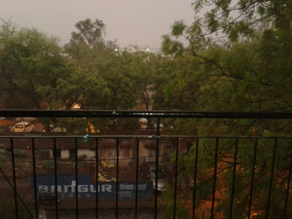
RT @GanpatTeli1: Raining in #delhi @weatherofindia http://t.co/r92LbDbGzf (7:13pm)


Weather Instagram at May 24, 2014 at 02:06PM

#chennai - IWM Polichalur station at 2:02pm shows 40.1 C. #weather


from Instagram

Weather Instagram at May 24, 2014 at 01:31PM

#chennai - 1:25pm, another #hot day. No sea breeze yet! #weather


from Instagram

Monsoon 2014: ‘Super’ El Niño is unlikely but rainfall deficiency can cross 16%!


Geez – a ‘Super’ El Niño??? It’s a bad enough that seasoned meteorologists have to struggle each year even to predict the emergence an El Niño with great certainity. But here are crackpots actually prepared to wager bets on its intensity and worse still,  even more cranks in the world including the gullible sections of the media willing to swallow their hype without question!!
Historically, the odds are stacked heavily against a ‘Super’ El Niño developing this year. The last two events were in 1997/1998, and 1982. Both these events occurred during the positive or warm phase of the Pacific Decadal Oscillation (PDO). During the cool or negative phase of the PDO (which we are currently in), overall the El Niño events are less frequent and of lower magnitude. 
The strongest El Niño in a previous cool phase of the PDO was in 1972/1973, at the fag stage of the last cool PDO cycle. Of these three, the 1997/98 event is widely considered having the greatest intensity on global temperatures with the 1972/73 the least impact.  The real intensity of the 1982 event on global temperatures has not been fully established being offset by some measure by the global cooling triggered from El Chichon volcanic eruption.
 
230514 15Z
230514 18Z

[1] 230514/15Z the North-Westerly winds (perhaps from anti cyclone in the Arabian Sea) meeting with the moisture laden South Easterly winds  formed thunder cloud development along Salem, TVmalai, Vilupuram, Perambalur, Ariyalur Trichy corridor and gave late evening TS

230514 21Z

240514 03Z


[2] It moved further East or the strength of SEly sea breeze is limited to few hundered km from the sea and formation of clouds closer to this region is seen.


[3] AMV (ATMOSPHERIC MOTION VECTORS) is helpful to monitor the movement of clouds / thunder clouds


Friday, May 23, 2014

92B - Weakened to a LOW and drifted N-N-W


Latest analysis of yesterday's depression 92B reveals that it has weakened to a Well marked LOW and has slightly drifted in N-N-W direction during past 24hrs.
Now the pressure is around 1002mb.
At present the circulation persists from low to mid-levels and a weak one in upper(500hpa) levels tiled in S-W direction.

3:30pm, Satellite IR shows heavy convective activity over Central Bay... this is due to the mid,upper level circulation of 92B lies tilted in S-W direction over central Bay.

GFS model suggests that this circulation will persist for next 72hrs and drift West or W-N-W and come close to Odisha coast on Sunday, 25-May.

But WRF model expects 92B to deepen again and move in N-W direction and make landfall along South Bengal coast as Deep Depression on Sunday !

JTWC at 1pm has cancelled the Cyclone formation alert for 92B.
~~~~~~~~~~~~~~~~~~~~~~~~~~~~~~~~~~~~~~~~~~~~~~~~~~~
BASED ON THE OBSERVED WEAKENING TREND AND CONSIDERING 
THE POTENTIAL FOR REDEVELOPMENT IF VERTICAL WIND SHEAR RELAXES OVER 
THE NEXT FEW DAYS, THE POTENTIAL FOR THE DEVELOPMENT OF A 
SIGNIFICANT TROPICAL CYCLONE WITHIN THE NEXT 24 HOURS IS DOWNGRADED 
TO MEDIUM

Today, the inland North-South trough is seen from a low-level circulation over S-E Uttarpradesh, N-E Madhyapradesh and dipping south upto N-E,N-central Tamilnadu all along S-E coast of India.
This is why HOT DRY winds coming from N-W over Chennai and most of S,S-central Andhra, N,N-E Tamilnadu.
If 92B drifts West near to Odisha coast in next 48hrs, this N-S trough will slightly drift West and the inland circulation will be over Madhyapradesh on Sunday.

Rainfall alert ::
~~~~~~~~~~~~

Today, before midnight - scattered T showers expected for W-ghats Kerala, N,N-E,N-W,N-central Tamilnadu.
Some early morning rain may push into coast of S tip Tamilnadu.
Tomorrow - T showers again for S,central Kerala, W-ghats Kerala and into N-W,N,N-E,N-central Tamilnadu

Monsoon update ::
~~~~~~~~~~~~~~
Monsoon current continues to be strong all over Andaman Islands and the cross equatorial flow from Somali coast to South Srilanka is strong below the 5th parallel.
A low-level circulation is expected to pop over S Arabian sea on 26-May, this can act as a engine to drive Monsoon into S,central Kerala.

Hot story from India !


Temperature forecast for #India ..
this how its going to be during next 3 days.. check this chart ... http://ow.ly/i/5Fd7L 

Some of the stations in N-W India has started recording above 30 C as night temperature ... Bikaner = 30.9 C
Jaipur = 30.3 C

Super #hot 40s of 22-May...
Bikaner = 43.5 C
Agra = 42.9 C
Jaisalmer = 44.1C
Barmer = 44.8 C
Ahmedabad = 43C
Bankura = 44.3C
Nagpur = 44.2 C

... Jharsuguda = 43.7 C
Gulbarga = 41.2 C
Rentachintala = 45 C
Machilipatnam = 43.8 C
Ongole = 44 C (night temp = 32.4 C)

#HOT at 2:30pm today...
Nagpur Airport shows 47 C
Lucknow = 44 C
Hyderabad, Delhi, Varanasi = 43 C
Jaipur, Chennai, Patna, Jamshedpur = 42 C

#Chennai - Dry and #HOT above 40 C temperature to continue till Sunday !
Less T showers expected over most of Tamilnadu on today, tomorrow.
Isolated T showers expected over N,N-E,N-W,N-central zones.

Weather Instagram at May 23, 2014 at 02:20PM

#chennai - 2:15pm, #hot ... Hottest day of #2014 . feels 47C. #weather


from Instagram

Weather Instagram at May 23, 2014 at 12:10PM

#chennai - 11:45am, hot now and expected to touch 42 C again. #weather


from Instagram