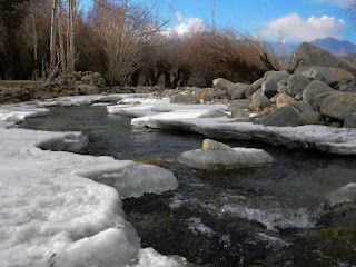
Wondering why Mysore registered the coldest minimum
temperature in 120 years recently? Steven Goddard who administers the bog Real
Science give us a clue: "Global temperatures are
plummeting, and the temperature recorded by AMSU satellite of 251.858K on January 19 was
the coldest of any day since at least 2002.”
It’s all happening. The Arctic Oscillation (AO) has
finally flipped to its strongly negative mode and if it stays that way, a deep
freeze is on its way that would plunge global temperatures to lows, last seen
during the 1945-77 global cooling cycle the very least. A foretaste of winter to
come during February is already indicated by some of these very recent
events:
Snow in Sahara
Desert
Snow fell Tuesday in the province of Bechar in the Sahara
Desert in western Algeria. A 24-hour cold spell brought snow and rain to the
region. Strong wind blew the snow across roads and buildings in the province of
Bechar. The weatherman at the National Centre of Meteorology and Seismology
(NCMS) recorded sub-zero temperatures at Jebel Jais area of Ras Al Khaimah and
forecast that these conditions are set to continue for the rest of the week.
People who live in the region said the snow was good for the palm trees because
it killed parasites. Bechar is located in the northern Sahara, about 36 miles
south of the Moroccan border. Click arrow to watch video.
Extreme Cold Wave in
the Gulf countries

According to the National Centre of Meteorology and
Seismology (NCMS) forecast for today, minimum temperatures are set to dip to 0°C
in the UAE’s mountainous regions while internal areas could see temperatures
dipping to a nippy 5°C and coastal areas could see minimum temperatures of
13°C.
The NCMS forecast reads: “Cold weather during day
times to very cold during night. The cloud amount will increase at times,
especially over the northern areas, with chance of light rain. Winds will be
west to northwesterly, moderate to fresh in general. Sea will be moderate to
rough with wave height 3 - 5 / 6 ft offshore.”
Unaccustomed to the
chill, UAE residents are putting up a brave front as a cold wave continues to
spread across the length and breadth of the country, with extreme weather
conditions sweeping mountainous regions and the country recording its lowest
temperatures for the year yesterday. Rough weather has prompted a warning to
beachgoers across the UAE to refrain from venturing into the sea. The UAE’s met
department has predicted that the rough weather will continue until
Friday
Leh:
minus 22.2 degrees Celsius

Leh town in Ladakh recorded the coldest night of this
season as mercury settled at a low of minus 21.8 degrees Celsius, an official of
the Met department said. Nearby Kargil town recorded a low of minus 21.0 degrees
Celsius, making it the second coldest place in the state.In Kashmir Valley,
Pahalgam resort was the coldest place at minus 16.5 degrees followed by Gulmarg
Skiing resort at minus 16.2 degrees Celsius, the official said.Qazigund, the
gateway town to Kashmir, recorded a low of minus 12.4 degrees Celsius followed by Kokernag resort at
minus 9.9 degrees Celsius.Srinagar city, the summer capital of the state, saw
mercury dipping to minus 5.0 degrees Celsius last night.
An
Igloo Village in Davos
The
Occupy protests that blossomed across the globe in the fall of 2011 are popping
up at the annual meeting of the rich and powerful in Davos Switzerland. Using
the weather to their advantage, protesters are carving out blocks of snow and
shaping them into igloos that are surprisingly warm, if not an effort to make.
They hope to make develop an "igloo village" near the Davos train
station.
Deep
freeze kicks in as Arctic Oscillation turns strongly
negative
The first half of
winter has clearly been much milder than the last couple of winters, as a very
strong polar vortex has controlled the pattern, and shielded Europe from any
sustained cold. Recently, the vortex has weakened and the AO turned strongly
negative as seen above, which would allow seasonably cold weather across much of
Europe in February if not earlier.

According
to NOAA as seen in the above diagrams the AO index describes the relative
intensity of a semi-permanent low-pressure centre over the North Pole. A band of
upper-level winds circulates around this centre, forming a vortex. When the AO
index is positive and the vortex intense, the winds tighten like a noose around
the North Pole, locking cold air in place.
A
negative AO and weak vortex … allow intrusions of cold air to plunge southward
into North America, Europe, and Asia. … the index has been mostly positive in
wintertime since the late 1980s. The Arctic Oscillation has strengthened in
recent decades, contributing to the unusual warmth over the Northern Hemisphere
land masses.
The
first sign of a much weakened polar vortex is that the Arctic Oscillation (AO),
also referred to as the Northern Annular Mode (NAM) has recently switched to a
strongly negative mode - the first time in four months.Britain blasted by snow
& ice yesterday is example of this. Read
here.
The
AO is an atmospheric circulation pattern in which the atmospheric pressure over
the Polar Regions varies in opposition with that over middle latitudes (about 45
degrees North) on time scales ranging from weeks to decades. The oscillation
extends through the depth of the troposphere. During the months of January
through March it extends upward into the stratosphere where it modulates in the
strength of the westerly vortex that encircles the Arctic polar cap
region.

The
NOAA's AO prediction for the next two weeks shows a strong negative trend which
typically in the past has brought colder weather for Europe. The bottom chart
for Europe shows the anomaly for the coming week. The middle chart shows the
foret.cast for the week after. It’s going to get even colder. Europe this year
may get a hard winter after all – it may be just arriving late. The lower chart
of central Asia shows below normal temps are forecast for almost every region
for the coming week, and the middle chart shows even deeper cold for the week
after, as we saw is the case for Europe. In fact it’s rare to see that much cold
over such a vast continent

However,
AO's cousin the North Atlantic Oscillation (NAO) sill remains weakly positive
(graph to right) but ensemble mean (graph to the left) suggests models are
indecisive which mode NAO will go by February. But since the polar vortex is
rapidly giving way, the odds favour the NAO too slipping into strongly negative
mode sometime in February or even earlier.
Atlantic over the past 50 years,. h Other studies have
found correlations between NAO and Indian monsoon. “Interannual and
long-term variability in the North Atlantic Oscillation and Indian summer
monsoon rainfall” (Dugam, Kakade and Verma, Indian Institue of Tropical
Meteorology, 1997 [http://cat.inist.fr/?aModele=afficheN&cpsidt=2068184])
investigated 108 years of NAO / monsoon data and
found that:
“The
decadal scale analysis reveals that the NAO during winter
(December-January-February) and spring (March-April-May) has a statistically
significant inverse relationship with the summer monsoon rainfall of Northwest
India, Peninsular India and the whole of India. The highest correlation is
observed with the winter NAO. The NAO and Northwest India rainfall relationship
is stronger than that for the Peninsular and whole of India rainfall on
climatological and sub-climatological scales.”
When
the polar vortex weakens, the polar jet stream slows and meanders in a form that
allows the extension of low pressure lobes much farther to the south. These can
become stationary for days and block the normal circulation of the atmosphere.
The negative AO/NAO is associated with a slowed polar vortex and polar jet
stream. When the jet stream slows, it meanders in a waveform pattern (Rossby
waves). The general effect is illustrated below:

Blocking has a lot to do with the severity of winter
weather in the Northern Hemisphere, and the AO has a strong ability to control
blocking. A blocking event can be defined as a week or more of excess pressure
in the mid-troposphere together with an anticyclone at the surface. … blocking
occurs preferentially during the low AO phase in Alaska, the North Atlantic, and
Russia. [http://www.jisao.washington.edu/wallace/ncar_notes/] Barriopedro et al
(“Solar modulation of Northern Hemisphere winter blocking”, Journal of
Geophysical Research, Vol.113, 2008 [http://idl.ul.pt/davidbarriopedro/2008%20Barriopedro%20et%20al.pdf]) found
that:
“Solar
activity modulates the preferred locations for blocking occurrence over both
Oceans, causing local frequency responses therein. Over the Pacific Ocean
high/low solar activity induces an enhanced blocking activity over its
eastern/western part. Atlantic blocking occurrence increases for both (high/low)
solar phases, with a spatial dependent response confined to western/eastern
Atlantic. … Low solar Atlantic blocking episodes last longer, are located
further east and become more intense than high solar blocking events.”
Taken from >> http://devconsultancygroup.blogspot.com


No comments:
Post a Comment