Chennai - another hot and humid day ahead! It'll be cloudy from 10am to 1pm with a chance of drizzle, light rain.

Tuesday, September 30, 2014

Latest analysis suggest that the low,mid-level circulation over S Arabian sea persists almost in same location ... http://ow.ly/i/73PDn
Latest models suggest that NO intensification expected with the S Arabian sea circulation in next 48hrs !
Expected to fizzle out moving NW.
For 2 days, the winds will be E,N-E along S Andhra and Tamilnadu coast!
A weak circulation expected along Central Tamilnadu coast on 2/3-Oct

Around 5-Oct, the S-W monsoon is expected to withdraw upto 20th parallel !
This is the present monsoon withdrawal line plotted by IMD ... http://ow.ly/i/73QfT
Before morning of 1-Oct...
Sharp showers may push into central Tamilnadu coast !
1-Oct, noon, evening, midnight...
HEAVY T showers for W-ghats Karnataka, w-ghats Kerala, w-ghats,S-tip,S,central Tamilnadu.
Overall the T showers activity will be reduced over N,N-E,N-central Tamilnadu from 1-Oct.
Most of the T showers will be along W-ghats, South


9:30pm, T showers seen over parts of Mumbai, W Maharastra, S,central Karnataka, S Kerala ... http://ow.ly/i/73Mn3
RT @OldSailor: @weatherofindia Raining in Coimbatore http://t.co/cK92v7D3wR (5:27pm)

The end of season
The rapid descending of upper level easterly winds to lower LATITUDE, is a hint of rapid withdrawal of SWM from Main land. The change of weather scenario is mixed response to high pressure systems in Indian ocean and descending of STWJ to North Indian latitudes.
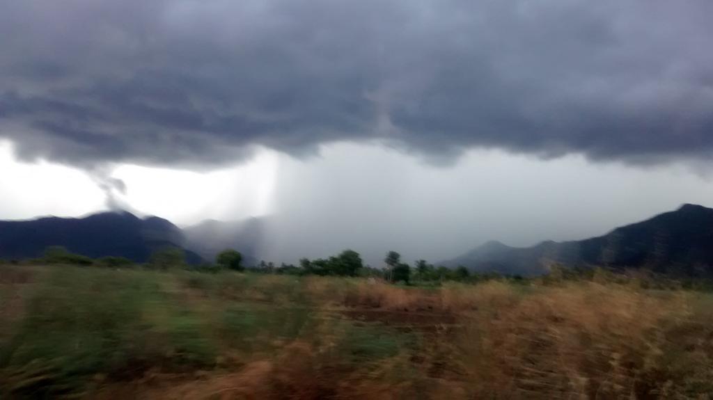
Today when I was returning from down south {Kanyakumari] to Chennai I could able to witness sporadic TS activity with rain en route. It is a sigh {?]= [/sign/] of START of withdrawal of SWM. Today SWM season ends. The country as a whole is deficit by [-]12% and by TN &PDY sub division by [-]1%.
 |
| 270914 04LT |
 |
| 300914 09Z upper winds |
Monday, September 29, 2014

Latest analysis, show that low,mid-level circulation has moved into S Arabian sea ... pic.twitter.com/TenHF5Wp1i
This circulation may intensify into a Depression in next 48hrs and drift W-N-W ... http://ow.ly/i/72MXI
In 36hrs, an upper-level weak circulation expected over Bihar, N-E Uttarpradesh and drift East as a trough ... http://ow.ly/i/72N8J
Before morning of 30-Sep...
HEAVY T showers for W-ghats of Tamilnadu, Kerala and into S-W Karnataka ... http://ow.ly/i/72NmO
Due to easterlies...
Early morning to mid-morning rain forecast again for central, N Tamilnadu coast, #Chennai
Morning, 30-Sep...
Showers expected along S,central Kerala coast and S tip Tamilnadu.
Afternoon of 30-Sep...
T showers again for N,central,W,S,W-ghats of Tamilnadu, W-ghats Kerala, W-Ghats,S Karnataka .. http://ow.ly/i/72NOh
Weather Instagram at September 29, 2014 at 05:40PM
#chennai - 4pm, clear blue skies. No more rain expected from present easterlies. #weather
RT @rajugana: Bangalore 5.25pm, Dark cloud floating from E to W..Beautiful silver lining at the edge... http://ow.ly/i/72H1C

RT @Arvind_LFC: @weatherofindia Rainfall pouring over Western ghats at Elumalai,Madurai district http://t.co/xvZGqFIHOD (5:57pm)
http://ow.ly/i/72JDO ... 6:15pm, weather photo from Karaikal. T cells seen over eastern sky.

ow.ly/i/72Lhg .. 6:25pm, weather photo from Alappuzha beach, Kerala.

RT @rajugana: Bangalore 5.25pm, Dark cloud floating from E to W..Beautiful silver lining at the edge... http://ow.ly/i/72H1C
RT @Arvind_LFC: @weatherofindia Rainfall pouring over Western ghats at Elumalai,Madurai district http://t.co/xvZGqFIHOD (5:57pm)
http://ow.ly/i/72JDO ... 6:15pm, weather photo from Karaikal. T cells seen over eastern sky.
ow.ly/i/72Lhg .. 6:25pm, weather photo from Alappuzha beach, Kerala.
Subscribe to:
Posts (Atom)