Monday, January 19, 2009

Some activity in South Bay


Chennai, remained clear and dry thru the day.
Some cloud formations can be seen till early Noon and nothing else after that.

Meanwhile, latest satellite pic shows lot's of activity near EAST of Srilanka and it covers a GOOD sizeable region in Southern Bay.
Early morning picture showed very small cloud mass, but now (7:07pm) it's a huge mass.
GFS reflects nothing for even South-Tamilnadu.

Friday, January 16, 2009

Almost an Electric shower

As expected we(Chennai) almost had an electric shower...
We had a sharp shower late into night with any electric activity.
From yesterday morning, it was DIM with a mild high cloud cover, Temperatures nearing 30 deg, Bit high in humidity around 60% and in late afternoon lot's of low cloud formations were seen.
We even had some sprinkles of rain around 6 PM.
After that also clouds formations were moderate and after midnight we had a shower.
Satellite pic analysis and latest visible satellite pic shows some formations overnight and nothing much now(16-Jan-09, 12:30PM).
For the past 3 days we have some moisture from sea, that is creating these local bursts.
Please note: These local moisture based activities CANNOT be predicted using any GFS models till date. These can be predicted ONLY using VERY LOCAL weather data.

Today(16-Jan-09), it's like a perfect November monsoon day.... bit warm and sultry.
Less cloud formations can be seen.
Forecast: These local disturbance will continue for another 48 hrs, then gradually the night will become cold again and with DEWs in morning.

Thursday, January 15, 2009

Landslide in Guatemala

Warm and Windy - Pongal Holidays.!

Chennai, lately is warm, sunny and WINDY.
Humidity was and is around 60%.
After some 10 days the minimum temperature was a bit low today(15-Jan-09) at 23.0°C.
Wind is from North-north-east and at times it's gusting from 20 KM/h to 30 km/h.
Going thru all local weather patterns, we might soon have a electric shower.

Latest Satellite pic shows nothing over Bay region.
And GFS shows no activity for next 5 days.

Tuesday, January 13, 2009

"Haze over North India"

Bit warm day(s) and morning(s)

Chennai:
For the past 7 days the minimum temperature was not low at this time of year.
Humidity was around 50%.
Although the DAY temperature was around 29 deg, we can feel some HEAT out of it.
Latest GFS & Satellite... shows NOTHING(No rain) for next 5 days.
Even the "Total percipitable Water" potential has also gone down over the Bay region.
This means there'll not be any formations over Bay for next 7 days.

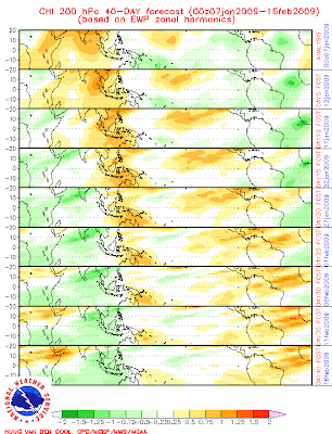
According to MJO forecat, we are moving into a VERY dry phase of MJO.


Today morning we got reports of MILD showers over South of Chennai(not suburbs).

"Snow over Syria" - Nice aerial shot

Turkmenistan - "Dust storm" Aerial shot

Thursday, January 08, 2009

After a January month wet night...

All Time record for this month
High: 34.4 C (25.1.2006)
Low: 13.9 C (29.1.1905)
Daily Rain: 212,9 mm (15.1.1915)
Total Rain: 244.1 mm (1915)

Chennai:
We received rainfall from yesterday Afternoon, initially it was a mild drizzle then it became showery and steady.
Mild showers thru the night.
Past 24 hr rain: 17 mm
Now (8:39AM) it's partly cloudy with rain cloud formations moving into city from east-north-east. It's bit warm now, signs of high humidity.
Last year also we had some showers around 10-Jan-08.

Latest satellite image shows...NOTHING.. for us.
Yesterday's cloud formation over us is melting away..
And we can see some activity near WEST of srilanka. And this will move west and cross Tamilnadu's Southern tip.


Here's the RAIN forecast from BBC for SATURDAY and SUNDAY.

Latest GFS shows..
A high pressure will be over us from 10-Jan to another 5 days.
This will give a good winter weather.
MJO
Latest MJO forecast shows...

SEVERE DRY phase for us till 22-Jan-09.
After that we move into a SEVERE WET phase.
We might experience a WET early february this year, if that happens then it'll be a UNUSUAL year to start.

Wednesday, January 07, 2009

Surprise Day in January!

What a surprise we woke up with slight drizzle.
No DEW around.
Temperature was mild with some slight breeze blowing from NORTH.
In the morning it was partly cloudy and with some signs of MORE drizzle.
Today thru the day we recorded high humidity..at 91%
Now (4:43PM) it's drizzling mild and steady.
More drizzles and even a mild shower is forecast for late evening. And from tomorrow morning this weather pattern will slowly move away.
Going by the latest Visible & IR satellite image...

We can see some mild cloud cover can be seen over most of North-Tamilnadu and South-Andhra.
This is causing some local formations and that too weak in nature.
We can expect this weather pattern for next 24 hrs and melt away.
Latest numeric models suggest... more rain for Southern Tamilnadu.