
Sunday, November 01, 2015
November 01, 2015 at 11:56AM
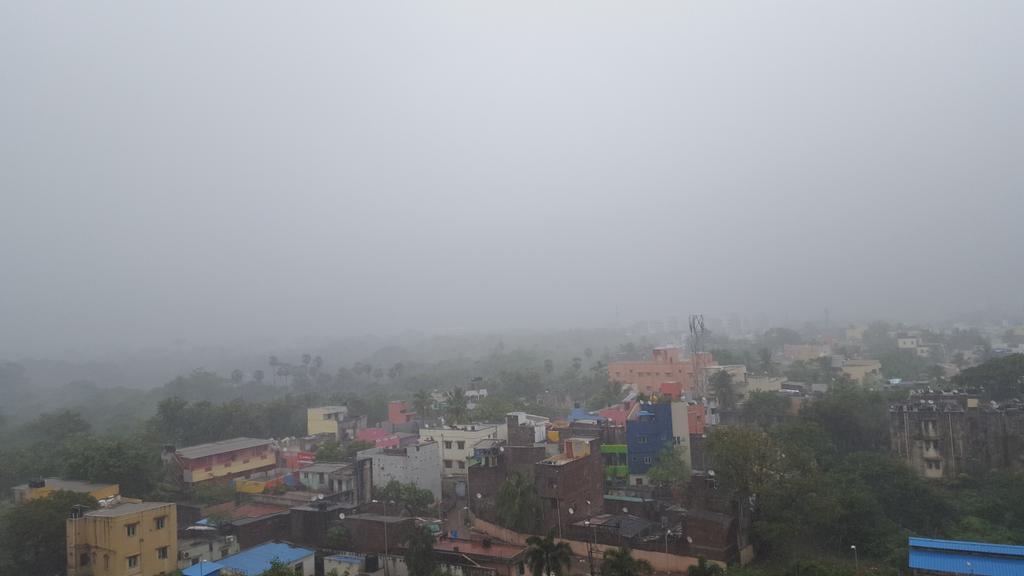
Dohnavur - 10:45am, Heavy passion showers from South with occasional thunder. #weather
Update on Easterly trough and Cyclone Chapala

Today, 3 circulations seen along Easterly trough from SE corner Arabian sea to N Bay .. https://d2jhuj1whasmze.cloudfront.net/photos/normal/e84GI.jpg
One circulation over SE corner Arabian sea, another along N-coast Andhra and another over N Bay near S Bangladesh coast.!
10:30am, Heavy rain started pushing into S-tip,S #Tamilnadu , S #Kerala .
Rain along N-coast #Andhra.
And
Rain into S-coast #Bangladesh .

HEAVY T showers ahead for Kerala, N,central,S,W Tamilnadu, S,S-W Karnataka in next 10 hrs... https://d2jhuj1whasmze.cloudfront.net/photos/normal/e84UA.jpg
Scattered Heavy / moderate rain ahead for N-coast Andhra and Odisha coast in next 10hrs.
~~~~~~~~~~~~~

#Chapala maintains intensity and moved west ...
Pos.. 13.32N, 55.47E
Pressure.. 951mb
Winds upto.. 200 kmph
... https://d2jhuj1whasmze.cloudfront.net/photos/normal/e855Q.jpg
#Chapala landfall expected along Yemen coast after noon, evening of Monday, 2-Nov.. as a weakened Cyclone !
Saturday, October 31, 2015


Cyclone Chapala Intensifying in Arabian Sea; Unusual Tropical Threat to...
Cyclone Chapala Remains a Powerful Storm in the Arabian Sea; Rare Destructive Landfall Threat to Yemen, Oman http://ow.ly/U4RvN #iwm
Taken from Weather of India
Taken from Weather of India
More HEAVY rain ahead for Tamilnadu and Kerala

Latest.. the SW Bay circulation has drifted West into SE corner Arabian sea and its easterly trough seen upto N Bay .. https://d2jhuj1whasmze.cloudfront.net/photos/normal/e7Auj.jpg
Present easterly trough from SE Arabian sea to N Bay has 2 more embedded circulations, 1 along central-coast Andhra and another over N Bay.

7:30pm, IR shows the convective activity all along Easterly trough from N Bay to #Maldives.. https://d2jhuj1whasmze.cloudfront.net/photos/normal/e7B7W.jpg
In next 24hrs, the SE corner Arabian sea circulation is expected to drift NW and fizzle out !
... while the N Bay circulation is expected to persist in that zone for another 2 days giving some rain for S Bengal, Bangladesh.
For next 36hrs, the low,mid-level winds over most of Tamilnadu will be from S,SSE... https://d2jhuj1whasmze.cloudfront.net/photos/normal/e7BEX.jpg

More HEAVY scattered T showers ahead for Kerala, W-ghats of Kerala, Karnataka, Tamilnadu, S,SW Karnataka in 24hrs.. https://d2jhuj1whasmze.cloudfront.net/photos/normal/e7C5B.jpg
More HEAVY rain for Kanyakumari dist of Tamilnadu and scattered T showers for W,S,NW,N,N-central zones of Tamilnadu on Sunday !

:: HEAVY rain #alert ::
for Eastern,SE slopes of Nilgiris (Coonoor) and W-ghats Tamilnadu, Kerala during next 36hrs.
N,central-coast Tamilnadu can get a moderate rain during early hrs, morning of Sunday.
#Chennai - can get a moderate rain towards early morning and after 12pm on Sunday.
Noon showers will be for W,S-W,NW suburbs of city.
Central,N-coast Andhra and coastal Odisha can expect some more rain in next 36hrs.
S Bengal, S Bangladesh can expect scattered rain from Sunday to 3-Nov... https://d2jhuj1whasmze.cloudfront.net/photos/normal/e7CyU.jpg

Cyclone Chapala inching towards war torn Yemen's coast

Extremely Severe Cyclone #Chapala at present..
Pressure.. 952mb
Pos.. 13.45N, 57.48E
Winds upto .. 200 kmph #wow .. https://d2jhuj1whasmze.cloudfront.net/photos/normal/e7xXc.jpg

At present #Chapala is tracking West towards "War torn" Yemen coast ... landfall expected by evening, 2-Nov.. https://d2jhuj1whasmze.cloudfront.net/photos/normal/e7y8V.jpg
Cyclone Chapala is expected to cross the Yemen coast as severe Cyclone with winds upto 150 kmph.

#Chapala to cross this location in Yemen coast .. "less populated, desert, dry mountains".. https://d2jhuj1whasmze.cloudfront.net/photos/normal/e7yna.jpg
Latest, 6:30pm, satellite IR of Cyclone #Chapala ... https://d2jhuj1whasmze.cloudfront.net/photos/normal/e7yOP.jpg

Friday, October 30, 2015
October 30, 2015 at 11:48PM
Chennai - 4pm, Chromepet, after heavy T showers. IWM Polichalur got 27.6mm. #weather
October 30, 2015 at 06:51AM
Cyclone #Chapala has undergone good intensification in last 12 hrs. Pressure 971mb, winds 160kmph, moved West. #weather
Subscribe to:
Posts (Atom)