
Thursday, August 28, 2014

Latest analysis show a strong low-level circulation over Bay near to N-E Andhra coast, S Odisha coast ... http://ow.ly/i/6Ham6
A weak low-level circulation also seen over Uttarpradesh as well.
Present Bay circulation is titled S-S-W with height.
700hpa / mid-level circulation is near to N-E Andhra coast .. http://ow.ly/i/6Haq8
At 500hpa / upper-level the circulation is near to S-central coast of Andhra ... http://ow.ly/i/6Harb
At low,mid-levels the circulation over S,S-W Rajasthan persists even today ... http://ow.ly/i/6HatI
11am, Due to this Bay circulation... HEAVY convective activity seen along central Andhra coast and central Bay .. http://ow.ly/i/6Havy
11am, HEAVY rain persisting along Karnataka coast, rain also over S Madhyapradesh, Odisha, S Bengal ... http://ow.ly/i/6Havy

In 42hrs, the low,mid-level circulation from Bay is expected to push into N-E,N-central Andhra coast and drift N-W .. http://ow.ly/i/6HazW
The upper-level circulation will push into S-central coast Andhra and drift N-W into inland in next 42hrs ... http://ow.ly/i/6HaE2
Bay circulation after crossing into N-E Andhra, the low,mid-level circulation expected to pop into Arabian sea along Mumbai coast on 31-Aug
Rainfall alert for next 42hrs
~~~~~~~~~~~~~~~~~~~~~~~~

HEAVY rain along Karnataka coast to persist during next 2 days.
Scattered rain will persist along N,central Kerala.. http://ow.ly/i/6HaMl
Before morning of Friday...
HEAVY rain for N,N-E,E Karnataka, N,N-W,N-E,central Andhra into S-E,E Maharastra .. http://ow.ly/i/6HbgB
Before today late-evening, scattered T showers for S Chatisgarh, Jharkhand, Odisha and S,N Bengal .
Friday - mid morning, afternoon, evening ..
Scattered HEAVY rain for N-E,N,N-W,central Andhra and push into S,central,E Maharastra.
Friday and into morning of Saturday, scattered HEAVY rain for N,N-E,N-central,E Karnataka ... http://ow.ly/i/6HbpC
As the circulation pushes N-W..
Heavy showers for S,S-W,central,S-E,N,N-W Maharastra on Friday and into Saturday... http://ow.ly/i/6Hbsf
Wednesday, August 27, 2014
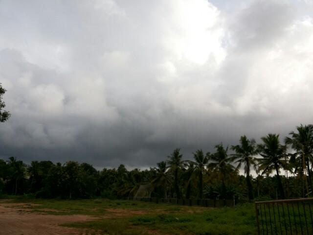
RT @WeAreTrivandrum: Cloudy #trivandrum. Chance for an evening shower! #Thiruvananthapuram #Kerala http://t.co/kO1zyTzYhu (5:22pm)
RT @WeAreTrivandrum: Yes! It is raining here now at #trivandrum, after 2 days!! #Kerala @weatherofindia (5:59pm)
Weather Instagram at August 27, 2014 at 03:42PM
#chennai - 3pm, a mild and fully cloudy day so far. Showers possible after 7pm. #weather

As expected a circulation has formed at all levels over Bay.
Sea level circulation is seen over N-central Bay ... http://ow.ly/i/6Gslu
The mid,upper-level circulations are slightly tilted to S-S-W.
Upper is seen over W-central Bay ... http://ow.ly/i/6Gsp2
1:30pm, Due to circulation over Bay.. it is very active over central,West Bay ... http://ow.ly/i/6GsqJ
1:30pm, Heavy rain along Karnataka coast and N,central Kerala ... http://ow.ly/i/6GsqJ

Tuesday, August 26, 2014

1pm, Massive rain seen all along from S-E Gujarat coast to S Karnataka coast ... http://ow.ly/i/6FGaR
"central Bay is very active"

Good offshore trough seen along Maharastra coast upto S Karnataka coast ... http://ow.ly/i/6FGhi
A good upper-level circulation seen along W, coast Maharastra ... http://ow.ly/i/6FGki
And expected to persist for next 18hrs.

In 24hrs, a strong low,mid-level circulation expected over N-central,central Bay ... http://ow.ly/i/6FGnk
On 29/30-Aug, the low,mid-level circulation from Bay is expected to reach N,central Andhra coast ... http://ow.ly/i/6FGqr
And, the upper-level circulation is expected to cross S Andhra coast, #Chennai on 29/30-Aug... http://ow.ly/i/6FGsG
Today, the low,mid-level circulation over S,S-W Rajasthan persists ... http://ow.ly/i/6FGvh
This S Rajasthan circulation is expected to persist for next 42hrs !
Rainfall alert
~~~~~~~~~~~~~~~~~~~
Widespread rain along Maharastra coast, Karnataka coast is expected to persist till Thursday morning.
Scattered HEAVY rain also expected for N,central Kerala during next 42hrs... http://ow.ly/i/6FGDx
Before early morning of 27-Aug...
Scattered T showers for S,central,W Maharastra, many parts of Karnataka, W,S,N-W Andhra.
T showers also for S Karnataka, N,N-W,N-E,N-central coast Tamilnadu and S Andhra on today and Wednesday.
Scattered T showers for S Odisha, S,central Bengal on today and 27-Aug !
Today, Tomorrow - T showers for S-E,E,N-E Gujarat, S,S-E Rajasthan, W,S-W Madhyapradesh

#Chennai - T showers expected today evening into midnight.
And Showers expected around mid-morning of Wednesday.
Tomorrow, scattered T showers expected for Odisha, N,N-E Andhra, E Maharastra, S Chatisgarh.. http://ow.ly/i/6FGQB
Monday, August 25, 2014

5:30pm, Scattered HEAVY rain over S,S-E,E Gujarat, W,central,S Maharastra, N,N-W,N-E Andhra, Odisha, Jharkhand.. http://ow.ly/i/6F2B8
#Chennai - 7:20pm, T showers seen over N-W at around 130km from city. T Showers "may" push into city after 10pm !
#Chennai - Rainfall till 8:30am today...
Nungambakkam = 89.3 mm,
Airport = 85.2 mm,
IWM Polichalur = 45 mm.
#Chennai - 24-Aug, Midnight Thunder Storm... RADAR images video ... http://youtu.be/v9OXLgS8030
Chennai - 24-Aug, Thunder Storm "Lightning Video" ... http://youtu.be/a0m1CIap3MY
Nungambakkam = 89.3 mm,
Airport = 85.2 mm,
IWM Polichalur = 45 mm.
#Chennai - 24-Aug, Midnight Thunder Storm... RADAR images video ... http://youtu.be/v9OXLgS8030
Chennai - 24-Aug, Thunder Storm "Lightning Video" ... http://youtu.be/a0m1CIap3MY
Subscribe to:
Posts (Atom)