Sunday, August 24, 2014

DHATSAN AYANAM & Rainfall

23.08.2014 16 LT

24.08.2014 16 LT
The downward [south] marching sun will be around 14 to 13 Degree North latitude for this date and time.

In land heating around this area is evident.


The South Indian Ocean (SIO) slowly getting warmer.

This diffuses the semi permanent high there

Impact will be felt on SWM rainfall after two or three days.

1:40pm, T showers seen over S Andhra, around 150 to 200km N-N-W,N-W from #Chennai ... http://ow.ly/i/6EvCC 
#Chennai - 2pm, After a cloudy morning.. it is getting hot and humid.
T showers expected to push in from W,N-W after 4pm.


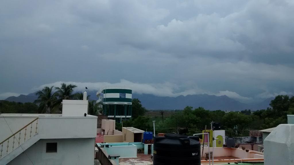
RT @rajugana: @weatherofindia Bangalore 1.30pm, Sky dotted with puffy clouds, sun playing hide n seek.. sky pic http://t.co/m3oEdYvDJF 

Analysis show that low,mid-level circulation is now over Arabian sea near to Karnataka coast ... http://ow.ly/i/6EujT 
This circulation is expected to weaken and become a trough along Goa, N-coast Karnataka, S-coast Maharastra in 36hrs http://ow.ly/i/6EulZ 
On 25-Aug evening, an upper-level(500hpa) weak circulation is expected along Maharastra coast ... http://ow.ly/i/6Eun4 

Goa and Karnataka coast, N-Kerala coast to get good rainfall till Tuesday !

A weak mid,low-level circulation expected to pop along S Chatisgarh and near-by Odisha on Tuesday.

Around late-evening of 23-Aug, a weak low-level(850hpa) circulation formed along S Andhra coast ... http://ow.ly/i/6EujT
11:30am, Satellite shows rain along Karnataka coast and cloudiness, rain along Andhra coast (due to circulation) .. http://ow.ly/i/6Eusc 
The Andhra coast circulation is not expected to persist after next 12hrs !

Before morning of 25-Aug...
Scattered rain for S,W,central,N-W Karnataka, W,S-W,central,S Maharastra... http://ow.ly/i/6Euun 
Today evening, late-evening, Heavy T showers expected to push into W,central,S,N-W,N Andhra.
Today, scattered T showers for N,N-E,N-central-coast Tamilnadu and #Chennai as well.
Scattered T showers for Odisha, S Bengal, S Chatisgarh and N-E Andhra expected before 8pm today.

After midnight today, scattered rain expected for S,central Maharastra coast and Goa.
Moderate scattered rain expected over N,N-W,N-central Maharastra on forenoon of Monday.
Tomorrow afternoon again...
Heavy scattered rain for W,S-W,S,central Maharastra, N,N-W,N-E Karnataka, into W,N-W,central, N-E Andhra.
Tomorrow, scattered Heavy T showers expected over most zones of Andhra and push into S Chatisgarh, S Odisha.. http://ow.ly/i/6EuyN 
Monday evening, T showers also for N,N-E Tamilnadu, #Chennai.

Saturday, August 23, 2014

Naraikadu  - 10:50am, "a violent push of SW rains since yesterday evening. Rainfall till 8.30 am is 109 mm and still going strong."

Today, the circulation is seen along N, central Kerala coast over Arabian sea .. http://ow.ly/i/6Eazg 
Present circulation is expected push North along Karnataka coast, Goa in next 36hrs ... http://ow.ly/i/6EaDM 

10:30am, HEAVY rain seen along Kerala coast, E Gujarat ... http://ow.ly/i/6EaBW 

Weather Instagram at August 23, 2014 at 11:51AM

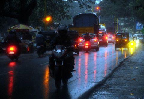
#chennai - 11:50am, sharp showers now near Tambaram. #weather . photo from Pallavaram.


from Instagram

The past one week of convective activity has transformed into a violent push of SW rains since yesterday evening. Naraikadu rainfall till 8.30 am is 109 mm and still going strong.

Friday, August 22, 2014

4:30pm, HEAVY rain over Kerala, S tip,S Tamilnadu, S,S-W,S-E Madhyapradesh, Chatisgarh, Odisha, Jharkhand, Bihar.. http://ow.ly/i/6DzjT 


RT @rajugana: @weatherofindia Bangalore 4.10pm, This Dark cloud has a Silver lining...hope it may rain!!.. sky pic http://ow.ly/i/6Dwoc 


RT @WeAreTrivandrum: #Trivandrum #Weather -  raining heavily. @weatherofindia (5:38pm)
RT @WeAreTrivandrum: Motorists were forced to turn on their lights at noon in #Trivandrum via @TvrmConnect.

 http://t.co/EzDVRKriWX 


RT @Arvind_LFC: @weatherofindia  Sathuragiri hills view from Elumalai,Madurai district after an hour rain http://t.co/p3h18PMlXT (5:47pm)

Nagercoil - 4:30pm, Raining from around 1pm.. now heavy [VIDEO] ... http://youtu.be/A63jWsJwWkk
Light rain yesterday evening as well.


Weather Instagram at August 22, 2014 at 03:27PM

#chennai - 2:10pm. Thunder cells over W,SW,WNW. Not expected to move in. #weather


from Instagram


Today as well the low-level N-S trough persists upto S Tamilnadu ... http://ow.ly/i/6Dsq3 
Low,mid-level circulation over S Tamilnadu persists ... http://ow.ly/i/6Dssj 
And even the upper-level (500hpa) circulation persists along S-E corner Arabian sea ... http://ow.ly/i/6Dsux 

From now, the mid,low-level circulation is expected to move N-N-W and push upto Karnataka coast on 24-Aug ... http://ow.ly/i/6DsxO 

Widespread HEAVY rain ahead for S,central Kerala, S tip Tamilnadu from today evening till midnight of Saturday and even into Sunday !!


RT @rajugana: @weatherofindia Bangalore 1.15pm, Sunny, hot and humid with passing clouds...,will it rain?? sky http://ow.ly/i/6DrC9 

#Delhi - 21-Aug, "At 38.4°C, hottest August day in Delhi in 12 years" ... http://ow.ly/ABg3K 
#Delhi - 1pm, HOT again 36.3 C (feels like 43 C).

12:30pm, Showers over N-W,S-W Maharastra, S Tamilnadu, S Kerala. Fresh T showers over Odisha, Jharkhand ... http://ow.ly/i/6Ds3T