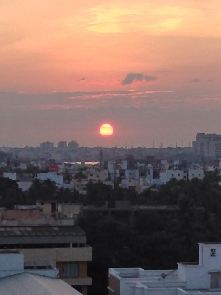
Wednesday, October 09, 2013

#chennai rain from 8 to 9pm

RT @RajanRamaswami: @weatherofindia @Indscattered rain with thunders at Pallikaranai Cennai Now. 8:40pm
Chennai - 8:45pm, heavy drizzle now over Polichalur zone.

~~ #Chennai rain updates recorded after 7:50pm ~~

fabwriteOct 09, 8:03pm via Web
Heavy thunder over the sea. I think it's pouring in the Bay of Bengal!!! #Chennai #Rain@chennaiweather @weatherofindia

@weatherofindia Heavy Rain, heavy Lightening and Thunder at TARAMANI #CHENNAIRAIN

Lightening and thunder filled chennai! @weatherofindia! YAY!

@weatherofindia and now its pouring here!#Chennai #Ambattur

@weatherofindia Rain Rain and more rains at Tharamani #Chennai

Chennai - 7:45pm, T showers seen over S-W, W, N-W from city. Today more chances of rain into city!

RT @chronics16: @weatherofindia pouring in tharamani #chennairain 7:50pm

Tuesday, October 08, 2013

Showers to continue along S-E India for 2 days

Tomorrow evening, Rain again expected for E,S,S-E Gujarat and N-W Maharastra.
Wednesday evening, showers again for S,S-E Karnataka, #Bangalore, central W ghats of Kerala, N,central Tamilnadu and S,central Andhra.
Scattered heavy expected for N,central,S Maharastra after evening of 9-Oct.
Moderate showers for S,S-W,W Madhyapradesh expected after evening of 9-Oct.
Showers over S,S-E Gujarat, N-W,N-central Maharastra rain can be expected on Thursday as well.
Showers can be expected along central Tamilnadu coast during next 2 days.

If "90W" becomes a Cyclone over E-Central Bay in next 36hrs, the rainfall activity over peninsula is expected to become lean.
#Bangalore - more chance of T Showers for city on tomorrow evening, late evening.
#Chennai - will continue to be #HOT and Humid for next 2 days with a chance of moderate T showers towards evening, late evening.

"90W" in 36hrs it can be Cyclone Phailin

Latest analysis at 5:30pm, suggests that "90W" is now a marked LOW pressure system and gathering intensity on a rapid pace.
At present the pressure is around 1004mb and has tracked W-N-W, still in Andaman seas.
This is the latest location as per analysis.

Latest GFS model, suggests that the system will intensify into a Deep Depression in 24hrs and to Cyclone strength in 48hrs over E-Central Bay.

GFS and NCMRWF models now suggest a N-E Andhra coast and S Odisha coast landfall on midnight of Saturday, 12-Oct as Cyclone Phailin.
NAVGEM model suggests a Central, N-E Andhra coast as a Depression.
Here's the last visible satellite shot of "90W".. showing heavy convective activity near Center, W, N-W quadrant and over most of Andaman Islands.

Due to this system, HEAVY rain with HIGH winds expected over most of N,central Islands of Andaman during next 36hrs.

Rain in #Indore and Andaman Islands getting battered

#Kolkata - most of the day it was gloomy with light rain. A mini shower at around 6:34pm.

#Indore - 6:11pm, "its raining cats and dogs here in Indore for the past 3 hours"

HEAVY rain now over N,central,N-W,W Tamilnadu and over W Ghats of Kerala ... http://ow.ly/i/3mFGV 

#Chennai - 7:40pm, T Showers seen over S-W from city at around 100 to 200km. City had a #HOT and Humid day ... temp max was 35 C.

#Bangalore - Got a T shower at around early hrs of today and after that it was cloudy with mild drizzles around till noon.

RT @chetanishere: #Chennai - Today morning view from  Velachery home balcony @weatherofindia @weatherchannel http://t.co/9W6Goerhr9 


8pm, HEAVY T-showers over N,central Andhra, scattered over S,S-E,E Maharastra, N,S,S-E Gujarat, S,S-W Madhyapradesh http://ow.ly/i/3mICA 
8pm, Heavy rain also over S Chatisgarh, S,central Odisha and ANDAMAN islands getting battered by "90W" LOW http://ow.ly/i/3mICA

Chennai - 11:13am, early T cell seen over N-W from city.. photo .. http://ow.ly/i/3mt0B

RT @IamKanal: Heavy Devil Rain at Kochi for last 2 hours.Roads full of water. @WeatherOfindia
11:07pm, 7-Oct

Monday, October 07, 2013

What's up for #India before the Cyclone brews over E-S-E Bay

In 48hrs, present circulation over E,S-E Madhyapradesh is expected to weaken and drift S-W into N,N-E Maharastra .. http://ow.ly/i/3m7J3 

Before evening of Tuesday, Showers expected over S Odisha, S,Central,N-E Andhra, E,S-E Madhyapradesh.
More showers ahead for S,S-W Bengal before tomorrow evening !
Tuesday evening can witness some showers for central, W Madhyapradesh as well.
E,S-E Gujarat can witness more rain before evening of Wednesday !
During next 48hrs, T showers expected for S Karnataka, N,N-E Tamilnadu, #Chennai and S Andhra.
During next 2 days, central, W Ghats of Kerala to get some T showers.
Central, central coast Tamilnadu also in for T showers on evening of 8,9-Oct.
#Bangalore can expect moderate rain on evening, late-evening of Tuesday and Wednesday.

"90W" - Is it going to become a Severe Cyclone ?

The circulation "90W" has now entered into E-S-E Bay (Andaman sea) ... http://ow.ly/i/3m6vz 

9pm, IR of "90W" shows Good convective activity over it's S,S-W,W quadrant ... http://ow.ly/i/3m6CM 

Here's the latest position of "90W" - Just entered into Andaman Sea.... pressure around 1008mb ... http://ow.ly/i/3m6Uh 

Latest GFS model expects "90W" to become a Depression by evening of 9-Oct, even before exiting Andaman sea. Initially expected to move W-N-W
Almost ALL models are expecting a Odisha coast landfall as "Severe Cyclone" . Here's the GFS model for 12-Oct.. http://ow.ly/i/3m7by 

NCMRWF model also predicts a Odisha coast landfall as "Severe Cyclone" ... http://ow.ly/i/3m7n4 

NAVGEM model also predicts a Odisha coast landfall on 13/14-Oct ... http://ow.ly/i/3m7zI 

8pm, Heavy T showers S Gujarat, E,S-E madhyapradesh, S,central Chatisgarh, central Andhra, central,N-E Odisha .. http://ow.ly/i/3m13l 
8pm, T Showers also seen over S, N-central Karnataka, central, N-E Tamilnadu and S,S-W Bengal .. http://ow.ly/i/3m13l
8pm, We can clearly see a GOOD circulation taking shape over E-S-E Bay (over Andaman sea) ... http://ow.ly/i/3m13l